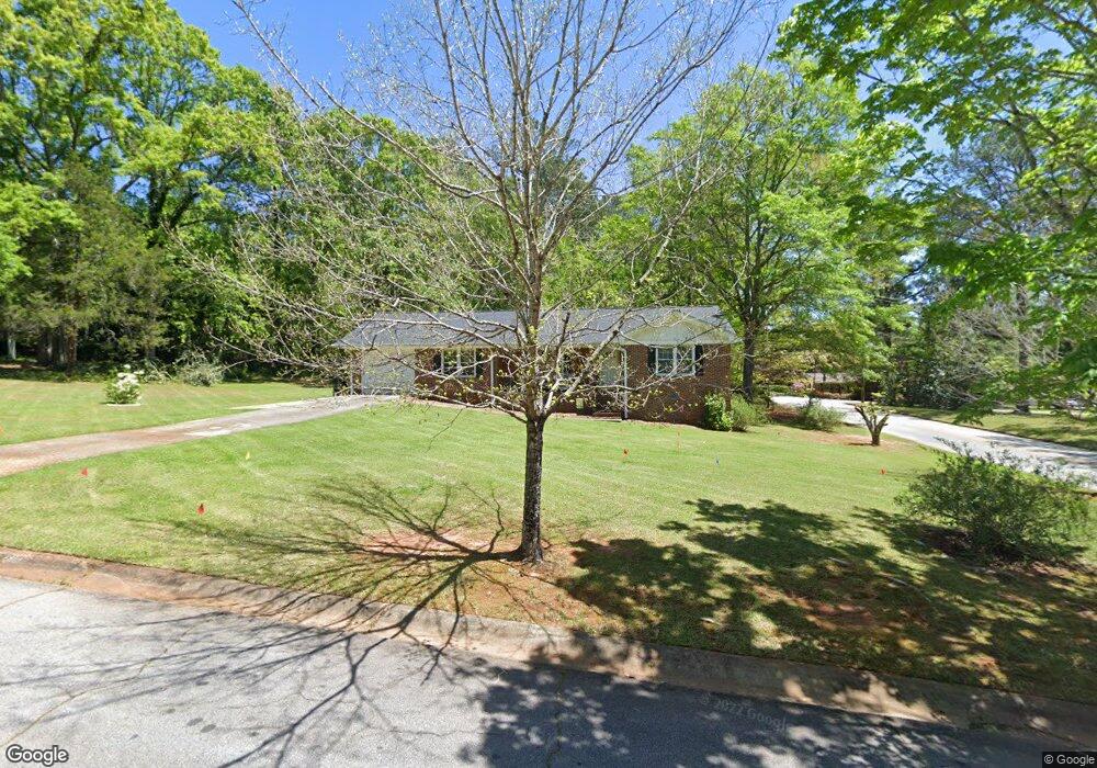
6110 Shamrock Dr NE Covington, GA 30014
Estimated Value: $232,503 - $346,000
--
Bed
2
Baths
1,839
Sq Ft
$162/Sq Ft
Est. Value
About This Home
This home is located at 6110 Shamrock Dr NE, Covington, GA 30014 and is currently estimated at $297,626, approximately $161 per square foot. 6110 Shamrock Dr NE is a home located in Newton County with nearby schools including East Newton Elementary School, Cousins Middle School, and Eastside High School.
Ownership History
Date
Name
Owned For
Owner Type
Purchase Details
Closed on
Aug 23, 2024
Sold by
Mitchell Susan P
Bought by
Parker Lydia C
Current Estimated Value
Purchase Details
Closed on
Jun 30, 2005
Sold by
Bowen Sharon K
Bought by
Parker Lydia C
Home Financials for this Owner
Home Financials are based on the most recent Mortgage that was taken out on this home.
Original Mortgage
$94,800
Interest Rate
5.66%
Mortgage Type
New Conventional
Purchase Details
Closed on
Mar 19, 2003
Sold by
Hall Helen
Bought by
Hall Helen
Create a Home Valuation Report for This Property
The Home Valuation Report is an in-depth analysis detailing your home's value as well as a comparison with similar homes in the area
Home Values in the Area
Average Home Value in this Area
Purchase History
| Date | Buyer | Sale Price | Title Company |
|---|---|---|---|
| Parker Lydia C | $15,000 | -- | |
| Parker Lydia C | $118,500 | -- | |
| Hall Helen | -- | -- |
Source: Public Records
Mortgage History
| Date | Status | Borrower | Loan Amount |
|---|---|---|---|
| Previous Owner | Parker Lydia C | $94,800 |
Source: Public Records
Tax History Compared to Growth
Tax History
| Year | Tax Paid | Tax Assessment Tax Assessment Total Assessment is a certain percentage of the fair market value that is determined by local assessors to be the total taxable value of land and additions on the property. | Land | Improvement |
|---|---|---|---|---|
| 2024 | $1,493 | $54,600 | $14,406 | $40,194 |
| 2023 | $1,607 | $54,600 | $14,406 | $40,194 |
| 2022 | $1,669 | $54,600 | $16,483 | $38,117 |
| 2021 | $1,497 | $44,472 | $15,983 | $28,489 |
| 2020 | $1,643 | $44,472 | $15,983 | $28,489 |
| 2019 | $1,674 | $44,472 | $15,482 | $28,990 |
| 2018 | $1,615 | $42,560 | $12,800 | $29,760 |
| 2017 | $1,584 | $41,800 | $12,800 | $29,000 |
| 2016 | $1,476 | $39,160 | $12,800 | $26,360 |
| 2015 | $1,463 | $38,800 | $12,800 | $26,000 |
| 2014 | $1,464 | $38,800 | $0 | $0 |
Source: Public Records
Map
Nearby Homes
- 6104 Floyd St NE
- 6127 Floyd St NE
- 5139 West Dr NE
- 7128 Honeysuckle Ct SE
- 5118 Floyd St NE
- 4181 A&B Floyd St NE
- 5130 N Dearing St NE
- 10630 Highway 278 NE
- 6203 Crestview Dr SE
- 4128 Elizabeth St NE
- 4105 Rose Ln NE
- 13238 Tolstoy
- 4217 Elizabeth St NE
- 4187 Cherry Laurel Dr SE
- 3127 Mill St SE
- 6129 Linwood Dr SE
- 0 Highway 278 NE Unit 10595588
- 3149 Thompson Ave SE
- 6169 Pinewood Dr SE
- 6134 Linwood Dr SE
- 0 Martin St SE Unit 8710251
- 0 Martin St SE Unit 8445526
- 0 Martin St SE Unit 7601525
- 6108 Flat Rock Trail SE
- 0 Shamrock Dr NE Unit 7315516
- 6107 Shamrock Dr NE
- 6117 Shamrock Dr NE
- 6118 Flat Rock Trail SE
- 6109 Flat Rock Trail SE
- 6129 Shamrock Dr NE
- 6144 Shamrock Dr NE
- 7114 Martin St SE
- 6132 Flat Rock Trail SE
- 7116 Martin St SE
- 6125 Flat Rock Trail SE
- 6147 Shamrock Dr NE
- 6152 Shamrock Dr NE
- 6157 Shamrock Dr NE
- 6141 Flat Rock Trail SE
- 6148 Flat Rock Trail SE