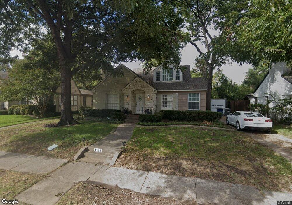
6111 Kenwood Ave Dallas, TX 75214
Lower Greenville NeighborhoodEstimated Value: $702,000 - $799,000
3
Beds
2
Baths
1,977
Sq Ft
$381/Sq Ft
Est. Value
About This Home
This home is located at 6111 Kenwood Ave, Dallas, TX 75214 and is currently estimated at $753,903, approximately $381 per square foot. 6111 Kenwood Ave is a home located in Dallas County with nearby schools including Mockingbird Elementary School, J L Long Middle School, and Woodrow Wilson High School.
Ownership History
Date
Name
Owned For
Owner Type
Purchase Details
Closed on
Oct 25, 1996
Sold by
Wilson Guy S and Wilson Rhonda G
Bought by
Eeds Monte
Current Estimated Value
Home Financials for this Owner
Home Financials are based on the most recent Mortgage that was taken out on this home.
Original Mortgage
$151,900
Outstanding Balance
$15,049
Interest Rate
8.15%
Estimated Equity
$738,854
Create a Home Valuation Report for This Property
The Home Valuation Report is an in-depth analysis detailing your home's value as well as a comparison with similar homes in the area
Home Values in the Area
Average Home Value in this Area
Purchase History
| Date | Buyer | Sale Price | Title Company |
|---|---|---|---|
| Eeds Monte | -- | -- |
Source: Public Records
Mortgage History
| Date | Status | Borrower | Loan Amount |
|---|---|---|---|
| Open | Eeds Monte | $151,900 |
Source: Public Records
Tax History Compared to Growth
Tax History
| Year | Tax Paid | Tax Assessment Tax Assessment Total Assessment is a certain percentage of the fair market value that is determined by local assessors to be the total taxable value of land and additions on the property. | Land | Improvement |
|---|---|---|---|---|
| 2025 | $5,797 | $718,900 | $448,700 | $270,200 |
| 2024 | $5,797 | $718,900 | $448,700 | $270,200 |
| 2023 | $5,797 | $720,550 | $414,180 | $306,370 |
| 2022 | $14,503 | $580,050 | $379,670 | $200,380 |
| 2021 | $12,723 | $482,280 | $310,640 | $171,640 |
| 2020 | $13,084 | $482,280 | $310,640 | $171,640 |
| 2019 | $12,944 | $454,950 | $276,120 | $178,830 |
| 2018 | $12,371 | $454,950 | $276,120 | $178,830 |
| 2017 | $10,493 | $385,870 | $227,800 | $158,070 |
| 2016 | $7,062 | $385,870 | $227,800 | $158,070 |
| 2015 | $8,122 | $357,970 | $207,090 | $150,880 |
| 2014 | $8,122 | $357,970 | $207,090 | $150,880 |
Source: Public Records
Map
Nearby Homes
- 6117 Martel Ave
- 6135 Anita St
- 6020 Penrose Ave
- 6008 Kenwood Ave
- 6034 Martel Ave
- 5916 Ellsworth Ave
- 6218 Ellsworth Ave
- 6222 Ellsworth Ave
- 4202 Somerville Ave Unit LOT
- 6222 Anita St
- 6129 Mccommas Blvd
- 5911 Anita St
- 6227 Anita St
- 4203 Camden Ave
- 5848 Kenwood Ave
- 6215 Mccommas Blvd
- 5836 Kenwood Ave
- 4235 Somerville Ave
- 6231 Mccommas Blvd
- 4241 Somerville Ave
- 6117 Kenwood Ave
- 6109 Kenwood Ave
- 6121 Kenwood Ave
- 6112 Ellsworth Ave
- 6118 Ellsworth Ave
- 6108 Ellsworth Ave
- 6112 Kenwood Ave
- 6116 Kenwood Ave
- 6122 Ellsworth Ave
- 6102 Ellsworth Ave
- 6125 Kenwood Ave
- 6120 Kenwood Ave
- 6128 Ellsworth Ave
- 6129 Kenwood Ave
- 6124 Kenwood Ave
- 6059 Kenwood Ave
- 6132 Ellsworth Ave
- 6111 Ellsworth Ave
- 6128 Kenwood Ave
- 6119 Ellsworth Ave