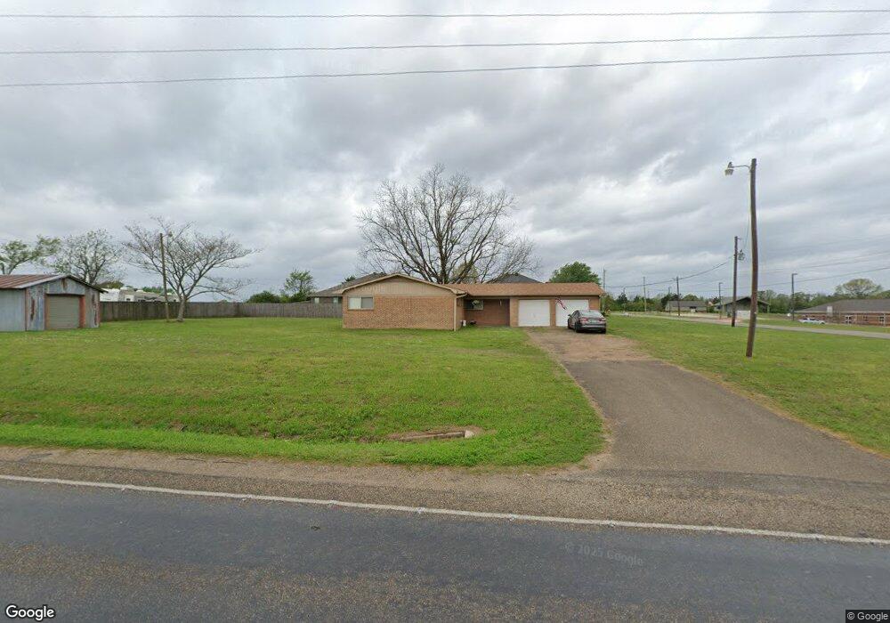
6111 N Kings Hwy Texarkana, TX 75503
Estimated Value: $158,671 - $219,000
--
Bed
--
Bath
1,260
Sq Ft
$161/Sq Ft
Est. Value
About This Home
This home is located at 6111 N Kings Hwy, Texarkana, TX 75503 and is currently estimated at $202,668, approximately $160 per square foot. 6111 N Kings Hwy is a home located in Bowie County with nearby schools including Red Lick Elementary School, Red Lick Middle School, and Texarkana Sda School.
Ownership History
Date
Name
Owned For
Owner Type
Purchase Details
Closed on
Nov 30, 2007
Sold by
Whitehurst Michael Loyd and Estate Of Travis C Norton
Bought by
Pillow Glenn D and Pillow Tajuana K
Current Estimated Value
Home Financials for this Owner
Home Financials are based on the most recent Mortgage that was taken out on this home.
Original Mortgage
$90,000
Outstanding Balance
$15,979
Interest Rate
6.27%
Mortgage Type
Future Advance Clause Open End Mortgage
Estimated Equity
$186,689
Create a Home Valuation Report for This Property
The Home Valuation Report is an in-depth analysis detailing your home's value as well as a comparison with similar homes in the area
Home Values in the Area
Average Home Value in this Area
Purchase History
| Date | Buyer | Sale Price | Title Company |
|---|---|---|---|
| Pillow Glenn D | -- | None Available |
Source: Public Records
Mortgage History
| Date | Status | Borrower | Loan Amount |
|---|---|---|---|
| Open | Pillow Glenn D | $90,000 |
Source: Public Records
Tax History Compared to Growth
Tax History
| Year | Tax Paid | Tax Assessment Tax Assessment Total Assessment is a certain percentage of the fair market value that is determined by local assessors to be the total taxable value of land and additions on the property. | Land | Improvement |
|---|---|---|---|---|
| 2025 | $2,062 | $127,402 | $19,000 | $108,402 |
| 2024 | $2,062 | $124,295 | $19,000 | $105,295 |
| 2023 | $1,949 | $118,431 | $19,000 | $99,431 |
| 2022 | $1,816 | $107,976 | $19,000 | $88,976 |
| 2021 | $1,690 | $95,908 | $19,000 | $76,908 |
| 2020 | $1,704 | $95,684 | $19,000 | $76,684 |
| 2019 | $1,735 | $94,243 | $19,000 | $75,243 |
| 2018 | $1,682 | $91,392 | $19,000 | $72,392 |
| 2017 | $1,643 | $90,002 | $19,000 | $71,002 |
| 2016 | $1,604 | $87,846 | $18,500 | $69,346 |
| 2015 | $1,525 | $87,178 | $18,500 | $68,678 |
| 2014 | $1,525 | $86,521 | $18,500 | $68,021 |
Source: Public Records
Map
Nearby Homes
- 1302 Arnold Ln
- 14 Stonewall Trace
- TBD Arnold Ln
- 7207 N Richland Dr
- 16 Irongate Dr
- 7 Coppercreek Cir
- 5608 Hillcrest Dr
- 7104 N Richland Dr
- 5128 Remington
- 5112 Remington St
- 8204 Thames Cir
- 6803 Kincaid St
- 5009 Nicholas Dr
- 6706 Cameron
- 6810 Kincaid St
- 5105 Remington
- 7008 Cameron
- 8227 N Kings Hwy
- 6714 Lawson Cir
- 8109 Gadwall Trail
- 1314 Arnold Ln
- 1312 Arnold Ln
- 1310 Arnold Ln
- 1308 Arnold Ln
- 6005 Lost Creek Dr
- 1306 Arnold Ln
- 6101 N Kings Hwy
- 1304 Arnold Ln
- 1218 Arnold Ln
- 5 Lost Creek Cir
- 1216 Arnold Ln
- 9 Lost Creek Cir
- 3 Lost Creek Cir
- 6004 Lost Creek Dr
- 1214 Arnold Ln
- 6009 Lost Creek Dr
- 1212 Arnold Ln
- 8 Lost Creek Cir
- 1210 Arnold Ln
- 6 Stonewall Cir