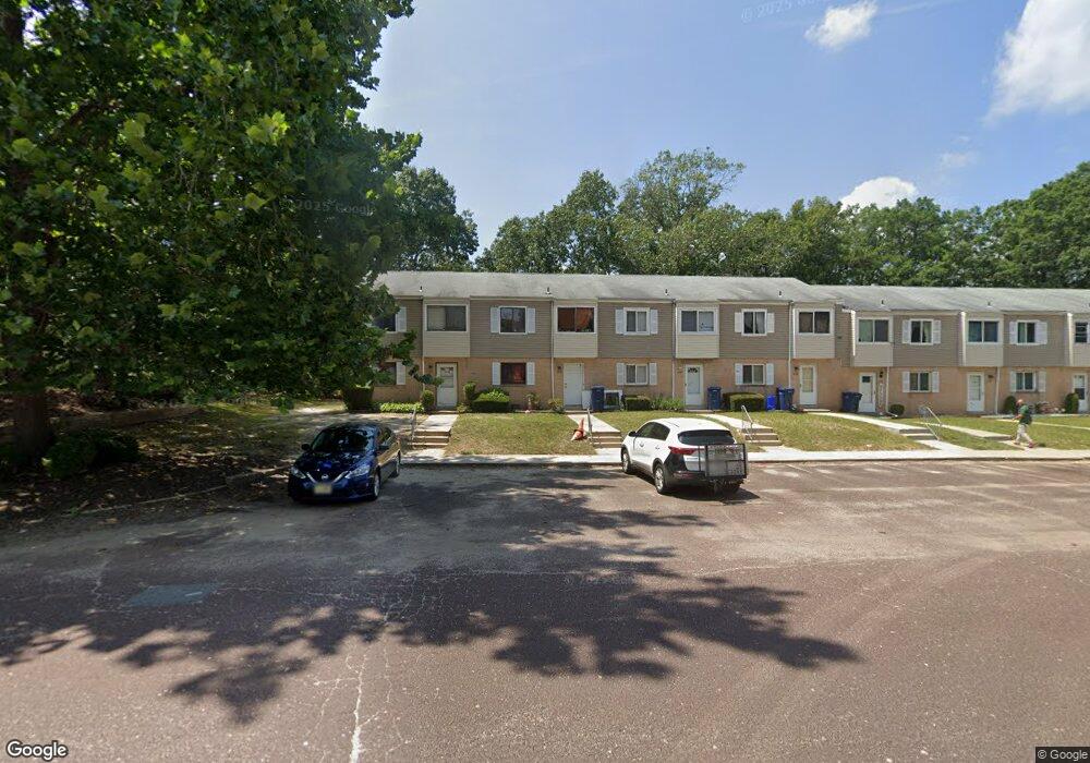
6112 Hoover Dr Unit 11B Mays Landing, NJ 08330
Estimated Value: $139,774 - $157,000
--
Bed
--
Bath
1,292
Sq Ft
$114/Sq Ft
Est. Value
About This Home
This home is located at 6112 Hoover Dr Unit 11B, Mays Landing, NJ 08330 and is currently estimated at $147,444, approximately $114 per square foot. 6112 Hoover Dr Unit 11B is a home located in Atlantic County with nearby schools including Joseph Shaner School, George L. Hess Educational Complex, and William Davies Middle School.
Ownership History
Date
Name
Owned For
Owner Type
Purchase Details
Closed on
Apr 17, 2003
Sold by
Citicorp Trust Bank Fsb
Bought by
Qazi Ahsan and Qazi Nawazish
Current Estimated Value
Purchase Details
Closed on
Jan 28, 2003
Sold by
Sidkoff Eric Scott and Snyder Sherrie
Bought by
Citifinancial Services Inc
Purchase Details
Closed on
Feb 26, 1996
Sold by
Sidkoff Richard D and Sidkoff Edwin
Bought by
Sidkoff Eric Scott and Sidkoff Todd Brian
Home Financials for this Owner
Home Financials are based on the most recent Mortgage that was taken out on this home.
Original Mortgage
$31,214
Interest Rate
12.25%
Create a Home Valuation Report for This Property
The Home Valuation Report is an in-depth analysis detailing your home's value as well as a comparison with similar homes in the area
Home Values in the Area
Average Home Value in this Area
Purchase History
| Date | Buyer | Sale Price | Title Company |
|---|---|---|---|
| Qazi Ahsan | $34,000 | Surety Title Corporation | |
| Citifinancial Services Inc | -- | -- | |
| Sidkoff Eric Scott | -- | -- |
Source: Public Records
Mortgage History
| Date | Status | Borrower | Loan Amount |
|---|---|---|---|
| Previous Owner | Sidkoff Eric Scott | $31,214 |
Source: Public Records
Tax History Compared to Growth
Tax History
| Year | Tax Paid | Tax Assessment Tax Assessment Total Assessment is a certain percentage of the fair market value that is determined by local assessors to be the total taxable value of land and additions on the property. | Land | Improvement |
|---|---|---|---|---|
| 2025 | $1,451 | $63,200 | $20,000 | $43,200 |
| 2024 | $1,451 | $42,300 | $4,500 | $37,800 |
| 2023 | $1,365 | $42,300 | $4,500 | $37,800 |
| 2022 | $1,365 | $42,300 | $4,500 | $37,800 |
| 2021 | $1,140 | $35,400 | $3,000 | $32,400 |
| 2020 | $1,140 | $35,400 | $3,000 | $32,400 |
| 2019 | $1,142 | $35,400 | $3,000 | $32,400 |
| 2018 | $1,102 | $35,400 | $3,000 | $32,400 |
| 2017 | $1,085 | $35,400 | $3,000 | $32,400 |
| 2016 | $1,195 | $40,100 | $5,000 | $35,100 |
| 2015 | $1,154 | $40,100 | $5,000 | $35,100 |
| 2014 | $1,476 | $56,200 | $5,000 | $51,200 |
Source: Public Records
Map
Nearby Homes
- 37 Delancy Ct
- 6310 Phillips Ave
- 6301 Knight Ave
- 6314 Lance Ave
- 87 Devon Rd
- 6202 Lance Ave
- 0 Harding Hwy Unit 597638
- 0 Harding Hwy Unit NJAC2019438
- 6206 Roberts Ave
- 6140 Robin Dr
- 0 Wheeling Ave Unit NJAC2018470
- 16 Holly Ct
- 24 Holly Ct
- 1 Walnut Ct
- 11 Maple Ct
- 9 Oaks Dr Unit 341
- 13 Hickory Ln
- 39 Dogwood Ln Unit OAKS OF WEYMOUTH
- 39 Dogwood Ln
- 14 Hickory Ln
- 6111 Hoover Dr Unit 11A
- 6113 Hoover Dr
- 6114 Hoover Dr
- 6115 Hoover Dr Unit 11E
- 6116 Hoover Dr
- 6117 Hoover Dr
- 6118 Hoover Dr Unit H
- 6121 Hoover Dr
- 6121 Hoover Dr Unit 1201
- 6122 Hoover Dr
- 6138 Hoover Dr Unit 13H
- 6123 Hoover Dr
- 6137 Hoover Dr Unit 13G
- 6136 Hoover Dr
- 6124 Hoover Dr Unit D12
- 6125 Hoover Dr
- 6135 Hoover Dr
- 6126 Hoover Dr Unit 12F
- 6134 Hoover Dr
- 6127 Hoover Dr