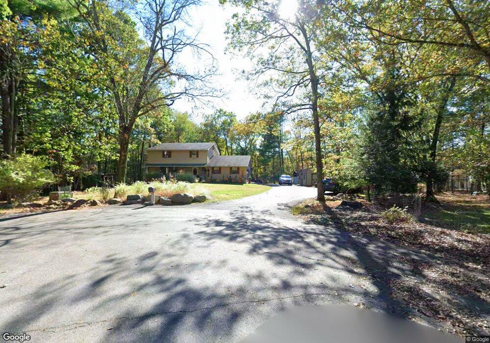
6113 James Ct East Stroudsburg, PA 18301
Estimated Value: $314,000 - $437,000
4
Beds
3
Baths
2,856
Sq Ft
$134/Sq Ft
Est. Value
About This Home
This home is located at 6113 James Ct, East Stroudsburg, PA 18301 and is currently estimated at $382,768, approximately $134 per square foot. 6113 James Ct is a home located in Monroe County with nearby schools including Stroudsburg Junior High School, Stroudsburg High School, and Stroudsburg Seventh-day Adventist School.
Ownership History
Date
Name
Owned For
Owner Type
Purchase Details
Closed on
Sep 10, 2021
Sold by
Rezny Robert R and Rezny Namhee K
Bought by
Harris Terrence D and Harris Melissa A
Current Estimated Value
Home Financials for this Owner
Home Financials are based on the most recent Mortgage that was taken out on this home.
Original Mortgage
$206,196
Outstanding Balance
$187,623
Interest Rate
2.8%
Mortgage Type
FHA
Estimated Equity
$195,145
Purchase Details
Closed on
Dec 26, 2003
Bought by
Rezny Robert R and Rezny Namhee K
Create a Home Valuation Report for This Property
The Home Valuation Report is an in-depth analysis detailing your home's value as well as a comparison with similar homes in the area
Home Values in the Area
Average Home Value in this Area
Purchase History
| Date | Buyer | Sale Price | Title Company |
|---|---|---|---|
| Harris Terrence D | $210,000 | Apex Abstract | |
| Rezny Robert R | $200,000 | -- |
Source: Public Records
Mortgage History
| Date | Status | Borrower | Loan Amount |
|---|---|---|---|
| Open | Harris Terrence D | $206,196 |
Source: Public Records
Tax History Compared to Growth
Tax History
| Year | Tax Paid | Tax Assessment Tax Assessment Total Assessment is a certain percentage of the fair market value that is determined by local assessors to be the total taxable value of land and additions on the property. | Land | Improvement |
|---|---|---|---|---|
| 2025 | $1,666 | $202,090 | $29,160 | $172,930 |
| 2024 | $1,363 | $202,090 | $29,160 | $172,930 |
| 2023 | $6,746 | $202,090 | $29,160 | $172,930 |
| 2022 | $6,888 | $202,090 | $29,160 | $172,930 |
| 2021 | $6,676 | $202,090 | $29,160 | $172,930 |
| 2019 | $6,273 | $33,270 | $7,750 | $25,520 |
| 2018 | $6,692 | $33,270 | $7,750 | $25,520 |
| 2017 | $6,692 | $33,270 | $7,750 | $25,520 |
| 2016 | $1,259 | $33,270 | $7,750 | $25,520 |
| 2015 | -- | $33,270 | $7,750 | $25,520 |
| 2014 | -- | $33,270 | $7,750 | $25,520 |
Source: Public Records
Map
Nearby Homes
- 6284 Cardinal Dr
- 0 Marshall Dr
- 0 Wigwam Park Rd
- 916 Mt Zion Ave
- 476 Hyland Dr
- 3114 Fairfax Terrace
- 102 Arbor Way
- 4104 Ashwood Ln
- 445 Hyland Dr
- 2636 Woodruff Ln
- 2463 Larkspur Dr
- 1117 Belaire Dr
- 2142 Wigwam Park Rd
- Lot 72 Larkspur Woodruff
- 1808 Jennifer Dr
- 329 Hyland Dr
- 317 Robinwood Terrace
- 7109 Pine Grove
- 179 Heathrow Ln
- 348 Clicko Ln
- 6113 James Ct
- 6115 James Ct
- 1 Park Ln
- 0 Cranberry Rd Unit PM-61562
- 0 Cranberry Rd Unit 7-8151
- 0 Cranberry Rd Unit 7-8067
- 0 Cranberry Rd Unit 7-8064
- 0 Cranberry Rd Unit 7-8153
- 0 Cranberry Rd Unit 5-10468
- 0 Cranberry Rd Unit 3-3281
- 0 Cranberry Rd Unit 18357
- 0 Cranberry Rd Unit 9-5406
- 0 Cranberry Rd Unit PM-24463
- 0 Cranberry Rd Unit PM-24369
- 0 Cranberry Rd Unit PM-24310
- 0 Cranberry Rd Unit PM-19623
- 0 Cranberry Rd Unit PM-13179
- 0 Cranberry Rd Unit 9-1701
- 0 Cranberry Rd Unit 8-9759
- 0 Cranberry Rd Unit 8-9758