Estimated Value: $147,000 - $255,000
2
Beds
1
Bath
1,292
Sq Ft
$137/Sq Ft
Est. Value
About This Home
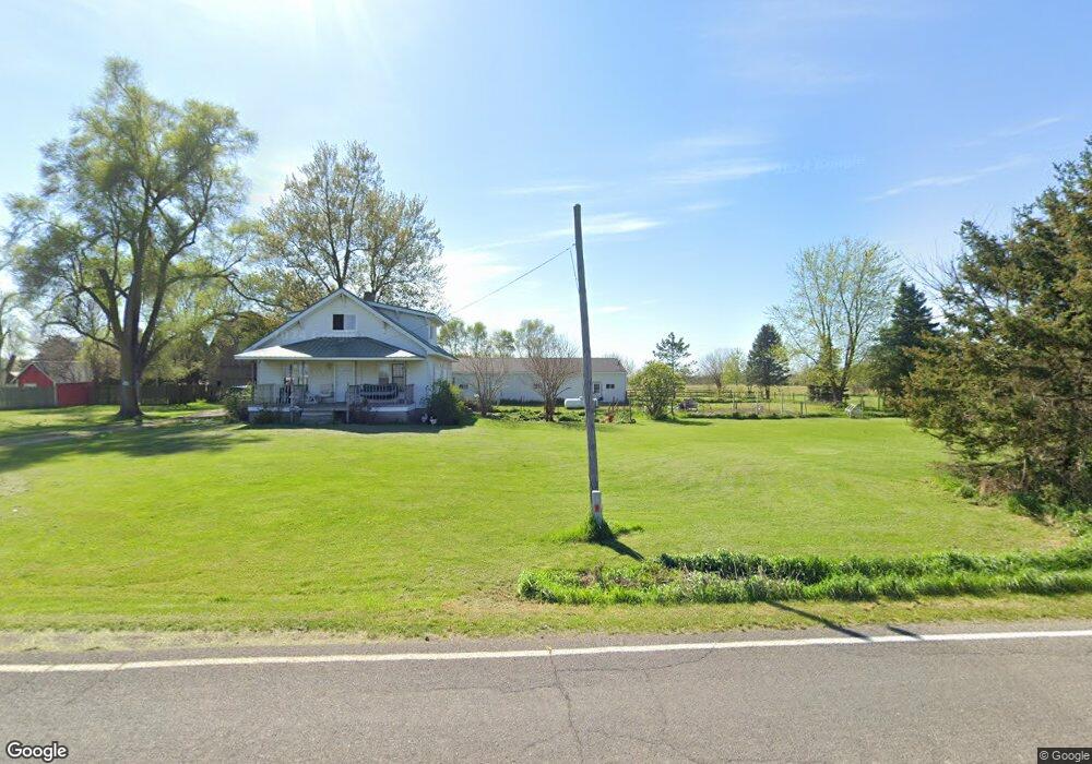
This home is located at 6113 N Watson Rd, Elsie, MI 48831 and is currently estimated at $177,581, approximately $137 per square foot. 6113 N Watson Rd is a home located in Clinton County with nearby schools including E.E. Knight Elementary School, Leonard Elementary School, and Ovid-Elsie Middle School.
Ownership History
Date
Name
Owned For
Owner Type
Purchase Details
Closed on
Apr 27, 2010
Sold by
Trierweiler Ann T and Trierweiler Dale G
Bought by
Frye Christopher J
Current Estimated Value
Purchase Details
Closed on
Aug 13, 2009
Sold by
Mortgage Electronic Registration Systems
Bought by
The Bank Of New York Mellon and The Bank Of New York
Purchase Details
Closed on
Jul 29, 2009
Sold by
Watson David E and Watson Julie A
Bought by
Mortgage Electronic Registration Systems
Purchase Details
Closed on
May 23, 2005
Sold by
Libey Robert and Libey Doris
Bought by
Watson David E and Watson Julie A
Create a Home Valuation Report for This Property
The Home Valuation Report is an in-depth analysis detailing your home's value as well as a comparison with similar homes in the area
Home Values in the Area
Average Home Value in this Area
Purchase History
| Date | Buyer | Sale Price | Title Company |
|---|---|---|---|
| Frye Christopher J | -- | None Available | |
| The Bank Of New York Mellon | -- | None Available | |
| Mortgage Electronic Registration Systems | $55,961 | None Available | |
| Watson David E | $4,000 | -- |
Source: Public Records
Tax History Compared to Growth
Tax History
| Year | Tax Paid | Tax Assessment Tax Assessment Total Assessment is a certain percentage of the fair market value that is determined by local assessors to be the total taxable value of land and additions on the property. | Land | Improvement |
|---|---|---|---|---|
| 2025 | $1,236 | $62,800 | $13,200 | $49,600 |
| 2024 | $469 | $56,000 | $13,200 | $42,800 |
| 2023 | $444 | $53,200 | $0 | $0 |
| 2022 | $1,098 | $47,300 | $14,000 | $33,300 |
| 2021 | $1,068 | $39,700 | $8,400 | $31,300 |
| 2020 | $1,040 | $37,100 | $8,400 | $28,700 |
| 2019 | $951 | $33,500 | $8,100 | $25,400 |
| 2018 | $953 | $33,600 | $8,100 | $25,500 |
| 2017 | -- | $33,300 | $8,800 | $24,500 |
| 2016 | $941 | $34,300 | $8,800 | $25,500 |
| 2015 | -- | $35,000 | $0 | $0 |
| 2011 | -- | $33,100 | $0 | $0 |
Source: Public Records
Map
Nearby Homes
- 0 E Colony Rd Unit 286182
- 5752 E Colony Rd
- 7060 E Maple Rapids Rd
- 7902 N Welling Rd
- 11550 S Wisner Rd
- 4321 N Upton Rd
- 4063 N Williams Rd
- 2920 Boulder Creek Dr
- 2866 Trillium Creek Way
- 2848 Trillium Creek Way
- 2843 Trillium Creek Way
- 2851 Trillium Creek Way
- 2844 Trillium Creek Way
- 2875 Trillium Creek Way
- 229 W Maple St
- 204 W Pine St
- 228 E Pine St
- 323 E Main St
- 6687 Winfield Rd
- 1630 W Kinley Rd
- 6101 N Watson Rd
- 6043 N Watson Rd
- 6292 N Watson Rd
- 5994 N Watson Rd
- 5173 E Mead Rd
- 6372 N Watson Rd
- 5842 N Watson Rd
- 6617 N Watson Rd
- 6617 N Watson Rd
- 6694 N Watson Rd
- 5549 E Mead Rd
- 4312 E Mead Rd
- 6720 N Watson Rd
- 6787 N Watson Rd
- 5483 N Watson Rd
- 5461 N Watson Rd
- 5388 N Watson Rd
- 5445 N Watson Rd
- 6899 N Watson Rd
- 5959 E Mead Rd