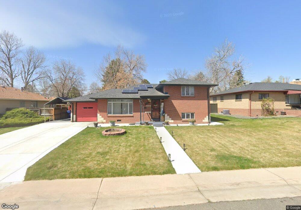
6115 Balsam St Arvada, CO 80004
Alta Vista NeighborhoodEstimated Value: $536,000 - $662,000
4
Beds
3
Baths
1,132
Sq Ft
$514/Sq Ft
Est. Value
About This Home
This home is located at 6115 Balsam St, Arvada, CO 80004 and is currently estimated at $582,369, approximately $514 per square foot. 6115 Balsam St is a home located in Jefferson County with nearby schools including Lawrence Elementary School, Arvada K-8, and Arvada High School.
Ownership History
Date
Name
Owned For
Owner Type
Purchase Details
Closed on
Dec 22, 2006
Sold by
Hud
Bought by
Gomez Manuel J
Current Estimated Value
Purchase Details
Closed on
Sep 22, 2006
Sold by
Gilman Bruce and Gilman Cheryl
Bought by
Hud
Purchase Details
Closed on
Nov 27, 2001
Sold by
Stover Hazel E
Bought by
Gilman Bruce and Gilman Cheryl
Home Financials for this Owner
Home Financials are based on the most recent Mortgage that was taken out on this home.
Original Mortgage
$191,479
Interest Rate
6.57%
Mortgage Type
FHA
Create a Home Valuation Report for This Property
The Home Valuation Report is an in-depth analysis detailing your home's value as well as a comparison with similar homes in the area
Home Values in the Area
Average Home Value in this Area
Purchase History
| Date | Buyer | Sale Price | Title Company |
|---|---|---|---|
| Gomez Manuel J | $182,000 | None Available | |
| Hud | $211,199 | None Available | |
| Gilman Bruce | $194,500 | -- |
Source: Public Records
Mortgage History
| Date | Status | Borrower | Loan Amount |
|---|---|---|---|
| Previous Owner | Gilman Bruce | $191,479 |
Source: Public Records
Tax History Compared to Growth
Tax History
| Year | Tax Paid | Tax Assessment Tax Assessment Total Assessment is a certain percentage of the fair market value that is determined by local assessors to be the total taxable value of land and additions on the property. | Land | Improvement |
|---|---|---|---|---|
| 2024 | $3,212 | $33,112 | $17,945 | $15,167 |
| 2023 | $3,212 | $33,112 | $17,945 | $15,167 |
| 2022 | $2,622 | $26,772 | $12,915 | $13,857 |
| 2021 | $2,665 | $27,543 | $13,287 | $14,256 |
| 2020 | $2,278 | $23,605 | $10,311 | $13,294 |
| 2019 | $2,247 | $23,605 | $10,311 | $13,294 |
| 2018 | $2,149 | $21,944 | $7,151 | $14,793 |
| 2017 | $1,967 | $21,944 | $7,151 | $14,793 |
| 2016 | $1,718 | $18,057 | $6,595 | $11,462 |
| 2015 | $1,507 | $18,057 | $6,595 | $11,462 |
| 2014 | $1,507 | $14,885 | $5,731 | $9,154 |
Source: Public Records
Map
Nearby Homes
- 6150 Carr St
- 6176 Ammons St
- 6015 Brentwood St
- 7885 Barbara Ann Dr Unit D
- 6011 Yarrow St Unit G
- 6011 Yarrow St Unit I
- 5975 Dover St
- 6007 Yarrow St Unit D
- 8410 W 59th Ave
- 8233 W 62nd Place
- 8420 W 59th Ave
- 8710 Alta Vista Dr
- 5920 Estes Ct
- 7707 Ralston Rd
- 7700 Robinson Way
- 6355 Carr St
- 6200 Estes St
- 6409 Brentwood St
- 0000S Balsam St Unit 1
- 0000N Balsam St Unit 1
- 6125 Balsam St
- 6105 Balsam St
- 6135 Balsam St
- 6110 Brentwood St
- 6120 Brentwood St
- 6100 Brentwood St
- 6108 Balsam St
- 6118 Balsam St
- 6130 Brentwood St
- 6145 Balsam St
- 8240 W 61st Ave
- 6098 Balsam St
- 6128 Balsam St
- 6140 Brentwood St
- 6090 Brentwood St
- 6088 Balsam St
- 6155 Balsam St
- 6138 Balsam St
- 6073 Balsam St
- 6111 Ammons St