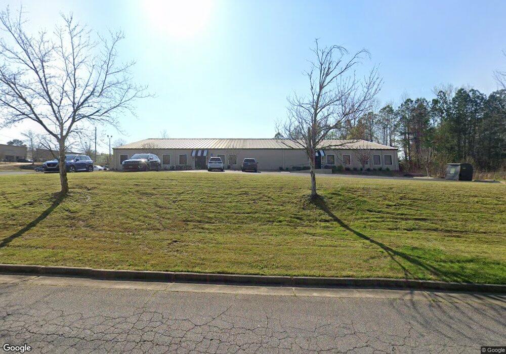
6115 Coca Cola Blvd Columbus, GA 31909
Midland NeighborhoodEstimated Value: $1,273,125
--
Bed
2
Baths
16,000
Sq Ft
$80/Sq Ft
Est. Value
About This Home
This home is located at 6115 Coca Cola Blvd, Columbus, GA 31909 and is currently estimated at $1,273,125, approximately $79 per square foot. 6115 Coca Cola Blvd is a home located in Muscogee County with nearby schools including Waddell Elementary School, Midland Middle School, and Shaw High School.
Ownership History
Date
Name
Owned For
Owner Type
Purchase Details
Closed on
Aug 21, 2024
Sold by
Jrf S P E Llc and Qi & Eat For Amber Mordic Properties Llc
Bought by
Amber Mordic Properties Llc
Current Estimated Value
Purchase Details
Closed on
Feb 22, 2024
Sold by
6115 Ccb Llc
Bought by
Jrf S P E Llc and Qi & Eat For Amber Mordic Properties Llc
Purchase Details
Closed on
Nov 16, 2010
Sold by
Mcgold Properties Llc
Bought by
6115 Ccb Llc
Home Financials for this Owner
Home Financials are based on the most recent Mortgage that was taken out on this home.
Original Mortgage
$1,000,000
Interest Rate
4.33%
Mortgage Type
Commercial
Create a Home Valuation Report for This Property
The Home Valuation Report is an in-depth analysis detailing your home's value as well as a comparison with similar homes in the area
Home Values in the Area
Average Home Value in this Area
Purchase History
| Date | Buyer | Sale Price | Title Company |
|---|---|---|---|
| Amber Mordic Properties Llc | -- | None Listed On Document | |
| Jrf S P E Llc | $1,160,000 | None Listed On Document | |
| 6115 Ccb Llc | $1,400,000 | None Available |
Source: Public Records
Mortgage History
| Date | Status | Borrower | Loan Amount |
|---|---|---|---|
| Previous Owner | 6115 Ccb Llc | $1,000,000 |
Source: Public Records
Tax History Compared to Growth
Tax History
| Year | Tax Paid | Tax Assessment Tax Assessment Total Assessment is a certain percentage of the fair market value that is determined by local assessors to be the total taxable value of land and additions on the property. | Land | Improvement |
|---|---|---|---|---|
| 2025 | $26,533 | $797,437 | $45,136 | $752,301 |
| 2024 | $31,216 | $797,437 | $45,136 | $752,301 |
| 2023 | $31,412 | $797,437 | $45,136 | $752,301 |
| 2022 | $28,666 | $702,064 | $45,136 | $656,928 |
| 2021 | $25,344 | $617,992 | $45,136 | $572,856 |
| 2020 | $25,239 | $617,992 | $45,136 | $572,856 |
| 2019 | $22,957 | $1,242,812 | $45,136 | $1,197,676 |
| 2018 | $22,957 | $560,334 | $45,136 | $515,198 |
| 2017 | $23,030 | $560,334 | $45,136 | $515,198 |
| 2016 | $23,057 | $558,966 | $52,188 | $506,778 |
| 2015 | $9,234 | $558,966 | $52,188 | $506,778 |
| 2014 | $9,245 | $558,966 | $52,188 | $506,778 |
| 2013 | -- | $558,966 | $52,188 | $506,778 |
Source: Public Records
Map
Nearby Homes
- 7101 Cross Tie Dr
- 6454 Patriot Dr
- 6222 Goodwin Dr
- 6251 Rockefeller Dr
- 5804 Dearborn Ave
- 6236 Olde Towne Dr
- 5966 Fornof Rd
- 6321 Milgen Rd Unit 3
- 5434 Rockhurst Dr
- 6 Jamestown Ct
- 5422 Colony Dr
- 5640 Lakeshore Rd
- 5408 Old Dominion Rd
- 5324 Colony Dr
- 6333 Stony Creek Dr
- 6127 Stony Creek Dr
- 5717 Flat Rock Rd
- 6528 Yellow Stone Ct
- 6215 Parker Dr
- 7170 Beaver Run Rd
- 6018 Business Park Dr
- 6000 Coca Cola Blvd
- 6149 Trestlewood Dr
- 6143 Trestlewood Dr
- 6197 Trestlewood Dr
- 6197 Trestlewood Dr Unit B
- 6030 Old Dominion Rd
- 6024 Old Dominion Rd
- 0 Trestlewood Dr
- 6012 Old Dominion Rd
- 6209 Trestlewood Dr
- 6036 Old Dominion Rd
- 6042 Old Dominion Rd
- 6006 Old Dominion Rd
- 6124 Trestlewood Dr
- 6112 Trestlewood Dr
- 6000 Old Dominion Rd
- 6124 Trestlewood Dr
- 6142 Brittany Ct