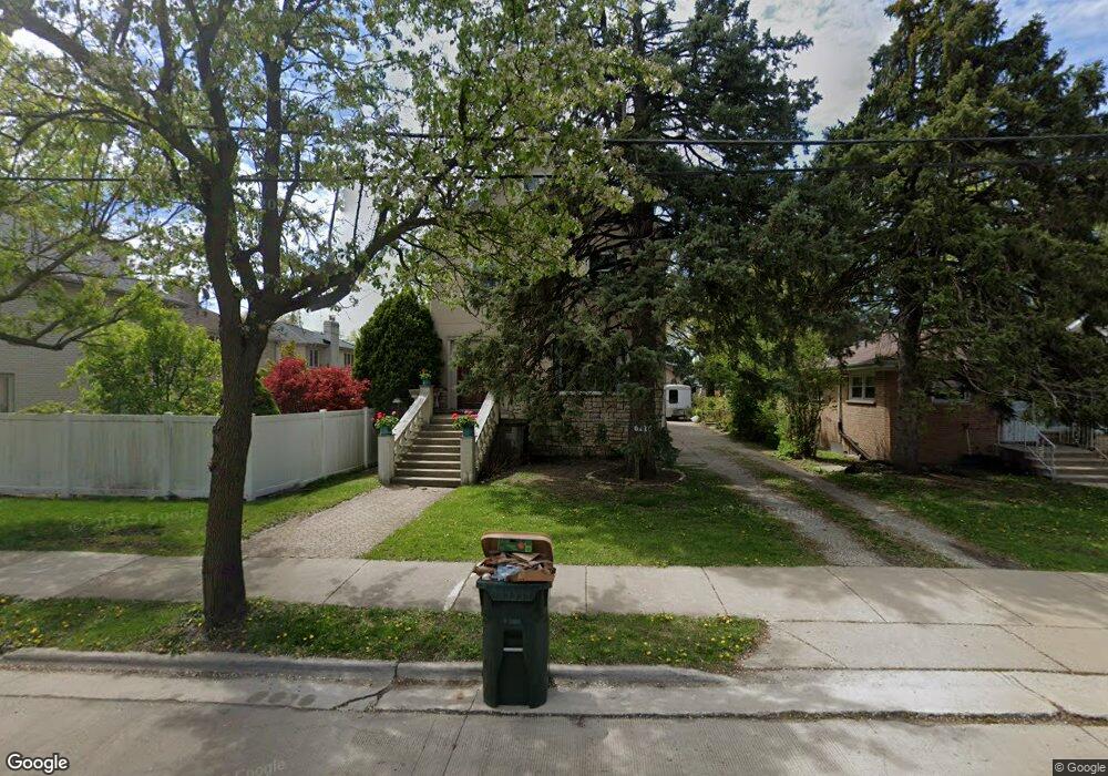
6115 Lincoln Ave Morton Grove, IL 60053
Estimated Value: $585,000 - $922,000
5
Beds
3
Baths
4,394
Sq Ft
$176/Sq Ft
Est. Value
About This Home
This home is located at 6115 Lincoln Ave, Morton Grove, IL 60053 and is currently estimated at $773,100, approximately $175 per square foot. 6115 Lincoln Ave is a home located in Cook County with nearby schools including Park View Elementary School and Niles West High School.
Ownership History
Date
Name
Owned For
Owner Type
Purchase Details
Closed on
Nov 22, 2000
Sold by
Adair Michael S and Adair Jean A
Bought by
Demian Daniel and Demian Adina S
Current Estimated Value
Purchase Details
Closed on
Jun 13, 1995
Sold by
Lembcke Michael P and Lembcke Michelle
Bought by
Adair Michael S and Adair Jean A
Home Financials for this Owner
Home Financials are based on the most recent Mortgage that was taken out on this home.
Original Mortgage
$125,100
Interest Rate
7.88%
Create a Home Valuation Report for This Property
The Home Valuation Report is an in-depth analysis detailing your home's value as well as a comparison with similar homes in the area
Home Values in the Area
Average Home Value in this Area
Purchase History
| Date | Buyer | Sale Price | Title Company |
|---|---|---|---|
| Demian Daniel | $162,000 | -- | |
| Adair Michael S | -- | -- |
Source: Public Records
Mortgage History
| Date | Status | Borrower | Loan Amount |
|---|---|---|---|
| Previous Owner | Adair Michael S | $125,100 |
Source: Public Records
Tax History Compared to Growth
Tax History
| Year | Tax Paid | Tax Assessment Tax Assessment Total Assessment is a certain percentage of the fair market value that is determined by local assessors to be the total taxable value of land and additions on the property. | Land | Improvement |
|---|---|---|---|---|
| 2024 | $16,084 | $59,000 | $8,575 | $50,425 |
| 2023 | $15,296 | $59,000 | $8,575 | $50,425 |
| 2022 | $15,296 | $59,000 | $8,575 | $50,425 |
| 2021 | $14,586 | $48,806 | $5,276 | $43,530 |
| 2020 | $14,270 | $48,806 | $5,276 | $43,530 |
| 2019 | $14,394 | $54,839 | $5,276 | $49,563 |
| 2018 | $16,989 | $57,275 | $4,782 | $52,493 |
| 2017 | $17,135 | $57,275 | $4,782 | $52,493 |
| 2016 | $16,415 | $57,275 | $4,782 | $52,493 |
| 2015 | $17,359 | $56,490 | $4,122 | $52,368 |
| 2014 | $17,358 | $56,490 | $4,122 | $52,368 |
| 2013 | $16,942 | $56,490 | $4,122 | $52,368 |
Source: Public Records
Map
Nearby Homes
- 6140 Elm St
- 6166 Mayfair St Unit 33714
- 6035 Lincoln Ave
- 6163 Mayfair St Unit 102714
- 8425 Callie Ave Unit 62
- 8400 Callie Ave Unit D209
- 8400 Callie Ave Unit D207
- 8300 Callie Ave Unit F314
- 8300 Callie Ave Unit F610
- 6330 Lincoln Ave Unit 2A
- 6411 Elm St
- 8380 Miami Ave
- 8712 Ferris Ave
- 6330 Hennings Ct
- 6338 Hennings Ct
- 6332 Hennings Ct
- 6336 Hennings Ct
- 6334 Hennings Ct
- 6340 Hennings Ct
- 6342 Hennings Ct
- 6117 Lincoln Ave
- 6119 Lincoln Ave
- 8440 Morton Ave
- 8436 Morton Ave
- 8444 Morton Ave
- 8432 Morton Ave
- 6123 Lincoln Ave
- 6112 Elm St
- 8428 Morton Ave
- 6108 Elm St
- 6116 Elm St
- 8501 School St
- 6120 Elm St
- 6125 Lincoln Ave
- 8424 Morton Ave
- 6126 Lincoln Ave
- 6100 Lincoln Ave
- 6124 Elm St
- 8420 Morton Ave
- 8437 Morton Ave