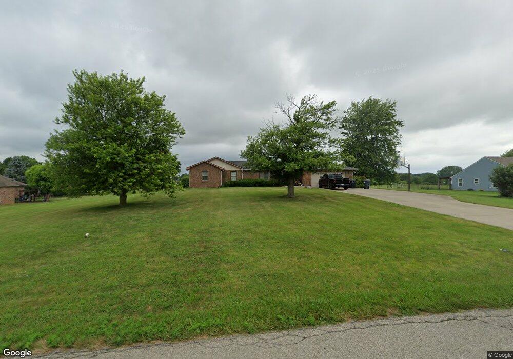
6116 N 25 W Whiteland, IN 46184
Estimated Value: $450,000 - $577,000
4
Beds
3
Baths
2,612
Sq Ft
$196/Sq Ft
Est. Value
About This Home
This home is located at 6116 N 25 W, Whiteland, IN 46184 and is currently estimated at $511,779, approximately $195 per square foot. 6116 N 25 W is a home located in Johnson County with nearby schools including Break-O-Day Elementary School, Clark-Pleasant Middle School, and Whiteland Community High School.
Ownership History
Date
Name
Owned For
Owner Type
Purchase Details
Closed on
May 15, 2017
Sold by
Lipps Gregory Dwayne
Bought by
Lipps Anthony W
Current Estimated Value
Purchase Details
Closed on
Jan 31, 2013
Sold by
Lipps Jammie Lou
Bought by
Lipps Gregory Dwayne
Create a Home Valuation Report for This Property
The Home Valuation Report is an in-depth analysis detailing your home's value as well as a comparison with similar homes in the area
Home Values in the Area
Average Home Value in this Area
Purchase History
| Date | Buyer | Sale Price | Title Company |
|---|---|---|---|
| Lipps Anthony W | -- | None Available | |
| Lipps Gregory Dwayne | -- | None Available |
Source: Public Records
Tax History Compared to Growth
Tax History
| Year | Tax Paid | Tax Assessment Tax Assessment Total Assessment is a certain percentage of the fair market value that is determined by local assessors to be the total taxable value of land and additions on the property. | Land | Improvement |
|---|---|---|---|---|
| 2025 | $3,384 | $443,700 | $51,400 | $392,300 |
| 2024 | $3,384 | $353,200 | $51,000 | $302,200 |
| 2023 | $3,443 | $339,900 | $48,300 | $291,600 |
| 2022 | $3,616 | $346,200 | $38,300 | $307,900 |
| 2021 | $2,949 | $282,100 | $37,600 | $244,500 |
| 2020 | $2,592 | $246,600 | $34,500 | $212,100 |
| 2019 | $2,394 | $226,900 | $33,500 | $193,400 |
| 2018 | $2,534 | $224,100 | $33,700 | $190,400 |
| 2017 | $2,817 | $245,100 | $58,200 | $186,900 |
| 2016 | $2,333 | $239,100 | $58,900 | $180,200 |
| 2014 | $2,062 | $197,500 | $44,800 | $152,700 |
| 2013 | $2,062 | $190,300 | $42,400 | $147,900 |
Source: Public Records
Map
Nearby Homes
- 1119 Chateaugay Ct
- 106 Tracy Ridge Blvd
- 190 Tracy Ridge Blvd
- 143 Tracy Ridge Blvd
- 256 Bittersweet Dr
- 731 W 600 N
- 821 Princeton Dr
- 12 Rypma Row
- 250 Southlane Dr
- 647 Bluestem Cir
- 53 Oakden Ct
- 57 Oakden Ct
- 6540 N Us Highway 31
- Liberty Plan at Crossroads at Southport
- 7331 Deerberg Dr
- Jefferson Plan at Crossroads at Southport
- 7338 Deerberg Dr
- Rushmore Plan at Crossroads at Southport
- Lincoln Plan at Crossroads at Southport
- Washington Plan at Crossroads at Southport
- 6074 N 25 W
- 1075 Hilltop Commons Blvd
- 1080 Hilltop Commons Blvd
- 1076 Hilltop Commons Blvd
- 6192 N 25 W
- 55 Hilltop Commons Blvd
- 181 Hilltop Commons Blvd
- 54 Hilltop Commons Blvd
- 1067 Hilltop Commons Blvd
- 1072 Hilltop Commons Blvd
- 1068 Hilltop Commons Blvd
- 1063 Hilltop Commons Blvd
- 1064 Hilltop Commons Blvd
- 1059 Hilltop Commons Blvd
- 6010 N 25 W
- 6203 N 25 W
- 1060 Hilltop Commons Blvd
- 318 W 600 N
- 1055 Hilltop Commons Blvd
- 164 Arabian Ct