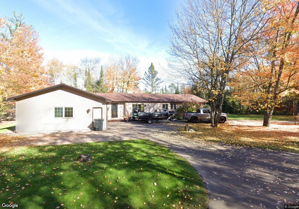
6116 River Rd Eagle River, WI 54521
Estimated Value: $465,000 - $693,201
Studio
--
Bath
--
Sq Ft
29,621
Sq Ft Lot
About This Home
This home is located at 6116 River Rd, Eagle River, WI 54521 and is currently estimated at $561,067. 6116 River Rd is a home located in Vilas County with nearby schools including Northland Pines High School.
Ownership History
Date
Name
Owned For
Owner Type
Purchase Details
Closed on
Nov 30, 2011
Sold by
Rozga Charisse A and Rozga Anderson Charisse A
Bought by
Rozga Anderson Charisse A and Anderson Scott C
Current Estimated Value
Home Financials for this Owner
Home Financials are based on the most recent Mortgage that was taken out on this home.
Original Mortgage
$167,700
Outstanding Balance
$12,265
Interest Rate
4.11%
Mortgage Type
New Conventional
Estimated Equity
$548,802
Purchase Details
Closed on
May 3, 2007
Sold by
Vacationland Invesiments Llc
Bought by
Rozga Charisse A
Create a Home Valuation Report for This Property
The Home Valuation Report is an in-depth analysis detailing your home's value as well as a comparison with similar homes in the area
Purchase History
| Date | Buyer | Sale Price | Title Company |
|---|---|---|---|
| Rozga Anderson Charisse A | -- | -- | |
| Rozga Charisse A | $270,000 | -- |
Source: Public Records
Mortgage History
| Date | Status | Borrower | Loan Amount |
|---|---|---|---|
| Open | Rozga Anderson Charisse A | $167,700 |
Source: Public Records
Tax History
| Year | Tax Paid | Tax Assessment Tax Assessment Total Assessment is a certain percentage of the fair market value that is determined by local assessors to be the total taxable value of land and additions on the property. | Land | Improvement |
|---|---|---|---|---|
| 2025 | $2,283 | $736,100 | $167,900 | $568,200 |
| 2024 | $2,326 | $736,100 | $167,900 | $568,200 |
| 2023 | $2,401 | $736,100 | $167,900 | $568,200 |
| 2022 | $2,062 | $209,300 | $52,200 | $157,100 |
| 2021 | $1,915 | $209,300 | $52,200 | $157,100 |
| 2020 | $2,020 | $209,300 | $52,200 | $157,100 |
| 2019 | $1,999 | $209,300 | $52,200 | $157,100 |
| 2018 | $1,973 | $209,300 | $52,200 | $157,100 |
| 2017 | $1,997 | $209,300 | $52,200 | $157,100 |
| 2016 | $1,796 | $209,300 | $52,200 | $157,100 |
| 2015 | $1,810 | $203,300 | $50,000 | $153,300 |
| 2014 | $1,774 | $203,300 | $50,000 | $153,300 |
| 2013 | $2,079 | $203,300 | $50,000 | $153,300 |
Source: Public Records
Map
Nearby Homes
- Lot 15 Butternut Cir
- Lot 16 Butternut Cir
- Lot 14 Butternut Cir
- Lot 2 Butternut Cir
- Lot 7 Butternut Cir
- Lot 17 Butternut Cir
- Lot 12 Butternut Cir
- Lot 11 Butternut Cir
- Lot 13 Butternut Cir
- Lot 18 Butternut Cir
- ON Chickaree Lake Rd Unit Lot 4
- Lot 22 Butternut Cir
- Lot 21 Butternut Cir
- ON River Rd Unit Lot 5
- ON River Rd Unit Lot 2
- Lot 20 Butternut Cir
- Lot 19 Butternut Cir
- Lot 6 Butternut Cir
- Lot 8 Butternut Cir
- Lot 12 Brook Trail
- 6108 River Rd
- 6127 River Rd
- 6132 River Rd
- 6100 River Rd
- 6121 River Rd
- 6136 River Rd
- 6109 River Rd
- 6101 River Rd
- 6096 River Rd
- 6138 River Rd
- 6095 River Rd
- 6078 State Highway 70 W Unit STH
- 1222 Cove Ln
- 6141 State Highway 70 W
- 1200 Cove Ln
- 6049 Otter Dr
- 6420 River Rd
- 6048 River Rd
- 6149 State Highway 70 W
- 6149 State Highway 70 W
Your Personal Tour Guide
Ask me questions while you tour the home.