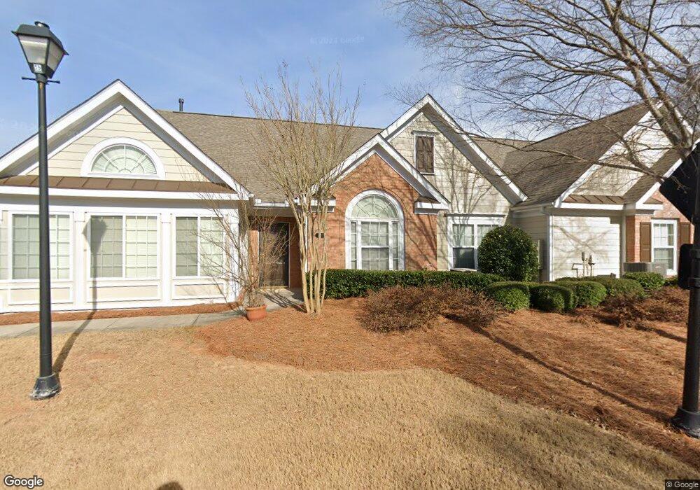
6117 Menlow Ct Cumming, GA 30041
Estimated Value: $434,000 - $465,000
3
Beds
2
Baths
1,729
Sq Ft
$259/Sq Ft
Est. Value
About This Home
This home is located at 6117 Menlow Ct, Cumming, GA 30041 and is currently estimated at $447,893, approximately $259 per square foot. 6117 Menlow Ct is a home located in Forsyth County with nearby schools including Haw Creek Elementary School, Lakeside Middle School, and South Forsyth High School.
Ownership History
Date
Name
Owned For
Owner Type
Purchase Details
Closed on
Aug 1, 2016
Sold by
Bregge Lori Vander
Bought by
Gordon Mary E
Current Estimated Value
Purchase Details
Closed on
Mar 31, 2011
Sold by
Breggen Mary J
Bought by
Lindsey Lori V B
Purchase Details
Closed on
Nov 19, 2004
Sold by
Orchards Of Forsyth Llc
Bought by
Vander Breggen Gordon J and Vander Breggen Mary
Home Financials for this Owner
Home Financials are based on the most recent Mortgage that was taken out on this home.
Original Mortgage
$80,010
Interest Rate
5.66%
Mortgage Type
New Conventional
Create a Home Valuation Report for This Property
The Home Valuation Report is an in-depth analysis detailing your home's value as well as a comparison with similar homes in the area
Home Values in the Area
Average Home Value in this Area
Purchase History
| Date | Buyer | Sale Price | Title Company |
|---|---|---|---|
| Gordon Mary E | $254,500 | -- | |
| Lindsey Lori V B | -- | -- | |
| Vander Breggen Gordon J | $241,200 | -- |
Source: Public Records
Mortgage History
| Date | Status | Borrower | Loan Amount |
|---|---|---|---|
| Previous Owner | Vander Breggen Gordon J | $80,010 |
Source: Public Records
Tax History Compared to Growth
Tax History
| Year | Tax Paid | Tax Assessment Tax Assessment Total Assessment is a certain percentage of the fair market value that is determined by local assessors to be the total taxable value of land and additions on the property. | Land | Improvement |
|---|---|---|---|---|
| 2025 | $742 | $178,320 | $72,000 | $106,320 |
| 2024 | $742 | $172,520 | $68,000 | $104,520 |
| 2023 | $635 | $162,040 | $60,000 | $102,040 |
| 2022 | $737 | $118,360 | $32,000 | $86,360 |
| 2021 | $719 | $118,360 | $32,000 | $86,360 |
| 2020 | $713 | $111,720 | $32,000 | $79,720 |
| 2019 | $721 | $115,040 | $32,000 | $83,040 |
| 2018 | $718 | $105,240 | $24,000 | $81,240 |
| 2017 | $2,650 | $95,480 | $24,000 | $71,480 |
| 2016 | $2,477 | $89,240 | $24,000 | $65,240 |
| 2015 | $2,403 | $86,440 | $24,000 | $62,440 |
| 2014 | $2,006 | $75,760 | $0 | $0 |
Source: Public Records
Map
Nearby Homes
- 6143 Menlow Ct
- 5985 Marlow Dr
- 6705 Marlow Dr
- 5303 Davenport Manor
- 2945 Links View Way
- 5349 Davenport Manor
- 3105 Neal Ct
- 3138 Neal Ct
- 4110 Morgan Elizabeth Way
- 2390 Colchester Ct
- 3147 Neal Ct
- 5613 Lancashire Ln
- 3935 Silver Springs Rd
- 4865 Cheltenham Place
- 3905 Silver Springs Rd
- 3945 Medley Way
- 4330 Wildener Way
- 6117 Menlow Ct Unit 6117
- 6117 Menlow Ct
- 6115 Menlow Ct
- 0 Milton Dr Unit 7103780
- 0 Milton Dr Unit 8535699
- 0 Milton Dr Unit 8533474
- 0 Milton Dr Unit 8196506
- 0 Milton Dr Unit 8159690
- 6135 Marlow Dr
- 6119 Menlow Ct
- 6125 Marlow Dr
- 6105 Menlow Ct
- 6121 Menlow Ct
- 6115 Marlow Dr
- 6118 Malloway Ct
- 6116 Malloway Ct Unit 6116
- 6109 Menlow Ct
- 6105 Marlow Dr
- 6108 Malloway Ct
- 6111 Menlow Ct