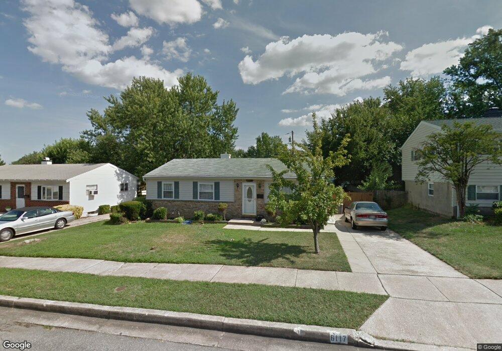
6117 Moorefield Rd Catonsville, MD 21228
Estimated Value: $347,567 - $421,000
--
Bed
2
Baths
1,092
Sq Ft
$360/Sq Ft
Est. Value
About This Home
This home is located at 6117 Moorefield Rd, Catonsville, MD 21228 and is currently estimated at $393,142, approximately $360 per square foot. 6117 Moorefield Rd is a home located in Baltimore County with nearby schools including Woodbridge Elementary School, Southwest Academy, and Woodlawn High School.
Ownership History
Date
Name
Owned For
Owner Type
Purchase Details
Closed on
Apr 26, 2004
Sold by
Singh Gurmukh
Bought by
Brown Herbert E and Brown Victoria E
Current Estimated Value
Purchase Details
Closed on
Aug 31, 1995
Sold by
Shallenberber Victoria E
Bought by
Singh Gurmukh
Home Financials for this Owner
Home Financials are based on the most recent Mortgage that was taken out on this home.
Original Mortgage
$90,000
Interest Rate
7.61%
Create a Home Valuation Report for This Property
The Home Valuation Report is an in-depth analysis detailing your home's value as well as a comparison with similar homes in the area
Home Values in the Area
Average Home Value in this Area
Purchase History
| Date | Buyer | Sale Price | Title Company |
|---|---|---|---|
| Brown Herbert E | $186,500 | -- | |
| Singh Gurmukh | $100,200 | -- |
Source: Public Records
Mortgage History
| Date | Status | Borrower | Loan Amount |
|---|---|---|---|
| Previous Owner | Singh Gurmukh | $90,000 |
Source: Public Records
Tax History Compared to Growth
Tax History
| Year | Tax Paid | Tax Assessment Tax Assessment Total Assessment is a certain percentage of the fair market value that is determined by local assessors to be the total taxable value of land and additions on the property. | Land | Improvement |
|---|---|---|---|---|
| 2025 | $3,316 | $253,900 | -- | -- |
| 2024 | $3,316 | $238,900 | $77,000 | $161,900 |
| 2023 | $1,599 | $228,233 | $0 | $0 |
| 2022 | $3,031 | $217,567 | $0 | $0 |
| 2021 | $2,878 | $206,900 | $77,000 | $129,900 |
| 2020 | $2,878 | $199,733 | $0 | $0 |
| 2019 | $2,786 | $192,567 | $0 | $0 |
| 2018 | $2,688 | $185,400 | $63,500 | $121,900 |
| 2017 | $2,660 | $182,133 | $0 | $0 |
| 2016 | $2,326 | $178,867 | $0 | $0 |
| 2015 | $2,326 | $175,600 | $0 | $0 |
| 2014 | $2,326 | $175,600 | $0 | $0 |
Source: Public Records
Map
Nearby Homes
- 6031 Burnt Oak Rd
- 800 Crosby Rd
- 1418 Harberson Rd
- 6200 Gilston Park Rd
- 6028 Moorehead Rd
- 1009 Rowe Ln
- 6263 Gilston Park Rd
- 3 Mcgrady Square
- 1111 Cummings Ave
- 67 Walden Mill Way
- 1503 Woodcliff Ave
- 908 Vanderwood Rd
- 14 Madison Mills Ct
- 1019 Cummings Ave
- 1007 Kent Ave
- 920 Vanderwood Rd
- 930 Sedgley Rd
- 1013 Cummings Ave
- 2100 Chantilla Rd
- 6011 Johnnycake Rd
- 6115 Moorefield Rd
- 6112 Chanceford Rd
- 6114 Chanceford Rd
- 6113 Moorefield Rd
- 6121 Moorefield Rd
- 6110 Chanceford Rd
- 6118 Moorefield Rd
- 6116 Chanceford Rd
- 6116 Moorefield Rd
- 6120 Moorefield Rd
- 6111 Moorefield Rd
- 6108 Chanceford Rd
- 6114 Moorefield Rd
- 6122 Moorefield Rd
- 6125 Moorefield Rd
- 6123 Moorefield Rd
- 6126 Moorefield Rd
- 6113 Chanceford Rd
- 6112 Moorefield Rd
- 6109 Moorefield Rd