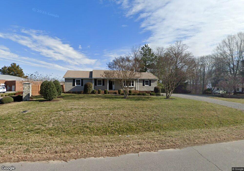
6119 Mockingbird Ln Midlothian, VA 23112
Estimated Value: $381,280 - $622,000
3
Beds
2
Baths
2,002
Sq Ft
$229/Sq Ft
Est. Value
About This Home
This home is located at 6119 Mockingbird Ln, Midlothian, VA 23112 and is currently estimated at $458,320, approximately $228 per square foot. 6119 Mockingbird Ln is a home located in Chesterfield County with nearby schools including Clover Hill Elementary School, Swift Creek Middle, and Clover Hill High.
Ownership History
Date
Name
Owned For
Owner Type
Purchase Details
Closed on
Nov 8, 2018
Sold by
Swift Creek Place Partners Llc
Bought by
Nnn Holdings Llc
Current Estimated Value
Purchase Details
Closed on
Oct 27, 2015
Sold by
Mills Roy T and Mills Janell J
Bought by
Swift Creek Place Partners Llc
Home Financials for this Owner
Home Financials are based on the most recent Mortgage that was taken out on this home.
Original Mortgage
$277,500
Interest Rate
3.92%
Mortgage Type
Land Contract Argmt. Of Sale
Create a Home Valuation Report for This Property
The Home Valuation Report is an in-depth analysis detailing your home's value as well as a comparison with similar homes in the area
Home Values in the Area
Average Home Value in this Area
Purchase History
| Date | Buyer | Sale Price | Title Company |
|---|---|---|---|
| Nnn Holdings Llc | -- | None Available | |
| Swift Creek Place Partners Llc | $400,000 | Safe Harbor Title Company |
Source: Public Records
Mortgage History
| Date | Status | Borrower | Loan Amount |
|---|---|---|---|
| Previous Owner | Swift Creek Place Partners Llc | $277,500 |
Source: Public Records
Tax History
| Year | Tax Paid | Tax Assessment Tax Assessment Total Assessment is a certain percentage of the fair market value that is determined by local assessors to be the total taxable value of land and additions on the property. | Land | Improvement |
|---|---|---|---|---|
| 2025 | $3,436 | $386,100 | $59,000 | $327,100 |
| 2024 | $3,436 | $383,100 | $56,000 | $327,100 |
| 2023 | $1,227 | $134,800 | $134,800 | $0 |
| 2022 | $1,213 | $131,800 | $131,800 | $0 |
| 2021 | $1,252 | $131,800 | $131,800 | $0 |
| 2020 | $1,246 | $131,200 | $131,200 | $0 |
| 2019 | $1,191 | $140,810 | $125,400 | $15,410 |
| 2018 | $2,642 | $318,800 | $125,400 | $193,400 |
| 2017 | $2,205 | $224,500 | $103,700 | $120,800 |
| 2016 | $2,155 | $224,500 | $103,700 | $120,800 |
| 2015 | $1,974 | $203,000 | $42,000 | $161,000 |
| 2014 | $1,829 | $187,900 | $42,000 | $145,900 |
Source: Public Records
Map
Nearby Homes
- 7112 Harbourside Ct
- 13501 Buck Rub Dr
- 6903 Whistlers Cove Dr
- 7018 Whistlers Cove Dr
- 4902 Court Ridge Terrace
- 5910 Harbourwood Place
- 13217 Court Ridge Rd
- 5900 Harbourwood Place
- 13642 Decidedly Ct
- 5601 Promontory Pointe Rd
- 13903 Deer Thicket Ln
- 7301 Native Dancer Dr
- 13707 Swale Ln
- 13624 Lucky Debonair Ln
- 4607 Morning Hill Ct
- 14000 Key Deer Dr
- 4602 Morning Hill Ct
- 13574 Heathbrook Terrace
- 12831 Red Clover Way
- 12815 Red Clover Way
- 6113 Mockingbird Ln
- 6201 Mockingbird Ln
- 6200 Mockingbird Ln
- 6107 Mockingbird Ln
- 6121 Mockingbird Ln
- 13511 Hull Street Rd
- 6301 Harbourside Dr
- 6209 Mockingbird Ln
- 6208 Mockingbird Ln
- 13501 Hull Street Rd
- 6325 Harbourside Dr
- 6217 Mockingbird Ln
- 6224 Mockingbird Ln
- 6316 Harbourside Dr
- 6308 Harbourside Dr
- 6331 Harbourside Dr
- 6300 Harbourside Dr
- 6400 Ships Watch Ln
- 6300 Mockingbird Ln
- 6225 Mockingbird Ln
Your Personal Tour Guide
Ask me questions while you tour the home.