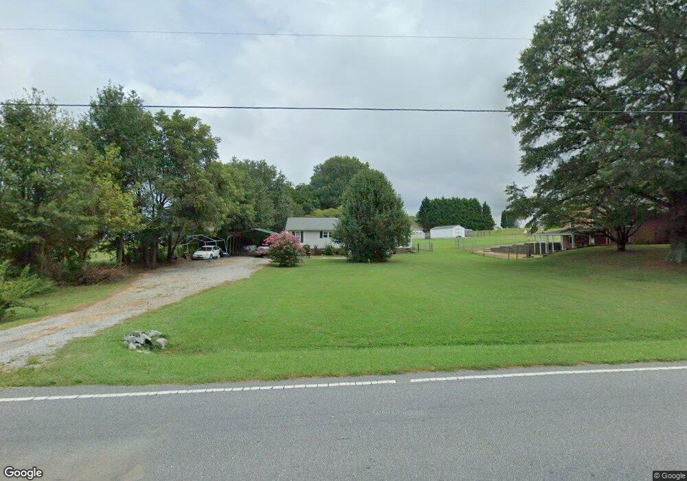
6119 Nc 27 Iron Station, NC 28080
Estimated Value: $245,000 - $314,000
3
Beds
2
Baths
1,512
Sq Ft
$188/Sq Ft
Est. Value
About This Home
This home is located at 6119 Nc 27, Iron Station, NC 28080 and is currently estimated at $284,424, approximately $188 per square foot. 6119 Nc 27 is a home located in Lincoln County with nearby schools including Iron Station Elementary School, East Lincoln Middle School, and East Lincoln High School.
Ownership History
Date
Name
Owned For
Owner Type
Purchase Details
Closed on
Jul 9, 2018
Sold by
Thomas Jonathan S
Bought by
Riley Benny G
Current Estimated Value
Home Financials for this Owner
Home Financials are based on the most recent Mortgage that was taken out on this home.
Original Mortgage
$149,246
Outstanding Balance
$130,053
Interest Rate
4.75%
Mortgage Type
FHA
Estimated Equity
$154,371
Purchase Details
Closed on
May 29, 2014
Sold by
Roach Deborah Leigh Morrison
Bought by
Thomas Jonathan S
Home Financials for this Owner
Home Financials are based on the most recent Mortgage that was taken out on this home.
Original Mortgage
$87,755
Interest Rate
4.32%
Mortgage Type
New Conventional
Create a Home Valuation Report for This Property
The Home Valuation Report is an in-depth analysis detailing your home's value as well as a comparison with similar homes in the area
Home Values in the Area
Average Home Value in this Area
Purchase History
| Date | Buyer | Sale Price | Title Company |
|---|---|---|---|
| Riley Benny G | $152,000 | None Available | |
| Thomas Jonathan S | $86,000 | None Available |
Source: Public Records
Mortgage History
| Date | Status | Borrower | Loan Amount |
|---|---|---|---|
| Open | Riley Benny G | $149,246 | |
| Previous Owner | Thomas Jonathan S | $87,755 |
Source: Public Records
Tax History Compared to Growth
Tax History
| Year | Tax Paid | Tax Assessment Tax Assessment Total Assessment is a certain percentage of the fair market value that is determined by local assessors to be the total taxable value of land and additions on the property. | Land | Improvement |
|---|---|---|---|---|
| 2025 | $1,357 | $196,679 | $35,780 | $160,899 |
| 2024 | $1,337 | $196,679 | $35,780 | $160,899 |
| 2023 | $1,306 | $196,679 | $35,780 | $160,899 |
| 2022 | $1,064 | $128,961 | $24,000 | $104,961 |
| 2021 | $1,064 | $128,961 | $24,000 | $104,961 |
| 2020 | $923 | $128,961 | $24,000 | $104,961 |
| 2019 | $923 | $128,961 | $24,000 | $104,961 |
| 2018 | $833 | $100,608 | $22,500 | $78,108 |
| 2017 | $732 | $100,608 | $22,500 | $78,108 |
| 2016 | $732 | $100,608 | $22,500 | $78,108 |
| 2015 | $803 | $100,608 | $22,500 | $78,108 |
| 2014 | $906 | $116,322 | $27,000 | $89,322 |
Source: Public Records
Map
Nearby Homes
- 5486 E Highway 27
- 222 Oakhill St
- 4394 Mountain Creek Rd
- 4364 Hager Mountain Ln
- 6 Hager Mountain Ln
- 3960 Orchard Rd
- 4859 Paysour Pond Rd
- 4435 Cornett Dr
- 1279 Craig Dr
- 3388 Rhyne Forest Rd
- 1481 Depot St
- 1554 Forum Ln
- 1987 & 1981 Magnolia Grove Rd
- 1713 Oak Park Ct
- 5038 Arden Gate Dr
- 1789 Doe Ct
- 1785 Doe Ct
- 0 Wolf Rd Unit 8
- 1485 Adkin Dr
- 5039 Penn Rd
- 6119 E Highway 27
- 6133 Nc 27
- 6133 E Highway 27
- 6133 E Hwy 27 Hwy
- 2530 Long Cir
- 2548 Long Cir
- 2486 Long Cir
- 2515 Long Cir
- 2495 Long Cir
- 2551 Long Cir
- 6069 E Highway 27
- 2481 Long Cir
- 2569 Long Cir
- 2592 Long Cir
- 2585 Long Cir
- 4918 Clay Rhine Ln
- 0 Clay Rhine Ln Unit 5 & 6 3539531
- 2618 Long Cir
- 2433 Long Cir
- 0000 Long Cir