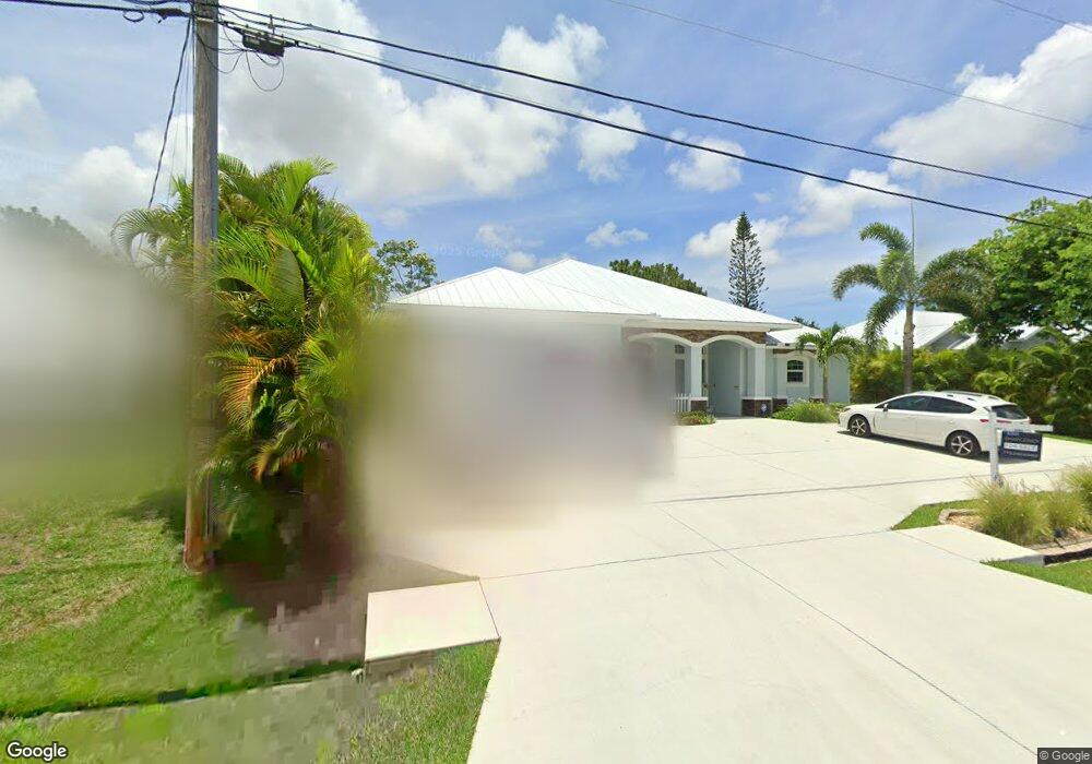
6119 NW East Deville Cir Port St. Lucie, FL 34986
Torino NeighborhoodEstimated Value: $489,000 - $611,106
5
Beds
3
Baths
2,581
Sq Ft
$217/Sq Ft
Est. Value
About This Home
This home is located at 6119 NW East Deville Cir, Port St. Lucie, FL 34986 and is currently estimated at $560,027, approximately $216 per square foot. 6119 NW East Deville Cir is a home located in St. Lucie County with nearby schools including West Gate K-8 School, Oak Hammock K-8 School, and Bayshore Elementary School.
Ownership History
Date
Name
Owned For
Owner Type
Purchase Details
Closed on
Oct 7, 2017
Sold by
Mineo Juliana P
Bought by
Mineo Anthony P
Current Estimated Value
Home Financials for this Owner
Home Financials are based on the most recent Mortgage that was taken out on this home.
Original Mortgage
$250,000
Interest Rate
3.94%
Mortgage Type
New Conventional
Purchase Details
Closed on
May 20, 2016
Sold by
Mineo Anthony P
Bought by
Mineo Anthony P and Mineo Juliana P
Home Financials for this Owner
Home Financials are based on the most recent Mortgage that was taken out on this home.
Original Mortgage
$220,000
Interest Rate
3.87%
Mortgage Type
Adjustable Rate Mortgage/ARM
Purchase Details
Closed on
Jan 6, 2015
Sold by
Dijak Steve and Dijak Katarina
Bought by
Mineo Anthony P
Create a Home Valuation Report for This Property
The Home Valuation Report is an in-depth analysis detailing your home's value as well as a comparison with similar homes in the area
Home Values in the Area
Average Home Value in this Area
Purchase History
| Date | Buyer | Sale Price | Title Company |
|---|---|---|---|
| Mineo Anthony P | $1,083,000 | None Available | |
| Mineo Anthony P | -- | First International Title In | |
| Mineo Anthony P | $19,500 | Community Land Title & Resea |
Source: Public Records
Mortgage History
| Date | Status | Borrower | Loan Amount |
|---|---|---|---|
| Previous Owner | Mineo Anthony P | $250,000 | |
| Previous Owner | Mineo Anthony P | $220,000 |
Source: Public Records
Tax History Compared to Growth
Tax History
| Year | Tax Paid | Tax Assessment Tax Assessment Total Assessment is a certain percentage of the fair market value that is determined by local assessors to be the total taxable value of land and additions on the property. | Land | Improvement |
|---|---|---|---|---|
| 2024 | $7,012 | $333,053 | -- | -- |
| 2023 | $7,012 | $323,353 | $0 | $0 |
| 2022 | $6,806 | $313,935 | $0 | $0 |
| 2021 | $6,777 | $304,792 | $0 | $0 |
| 2020 | $6,450 | $284,707 | $0 | $0 |
| 2019 | $6,405 | $278,306 | $0 | $0 |
| 2018 | $6,119 | $273,117 | $0 | $0 |
| 2017 | $6,064 | $264,700 | $38,000 | $226,700 |
| 2016 | $697 | $21,800 | $21,800 | $0 |
| 2015 | $504 | $18,700 | $18,700 | $0 |
| 2014 | $426 | $11,110 | $0 | $0 |
Source: Public Records
Map
Nearby Homes
- 6121 NW Daroco Terrace
- 6049 NW Winfield Dr
- 6116 NW Daroco Terrace
- 6148 NW Densaw Terrace
- 6215 NW West Deville Cir
- 6457 NW Favian Ct
- 5928 NW Wesley Rd
- 6029 NW Winfield Dr
- 5853 NW Culebra Ave
- 6135 NW Densaw Terrace
- 6127 NW Drophy Ave
- 5745 NW Wesley Rd
- 6018 NW Winfield Dr
- 5909 NW Bayou Ct
- 5910 NW Bayou Ct
- 6443 NW Fir Ct
- 5664 NW Whitecap Rd
- 6024 NW Favian Ave
- 6460 NW Flair St
- 6116 NW Densaw Terrace
- 6117 NW East Deville Cir
- 6121 NW East Deville Cir
- 6123 NW East Deville Cir
- 6118 NW East Deville Cir
- 6120 NW East Deville Cir
- 6115 NW East Deville Cir
- 6113 NW East Deville Cir
- 6122 NW East Deville Cir
- 6121 NW Durian St
- 6125 NW East Deville Cir
- 6113 NW Deville Cir
- 6124 NW East Deville Cir
- 6127 NW East Deville Cir
- 6127 NW Deville Cir
- 6110 NW East Deville Cir
- 6126 NW East Deville Cir
- 6125 NW Durian St
- 6129 NW Daroco Terrace
- 6111 NW East Deville Cir
- 6127 NW Daroco Terrace