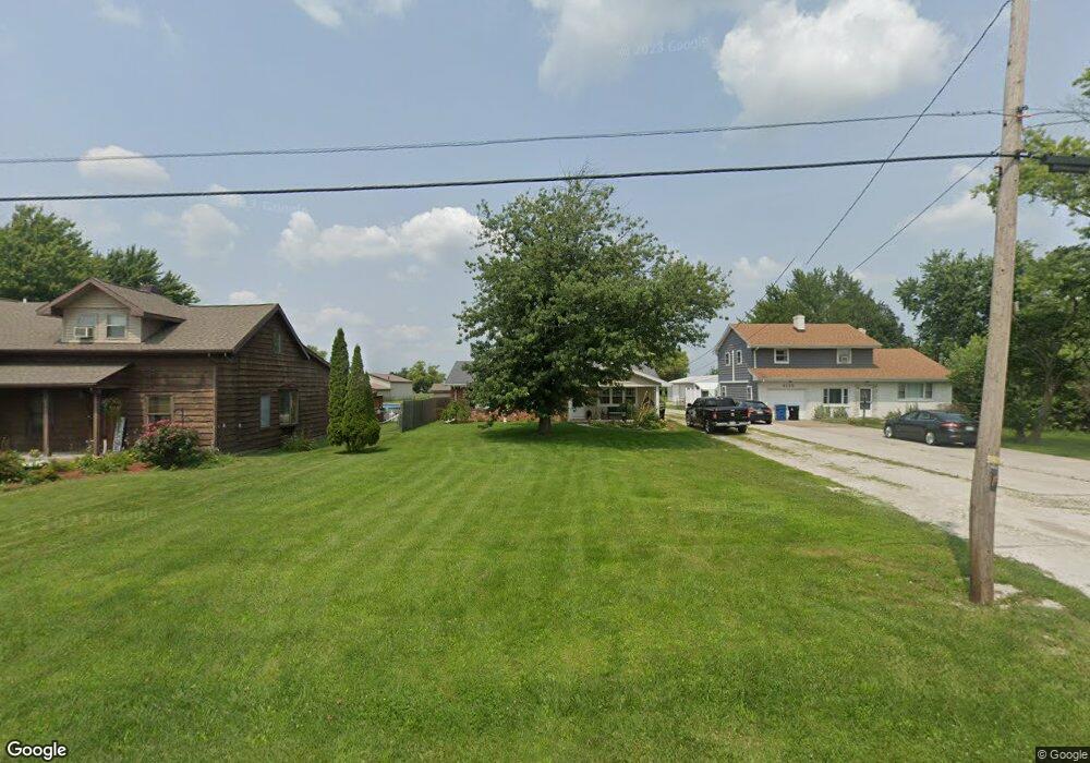
6119 Seaman Rd Oregon, OH 43616
Estimated Value: $176,000 - $316,000
5
Beds
3
Baths
2,229
Sq Ft
$107/Sq Ft
Est. Value
About This Home
This home is located at 6119 Seaman Rd, Oregon, OH 43616 and is currently estimated at $237,670, approximately $106 per square foot. 6119 Seaman Rd is a home located in Lucas County.
Ownership History
Date
Name
Owned For
Owner Type
Purchase Details
Closed on
Mar 18, 2021
Sold by
Campbell Bryan A and Campbell Amy S
Bought by
Hamilton Sean P and Hamilton Jessica
Current Estimated Value
Home Financials for this Owner
Home Financials are based on the most recent Mortgage that was taken out on this home.
Original Mortgage
$225,834
Outstanding Balance
$203,461
Interest Rate
2.73%
Mortgage Type
FHA
Estimated Equity
$27,550
Purchase Details
Closed on
Dec 20, 2019
Sold by
Estate Of Dorothy A Campbell
Bought by
Campbell Scott F and Campbell Bryan A
Purchase Details
Closed on
Oct 11, 2012
Sold by
Estate Of William W Fisher
Bought by
Campbell Dorothy A and Krupp Penny
Purchase Details
Closed on
Sep 24, 2012
Sold by
Fisher William W and Fisher Melissa
Bought by
Campbell Dorothy A
Purchase Details
Closed on
Aug 14, 2012
Sold by
Krupp Penny and Krupp David
Bought by
Campbell Dorothy A
Purchase Details
Closed on
Jun 22, 2005
Sold by
Fisher William W
Bought by
Fisher William W and Krupp David
Home Financials for this Owner
Home Financials are based on the most recent Mortgage that was taken out on this home.
Original Mortgage
$31,700
Interest Rate
5.68%
Mortgage Type
New Conventional
Create a Home Valuation Report for This Property
The Home Valuation Report is an in-depth analysis detailing your home's value as well as a comparison with similar homes in the area
Home Values in the Area
Average Home Value in this Area
Purchase History
| Date | Buyer | Sale Price | Title Company |
|---|---|---|---|
| Hamilton Sean P | $115,000 | Epstein Robert | |
| Hamilton Sean P | $115,000 | Epstein Robert | |
| Campbell Scott F | -- | None Available | |
| Campbell Dorothy A | -- | None Available | |
| Campbell Dorothy A | -- | None Available | |
| Campbell Dorothy A | -- | None Available | |
| Fisher William W | -- | Landresource Title Agency Ll |
Source: Public Records
Mortgage History
| Date | Status | Borrower | Loan Amount |
|---|---|---|---|
| Open | Hamilton Sean P | $225,834 | |
| Closed | Hamilton Sean P | $225,834 | |
| Previous Owner | Fisher William W | $31,700 |
Source: Public Records
Tax History Compared to Growth
Tax History
| Year | Tax Paid | Tax Assessment Tax Assessment Total Assessment is a certain percentage of the fair market value that is determined by local assessors to be the total taxable value of land and additions on the property. | Land | Improvement |
|---|---|---|---|---|
| 2024 | $1,381 | $58,415 | $10,325 | $48,090 |
| 2023 | $1,782 | $31,955 | $5,985 | $25,970 |
| 2022 | $2,036 | $31,955 | $5,985 | $25,970 |
| 2021 | $2,094 | $31,955 | $5,985 | $25,970 |
| 2020 | $1,973 | $26,530 | $4,935 | $21,595 |
| 2019 | $1,925 | $26,530 | $4,935 | $21,595 |
| 2018 | $1,792 | $26,530 | $4,935 | $21,595 |
| 2017 | $1,693 | $21,420 | $7,840 | $13,580 |
| 2016 | $1,675 | $61,200 | $22,400 | $38,800 |
| 2015 | $1,906 | $61,200 | $22,400 | $38,800 |
| 2014 | $1,315 | $21,000 | $7,700 | $13,300 |
| 2013 | $1,315 | $21,000 | $7,700 | $13,300 |
Source: Public Records
Map
Nearby Homes
- 6530 Corduroy Rd
- 234 Avilyn Ln
- 5054 Magnolia Dr
- 5065 Magnolia Dr
- 5071 Magnolia Dr
- 5047 Noah Ln
- 140 N Wynn Rd
- 5037 Easton Dr
- 5040 Easton Dr
- 5033 Easton Dr
- 5036 Easton Dr
- 5029 Easton Dr
- 5032 Easton Dr
- 5025 Easton Dr
- 5026 Easton Dr
- 5021 Easton Dr
- 7330 Jerusalem Rd
- 5555 Brown Rd
- 5243 Eagles Landing Dr
- 5911 Plympton Cir
