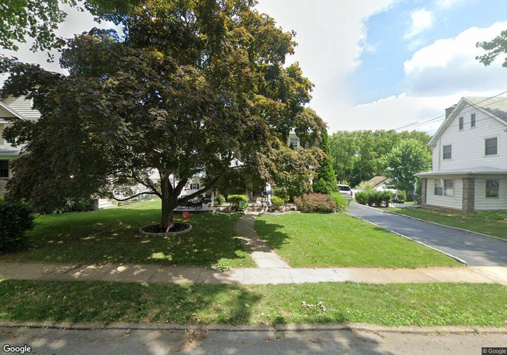
612 Ashurst Rd Havertown, PA 19083
Estimated Value: $785,000 - $932,000
4
Beds
3
Baths
2,958
Sq Ft
$280/Sq Ft
Est. Value
About This Home
This home is located at 612 Ashurst Rd, Havertown, PA 19083 and is currently estimated at $828,276, approximately $280 per square foot. 612 Ashurst Rd is a home located in Delaware County with nearby schools including Chatham Park Elementary School, Haverford Middle School, and Haverford Senior High School.
Ownership History
Date
Name
Owned For
Owner Type
Purchase Details
Closed on
Aug 1, 2002
Sold by
Eberz Eric and Eberz Michele
Bought by
Eberz Eric and Eberz Michele
Current Estimated Value
Home Financials for this Owner
Home Financials are based on the most recent Mortgage that was taken out on this home.
Original Mortgage
$100,000
Interest Rate
6.06%
Mortgage Type
Purchase Money Mortgage
Purchase Details
Closed on
Jun 25, 1998
Sold by
Helmer Ruth K and Bishop Helen H
Bought by
Eberz Eric and Thornton Michele
Home Financials for this Owner
Home Financials are based on the most recent Mortgage that was taken out on this home.
Original Mortgage
$105,000
Interest Rate
7.25%
Mortgage Type
Purchase Money Mortgage
Create a Home Valuation Report for This Property
The Home Valuation Report is an in-depth analysis detailing your home's value as well as a comparison with similar homes in the area
Home Values in the Area
Average Home Value in this Area
Purchase History
| Date | Buyer | Sale Price | Title Company |
|---|---|---|---|
| Eberz Eric | -- | -- | |
| Eberz Eric | $145,000 | Security Search & Abstract C |
Source: Public Records
Mortgage History
| Date | Status | Borrower | Loan Amount |
|---|---|---|---|
| Closed | Eberz Eric | $100,000 | |
| Closed | Eberz Eric | $105,000 |
Source: Public Records
Tax History Compared to Growth
Tax History
| Year | Tax Paid | Tax Assessment Tax Assessment Total Assessment is a certain percentage of the fair market value that is determined by local assessors to be the total taxable value of land and additions on the property. | Land | Improvement |
|---|---|---|---|---|
| 2025 | $11,273 | $438,430 | $108,400 | $330,030 |
| 2024 | $11,273 | $438,430 | $108,400 | $330,030 |
| 2023 | $10,953 | $438,430 | $108,400 | $330,030 |
| 2022 | $10,697 | $438,430 | $108,400 | $330,030 |
| 2021 | $16,681 | $419,680 | $108,400 | $311,280 |
| 2020 | $8,497 | $182,810 | $54,890 | $127,920 |
| 2019 | $8,340 | $182,810 | $54,890 | $127,920 |
| 2018 | $8,197 | $182,810 | $0 | $0 |
| 2017 | $8,023 | $182,810 | $0 | $0 |
| 2016 | $1,003 | $182,810 | $0 | $0 |
| 2015 | $1,024 | $182,810 | $0 | $0 |
| 2014 | $1,003 | $182,810 | $0 | $0 |
Source: Public Records
Map
Nearby Homes
- 501 E Manoa Rd
- 304 Earlington Rd
- 524 Sagamore Rd
- 214 Brentwood Rd
- 210 Farnham Rd
- 171 Juniper Rd
- 204 E Manoa Rd
- 104 Brentwood Rd
- 222 Harrogate Rd
- 978 Township Line Rd
- 142 Foster Ave
- 111 Harrogate Rd
- 1460 Drayton Ln
- 228 N Linden Ave
- 100 Brookline Blvd
- 221 E Park Rd
- 223 E Park Rd
- 243 Rock Glen Rd
- 148 Meadowbrook Ave
- 110 E Township Line Rd
- 618 Ashurst Rd
- 608 Ashurst Rd
- 622 Ashurst Rd
- 801 Walnut Place
- 615 E Manoa Rd
- 615 N Manoa Rd
- 611 E Manoa Rd
- 617 E Manoa Rd
- 617 E Manoa Rd
- 607 E Manoa Rd
- 617 Ashurst Rd
- 605 Ashurst Rd
- 621 Ashurst Rd
- 630 Ashurst Rd
- 627 E Manoa Rd
- 601 E Manoa Rd
- 601 Ashurst Rd
- 627 Ashurst Rd
- 636 Ashurst Rd
- 631 Ashurst Rd