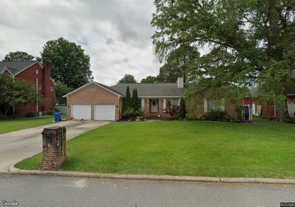
612 Box St Athens, AL 35611
Estimated Value: $303,000 - $412,000
--
Bed
1
Bath
2,356
Sq Ft
$153/Sq Ft
Est. Value
About This Home
This home is located at 612 Box St, Athens, AL 35611 and is currently estimated at $359,674, approximately $152 per square foot. 612 Box St is a home with nearby schools including Julian Newman Elementary School, Athens Intermediate School, and Athens Middle School.
Ownership History
Date
Name
Owned For
Owner Type
Purchase Details
Closed on
Jun 23, 2005
Sold by
Brown Polk Charles E and Brown Polk
Bought by
Brown William Richard
Current Estimated Value
Home Financials for this Owner
Home Financials are based on the most recent Mortgage that was taken out on this home.
Original Mortgage
$44,000
Outstanding Balance
$22,835
Interest Rate
5.57%
Estimated Equity
$336,839
Create a Home Valuation Report for This Property
The Home Valuation Report is an in-depth analysis detailing your home's value as well as a comparison with similar homes in the area
Home Values in the Area
Average Home Value in this Area
Purchase History
| Date | Buyer | Sale Price | Title Company |
|---|---|---|---|
| Brown William Richard | -- | -- |
Source: Public Records
Mortgage History
| Date | Status | Borrower | Loan Amount |
|---|---|---|---|
| Open | Brown William Richard | $44,000 | |
| Open | Brown William Richard | $176,000 |
Source: Public Records
Tax History Compared to Growth
Tax History
| Year | Tax Paid | Tax Assessment Tax Assessment Total Assessment is a certain percentage of the fair market value that is determined by local assessors to be the total taxable value of land and additions on the property. | Land | Improvement |
|---|---|---|---|---|
| 2024 | $1,398 | $33,920 | $0 | $0 |
| 2023 | $1,304 | $32,440 | $0 | $0 |
| 2022 | $960 | $25,320 | $0 | $0 |
| 2021 | $858 | $22,780 | $0 | $0 |
| 2020 | $861 | $22,860 | $0 | $0 |
| 2019 | $822 | $21,880 | $0 | $0 |
| 2018 | $824 | $21,920 | $0 | $0 |
| 2017 | $824 | $21,920 | $0 | $0 |
| 2016 | $868 | $230,030 | $0 | $0 |
| 2015 | $868 | $23,020 | $0 | $0 |
| 2014 | $851 | $0 | $0 | $0 |
Source: Public Records
Map
Nearby Homes
- 612 Hereford Dr
- 521 East St
- 1000 Park Place
- 903 Brahma St
- 801 E Forrest St
- 906 E Forrest St
- 136 Christopher Cir
- 1 Highway 72
- 5.47 +/- ACRES Forrest St
- 1108 Winston Dr
- 1400 SW Jefferson St
- 1305 S Madison St
- 16 Highway 72 W
- 402 6th St
- 1306 S Madison St
- 1308 S Madison St
- 402 Morningview St
- 305 Thomas St
- 1308 S Houston St
- 804 S Houston St