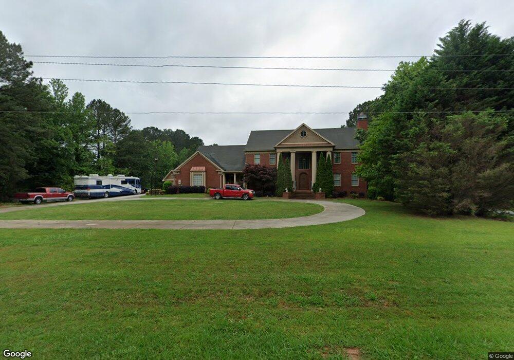
612 Forrest Ave Fayetteville, GA 30214
Estimated Value: $551,000 - $782,000
--
Bed
--
Bath
4,721
Sq Ft
$140/Sq Ft
Est. Value
About This Home
This home is located at 612 Forrest Ave, Fayetteville, GA 30214 and is currently estimated at $659,667, approximately $139 per square foot. 612 Forrest Ave is a home located in Fayette County with nearby schools including Bennett's Mill Middle School, Fayette County High School, and Rising Star Montessori School.
Ownership History
Date
Name
Owned For
Owner Type
Purchase Details
Closed on
Oct 13, 2020
Sold by
Glover Letitia
Bought by
Glover John and Sanders Wanda
Current Estimated Value
Purchase Details
Closed on
Jul 22, 2009
Sold by
Indymac Federal Bank Fsb
Bought by
Glover Letitia
Purchase Details
Closed on
May 6, 2008
Sold by
Bowen Robin
Bought by
Indy Mac Bank Fsb
Purchase Details
Closed on
Sep 30, 1997
Sold by
Morris Brenda Mccay
Bought by
Bowen Debra
Home Financials for this Owner
Home Financials are based on the most recent Mortgage that was taken out on this home.
Original Mortgage
$22,400
Interest Rate
7.39%
Mortgage Type
Seller Take Back
Create a Home Valuation Report for This Property
The Home Valuation Report is an in-depth analysis detailing your home's value as well as a comparison with similar homes in the area
Home Values in the Area
Average Home Value in this Area
Purchase History
| Date | Buyer | Sale Price | Title Company |
|---|---|---|---|
| Glover John | -- | Providence Title | |
| Glover John | -- | Providence Title | |
| Glover John | -- | -- | |
| Glover Letitia | $149,000 | -- | |
| Indy Mac Bank Fsb | $351,949 | -- | |
| Bowen Debra | $28,000 | -- |
Source: Public Records
Mortgage History
| Date | Status | Borrower | Loan Amount |
|---|---|---|---|
| Previous Owner | Bowen Debra | $22,400 |
Source: Public Records
Tax History Compared to Growth
Tax History
| Year | Tax Paid | Tax Assessment Tax Assessment Total Assessment is a certain percentage of the fair market value that is determined by local assessors to be the total taxable value of land and additions on the property. | Land | Improvement |
|---|---|---|---|---|
| 2024 | $5,832 | $275,808 | $48,000 | $227,808 |
| 2023 | $5,434 | $264,680 | $48,000 | $216,680 |
| 2022 | $5,645 | $253,480 | $48,000 | $205,480 |
| 2021 | $5,125 | $196,840 | $26,000 | $170,840 |
| 2020 | $4,948 | $174,560 | $26,000 | $148,560 |
| 2019 | $4,855 | $169,480 | $26,000 | $143,480 |
| 2018 | $6,185 | $213,440 | $18,000 | $195,440 |
| 2017 | $6,122 | $210,400 | $18,000 | $192,400 |
| 2016 | $5,589 | $187,840 | $18,000 | $169,840 |
| 2015 | $5,181 | $170,960 | $18,000 | $152,960 |
| 2014 | $4,637 | $150,120 | $18,000 | $132,120 |
| 2013 | -- | $138,600 | $0 | $0 |
Source: Public Records
Map
Nearby Homes
- E OF 118 Stanley Rd
- 115 Westside Way
- Columbia Plan at Arborvale
- Oak Park Plan at Arborvale
- Esquire Place Plan at Arborvale
- Cumberland Plan at Arborvale
- Lehigh Plan at Arborvale
- 140 Rolison Way
- 150 Rolison Way
- 235 Rolison Way
- 170 Liberty Dr
- 150 Bartow St Unit LOT 5
- 140 Bartow St Unit LOT 4
- 130 Reese St
- 190 Rolison Way
- 560 Hawthorne Dr
- 234 Stanley Rd
- 225 S Shore Terrace
- 230 White Rd
- 145 Woodsong Dr
- 100 Victoria Dr
- 624 Forrest Ave
- 110 Victoria Dr
- 609 Forrest Ave
- 98 Fernway Dr
- 609 Hwy 92 N
- 118 Stanley Rd
- 120 Victoria Dr
- 607 Forrest Ave
- 0 White Rd
- 0 White Rd Unit 8476636
- 0 White Rd Unit 8436332
- 0 White Rd Unit 8436247
- 0 White Rd Unit 8283414
- 0 White Rd Unit 8181841
- 0 White Rd Unit 7604430
- 0 White Rd Unit 8700035
- 0 White Rd Unit 8549402
- 0 White Rd Unit 7222366
- 0 White Rd Unit 8984537