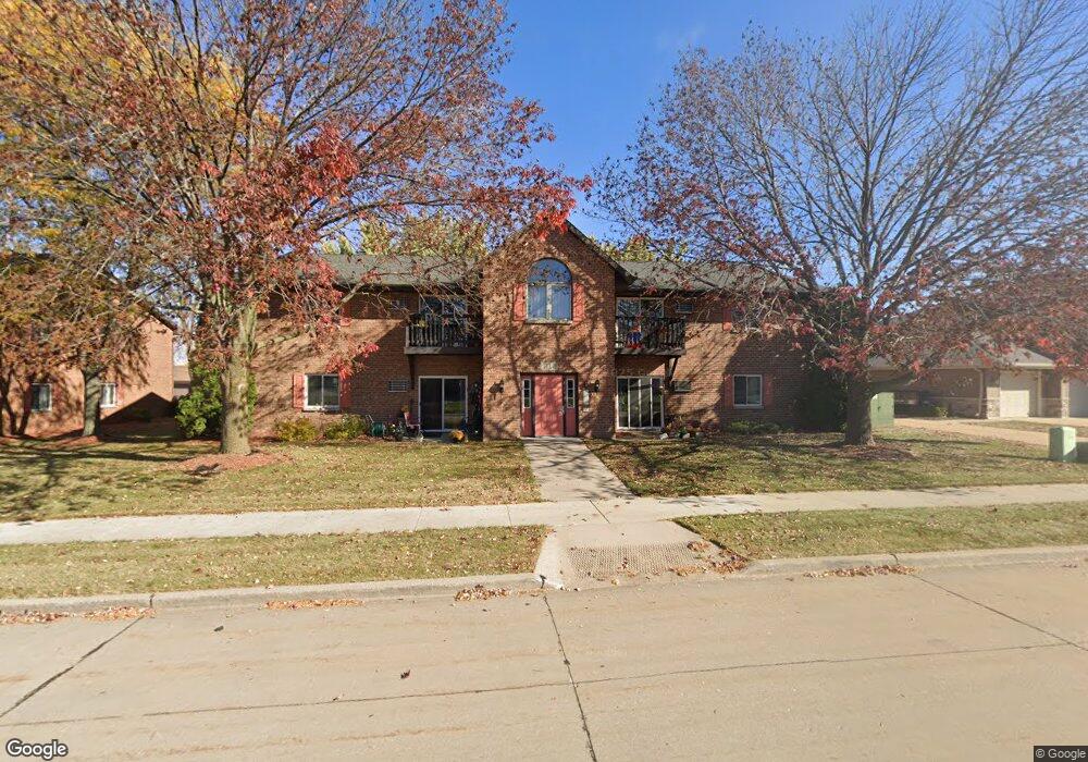
612 Frances St Kaukauna, WI 54130
Estimated Value: $1,747,700
8
Beds
4
Baths
21,825
Sq Ft
$80/Sq Ft
Est. Value
About This Home
This home is located at 612 Frances St, Kaukauna, WI 54130 and is currently priced at $1,747,700, approximately $80 per square foot. 612 Frances St is a home located in Outagamie County with nearby schools including River View School, Kaukauna High School, and New Directions Learning Community.
Ownership History
Date
Name
Owned For
Owner Type
Purchase Details
Closed on
Dec 12, 2019
Sold by
Wright Michael S
Bought by
Mw Frances Kaukauna Llc
Current Estimated Value
Purchase Details
Closed on
Sep 25, 2017
Sold by
Wright Jodie Lea
Bought by
Wright Michael S
Purchase Details
Closed on
Aug 24, 2011
Sold by
First Harvest Apartments Llc
Bought by
Wright Thomas A
Purchase Details
Closed on
Jan 20, 2009
Sold by
Ferguson Alden G Fam Trust and Ferguson Susan A
Bought by
Firstharvestapartmentsllc
Create a Home Valuation Report for This Property
The Home Valuation Report is an in-depth analysis detailing your home's value as well as a comparison with similar homes in the area
Home Values in the Area
Average Home Value in this Area
Purchase History
| Date | Buyer | Sale Price | Title Company |
|---|---|---|---|
| Mw Frances Kaukauna Llc | $1,008,000 | -- | |
| Tw Frances Kaukauna Llc | $1,008,000 | -- | |
| Wright Michael S | $1,008,000 | -- | |
| Wright Thomas A | $902,000 | -- | |
| Firstharvestapartmentsllc | $1,190,000 | -- |
Source: Public Records
Tax History Compared to Growth
Tax History
| Year | Tax Paid | Tax Assessment Tax Assessment Total Assessment is a certain percentage of the fair market value that is determined by local assessors to be the total taxable value of land and additions on the property. | Land | Improvement |
|---|---|---|---|---|
| 2023 | $27,513 | $1,361,000 | $167,600 | $1,193,400 |
| 2022 | $25,567 | $1,361,000 | $167,600 | $1,193,400 |
| 2021 | $24,479 | $1,361,000 | $167,600 | $1,193,400 |
| 2020 | $23,555 | $1,008,000 | $167,600 | $840,400 |
| 2019 | $23,682 | $1,008,000 | $167,600 | $840,400 |
| 2018 | $23,702 | $1,008,000 | $167,600 | $840,400 |
| 2017 | $23,474 | $1,008,000 | $167,600 | $840,400 |
| 2016 | $22,394 | $1,008,000 | $167,600 | $840,400 |
| 2015 | $22,405 | $1,008,000 | $167,600 | $840,400 |
| 2014 | $22,342 | $1,008,000 | $167,600 | $840,400 |
| 2013 | $22,528 | $1,008,000 | $167,600 | $840,400 |
Source: Public Records
Map
Nearby Homes
- 1207 Saunders Rd
- 3005 Crooks Ave
- 708 Westfield St
- 2200 Sullivan Ave
- N176 Debruin Rd
- 406 E 20th St
- 213 Fairway St
- 1601 Main Ave
- 1401 Main Ave
- 213 E 17th St
- 216 E 17th St
- 304 E 17th St
- 592 Cornrow Ln
- 405 E 17th St
- 107 Lamine Ln
- 417 W 11th St
- W2286 Valleywood Ln
- 1031 Melrose Ct
- 123 W 10th St
- W2313 Saint Germaine Ct
- 624 Frances St
- 2703 Fieldstone Ct
- 2701 Fieldstone Ct
- 2709 Fieldstone Ct
- 2717 Fieldstone Ct
- 2801 Fieldstone Ct
- 2812 Fieldstone Ct
- 2810 Fieldstone Ct
- 2800 Fieldstone Ct
- 2718 Fieldstone Ct
- 2700 Fieldstone Ct
- 2720 Fieldstone Ct
- 2802 Fieldstone Ct
- 661 Frances St
- 648 Frances St
- 662 Frances St
- 660 Frances St Unit 660
- 611 Frances St
- 654 Frances St
- 601 Frances St