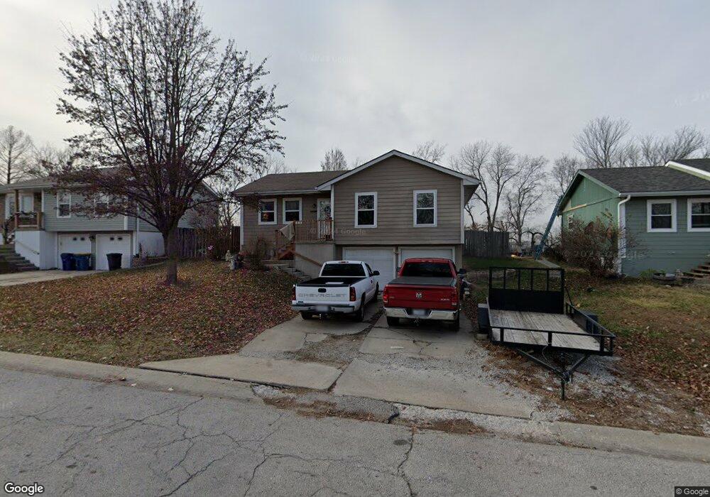
612 Kountry Ln Excelsior Springs, MO 64024
Estimated Value: $207,000 - $242,000
3
Beds
1
Bath
1,010
Sq Ft
$216/Sq Ft
Est. Value
About This Home
This home is located at 612 Kountry Ln, Excelsior Springs, MO 64024 and is currently estimated at $217,988, approximately $215 per square foot. 612 Kountry Ln is a home located in Clay County with nearby schools including Excelsior Springs High School.
Ownership History
Date
Name
Owned For
Owner Type
Purchase Details
Closed on
Jun 13, 2007
Sold by
Campbell Randall Scott
Bought by
Campbell Nicole Suzanne
Current Estimated Value
Purchase Details
Closed on
Oct 22, 1998
Sold by
Simmons Mcelwee Kimberly A and Mcelwee James Brent
Bought by
Campbell Randall Scott and Campbell Nichole Suzanne
Home Financials for this Owner
Home Financials are based on the most recent Mortgage that was taken out on this home.
Original Mortgage
$81,500
Interest Rate
6.25%
Purchase Details
Closed on
Jun 18, 1998
Sold by
Mullikin Mathew T and Smith Tamara K
Bought by
Mcelwee Kimberly A Simmons
Create a Home Valuation Report for This Property
The Home Valuation Report is an in-depth analysis detailing your home's value as well as a comparison with similar homes in the area
Home Values in the Area
Average Home Value in this Area
Purchase History
| Date | Buyer | Sale Price | Title Company |
|---|---|---|---|
| Campbell Nicole Suzanne | -- | None Available | |
| Campbell Randall Scott | -- | -- | |
| Simmons Mcelwee Kimberly A | -- | -- | |
| Mcelwee Kimberly A Simmons | $59,800 | Excelsior Abstract & Title C |
Source: Public Records
Mortgage History
| Date | Status | Borrower | Loan Amount |
|---|---|---|---|
| Previous Owner | Campbell Randall Scott | $81,500 |
Source: Public Records
Tax History Compared to Growth
Tax History
| Year | Tax Paid | Tax Assessment Tax Assessment Total Assessment is a certain percentage of the fair market value that is determined by local assessors to be the total taxable value of land and additions on the property. | Land | Improvement |
|---|---|---|---|---|
| 2025 | $1,847 | $30,100 | -- | -- |
| 2024 | $1,847 | $26,330 | -- | -- |
| 2023 | $1,835 | $26,330 | $0 | $0 |
| 2022 | $1,647 | $23,240 | $0 | $0 |
| 2021 | $1,653 | $23,237 | $3,800 | $19,437 |
| 2020 | $1,429 | $19,530 | $0 | $0 |
| 2019 | $1,428 | $19,532 | $3,420 | $16,112 |
| 2018 | $1,276 | $17,400 | $0 | $0 |
| 2017 | $1,245 | $17,400 | $3,420 | $13,980 |
| 2016 | $1,245 | $17,400 | $3,420 | $13,980 |
| 2015 | $1,256 | $17,400 | $3,420 | $13,980 |
| 2014 | $1,267 | $17,400 | $3,420 | $13,980 |
Source: Public Records
Map
Nearby Homes
- 2017 Karlton Way
- 609 Kimberly Dr
- 617 Lodwick Ln
- 2116 Bradford Place
- 2081 Rock Bridge Pkwy
- 206 Crest Dr
- Lot 2 Wornall Rd
- 2017 Wornall Rd
- 106 Sunset Ln
- 240 Rock Bridge Pkwy
- 220 Rock Bridge Pkwy
- 2021 Riverstone Dr
- 125 Crown Hill Rd
- 1318 Kristie Cir
- 25421 Marel Rd
- 2210 Piedmont Place
- 2305 Arbor Ln
- 112 Delores St
- 1104 Frontier St
- 328 Virginia Rd
- 614 Kountry Ln
- 610 Kountry Ln
- 608 Kountry Ln
- 700 Kountry Ln
- 2011 Kimberly Dr
- 606 Kountry Ln
- 702 Kountry Ln
- 2010 Kimberly Dr
- 2009 Kimberly Dr
- 704 Kountry Ln
- 604 Kountry Ln
- 2010 Kary Ln
- 2008 Kimberly Dr
- 2007 Kimberly Dr
- 705 Kountry Ln
- 706 Kountry Ln
- 2008 Kary Ln
- 2006 Kimberly Dr
- 602 Kountry Ln
- 2005 Kimberly Dr