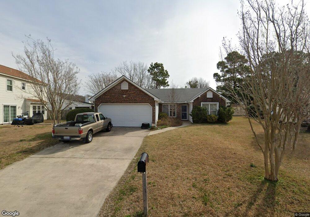
612 Mandy Ct Morehead City, NC 28557
Estimated Value: $300,667 - $349,000
3
Beds
2
Baths
1,200
Sq Ft
$272/Sq Ft
Est. Value
About This Home
This home is located at 612 Mandy Ct, Morehead City, NC 28557 and is currently estimated at $326,667, approximately $272 per square foot. 612 Mandy Ct is a home located in Carteret County with nearby schools including Morehead City Primary School, Morehead Elementary School at Camp Glenn, and Morehead City Middle School.
Ownership History
Date
Name
Owned For
Owner Type
Purchase Details
Closed on
Nov 10, 2011
Sold by
Fusaro Elizabeth J and Fusaro Margaret A
Bought by
Graham Matthew J and Graham Allison L
Current Estimated Value
Home Financials for this Owner
Home Financials are based on the most recent Mortgage that was taken out on this home.
Original Mortgage
$148,000
Outstanding Balance
$104,409
Interest Rate
4.75%
Mortgage Type
New Conventional
Estimated Equity
$222,258
Purchase Details
Closed on
Sep 18, 2009
Sold by
Fusaro John and Trader Free
Bought by
Fusaro John and The John Fusaro Jr Revocable Trust
Purchase Details
Closed on
Sep 11, 2009
Sold by
Fusaro John
Bought by
Fusaro Elizabeth Jean and Fusaro Margaret Ann
Create a Home Valuation Report for This Property
The Home Valuation Report is an in-depth analysis detailing your home's value as well as a comparison with similar homes in the area
Home Values in the Area
Average Home Value in this Area
Purchase History
| Date | Buyer | Sale Price | Title Company |
|---|---|---|---|
| Graham Matthew J | $148,000 | None Available | |
| Fusaro John | -- | None Available | |
| Fusaro Elizabeth Jean | -- | None Available |
Source: Public Records
Mortgage History
| Date | Status | Borrower | Loan Amount |
|---|---|---|---|
| Open | Graham Matthew J | $148,000 |
Source: Public Records
Tax History Compared to Growth
Tax History
| Year | Tax Paid | Tax Assessment Tax Assessment Total Assessment is a certain percentage of the fair market value that is determined by local assessors to be the total taxable value of land and additions on the property. | Land | Improvement |
|---|---|---|---|---|
| 2025 | $1,592 | $263,298 | $77,739 | $185,559 |
| 2024 | $1,341 | $165,684 | $85,068 | $80,616 |
| 2023 | $578 | $165,684 | $85,068 | $80,616 |
| 2022 | $562 | $165,684 | $85,068 | $80,616 |
| 2021 | $562 | $165,684 | $85,068 | $80,616 |
| 2020 | $562 | $165,684 | $85,068 | $80,616 |
| 2019 | $489 | $152,746 | $68,055 | $84,691 |
| 2017 | $489 | $152,746 | $68,055 | $84,691 |
| 2016 | $489 | $152,746 | $68,055 | $84,691 |
| 2015 | $473 | $152,746 | $68,055 | $84,691 |
| 2014 | $447 | $144,031 | $64,675 | $79,356 |
Source: Public Records
Map
Nearby Homes
- 3006 Old Gate Rd
- 608 Barbour Rd
- 2412 Mayberry Loop Rd
- 309 Barbour Rd
- 424 Commerce Ave Unit A
- 2601 Mayberry Loop Rd
- 421 Commerce Ave Unit B
- 3208 Country Club Rd
- 209 Church St
- 3405 Old Gate Rd
- 2408 Bradford St
- 600 N 35th St Unit 1301
- 600 N 35th St Unit 701
- 914 Harrell Dr
- 964 Country Club Ct
- 512 N 35th St
- 3200 Crystal Oaks Ln
- 504 N 25th St
- 117 Noyes Ave
- 115 Noyes Ave