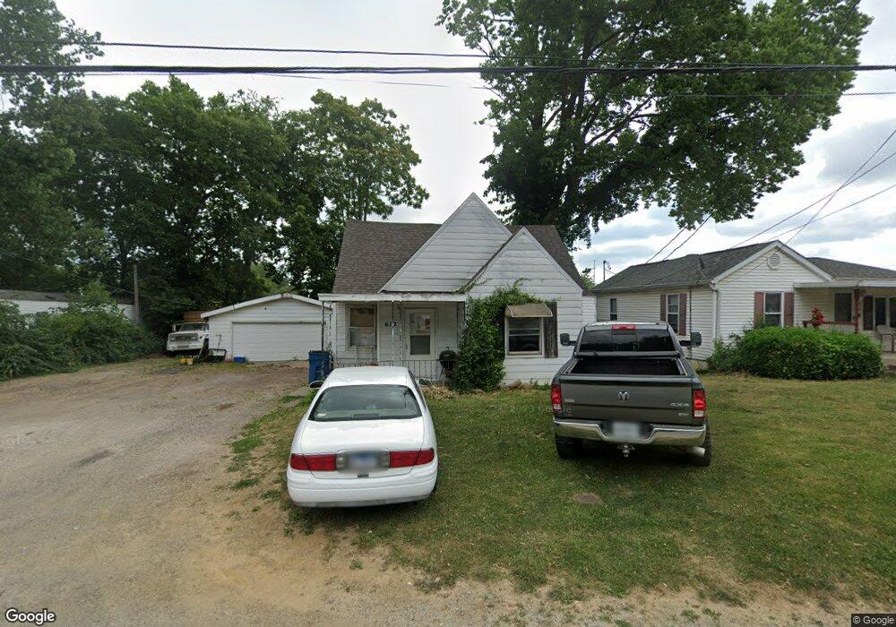
612 S Wesley St Unit 1 Springfield, IL 62703
Estimated Value: $39,000 - $53,637
--
Bed
--
Bath
--
Sq Ft
4,356
Sq Ft Lot
About This Home
This home is located at 612 S Wesley St Unit 1, Springfield, IL 62703 and is currently estimated at $46,546. 612 S Wesley St Unit 1 is a home located in Sangamon County with nearby schools including Matheny-Withrow Elementary School, Washington Middle School, and Lanphier High School.
Ownership History
Date
Name
Owned For
Owner Type
Purchase Details
Closed on
Feb 23, 2023
Sold by
Rechner Joseph B
Bought by
Rechner Joseph C and Rechner Rebecca
Current Estimated Value
Purchase Details
Closed on
Feb 15, 2023
Sold by
Rechner Joseph B
Bought by
Rechner Joseph
Purchase Details
Closed on
May 7, 2018
Sold by
Rechner Joseph B
Bought by
Rechnner Joseph B and Rechner Costa L
Purchase Details
Closed on
Jul 26, 2017
Sold by
Richard Hill
Bought by
Rechner Joseph B
Purchase Details
Closed on
May 26, 1998
Purchase Details
Closed on
Jun 9, 1997
Create a Home Valuation Report for This Property
The Home Valuation Report is an in-depth analysis detailing your home's value as well as a comparison with similar homes in the area
Home Values in the Area
Average Home Value in this Area
Purchase History
| Date | Buyer | Sale Price | Title Company |
|---|---|---|---|
| Rechner Joseph C | $20,000 | -- | |
| Rechner Joseph | -- | -- | |
| Rechnner Joseph B | -- | -- | |
| Rechner Joseph B | $7,000 | Fernandes David A | |
| -- | -- | -- | |
| -- | $25,000 | -- |
Source: Public Records
Tax History Compared to Growth
Tax History
| Year | Tax Paid | Tax Assessment Tax Assessment Total Assessment is a certain percentage of the fair market value that is determined by local assessors to be the total taxable value of land and additions on the property. | Land | Improvement |
|---|---|---|---|---|
| 2024 | $947 | $11,284 | $1,277 | $10,007 |
| 2023 | $910 | $10,223 | $1,157 | $9,066 |
| 2022 | $877 | $9,731 | $1,101 | $8,630 |
| 2021 | $811 | $8,924 | $1,010 | $7,914 |
| 2020 | $118 | $1,333 | $1,004 | $329 |
| 2019 | $1,843 | $21,192 | $2,206 | $18,986 |
| 2018 | $1,817 | $21,594 | $2,248 | $19,346 |
| 2017 | $726 | $20,937 | $2,180 | $18,757 |
| 2016 | $726 | $19,763 | $2,058 | $17,705 |
| 2015 | $727 | $19,673 | $2,049 | $17,624 |
| 2014 | $770 | $20,310 | $2,115 | $18,195 |
| 2013 | $1,240 | $21,451 | $2,234 | $19,217 |
Source: Public Records
Map
Nearby Homes
- 530 S Livingston St Unit 1
- 2991 Niccolls Rd
- 3011 Niccolls Rd
- 143 S Wesley St Unit 1
- 1105 Knoll Pointe Place
- 2128 E Capitol Ave
- 2152 E Adams St
- 160 Forrest Ave Unit FP-35
- 2132 E Adams St
- 2310 E Kansas St
- 2331 South Grand Ave E
- 404 N Daniels Ave
- 300 Forrest Ave Unit 120
- 300 Forrest Ave Unit 62
- 300 Forrest Ave Unit 103
- 300 Forrest Ave Unit 59
- 300 Forrest Ave Unit 107
- 300 Forrest Ave Unit 41
- 300 Forrest Ave Unit 109
- 2009 E Kansas St
- 614 S Wesley St Unit 1
- 608 S Wesley St
- 606 S Wesley St
- 2805 E Cook St
- 615 S Wesley St
- 604 S Wesley St
- 602 S Wesley St
- 631 S Wesley St
- 605 S Wesley St
- 512 S Wesley St
- 601 S Wesley St Unit 1
- 510 S Wesley St Unit 1
- 624 S Livingston St Unit 1
- 620 S Livingston St Unit 1
- 538 S Livingston St Unit 1
- 626 S Livingston St
- 511 S Wesley St
- 630 S Livingston St
- 506 S Wesley St
- 509 S Wesley St