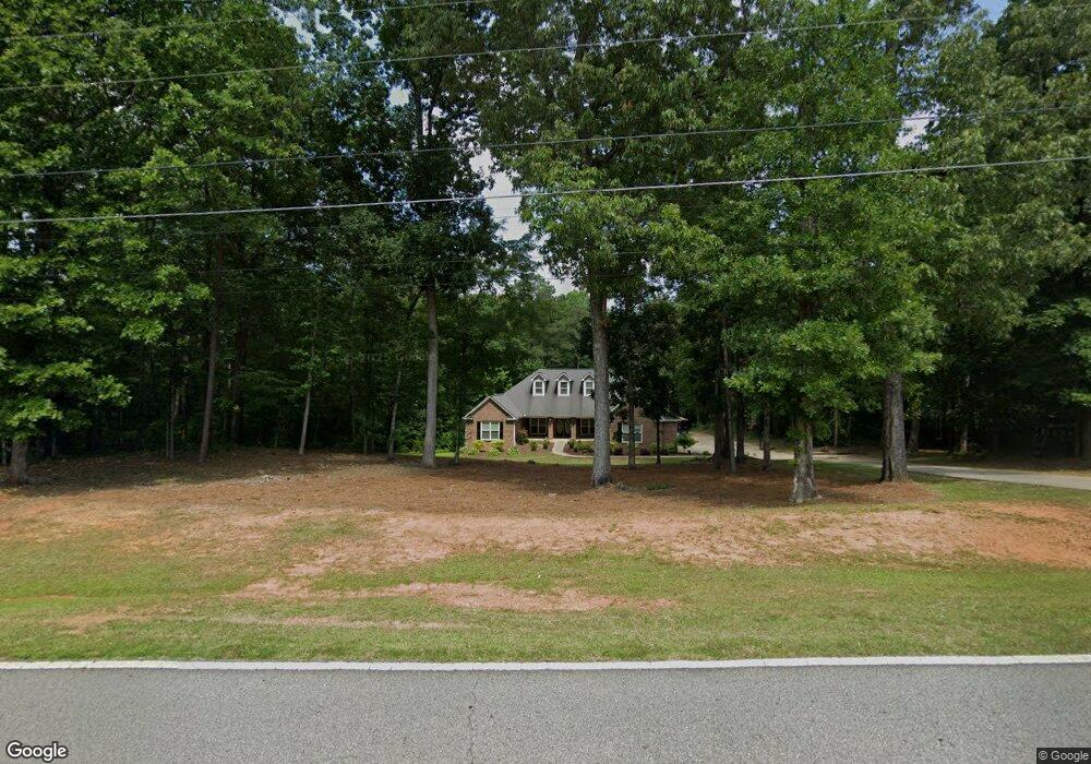
612 Sandy Ridge Rd McDonough, GA 30252
Estimated Value: $640,000 - $688,000
6
Beds
5
Baths
5,866
Sq Ft
$114/Sq Ft
Est. Value
About This Home
This home is located at 612 Sandy Ridge Rd, McDonough, GA 30252 and is currently estimated at $667,909, approximately $113 per square foot. 612 Sandy Ridge Rd is a home located in Henry County with nearby schools including Rock Spring Elementary School, Ola Middle School, and Ola High School.
Ownership History
Date
Name
Owned For
Owner Type
Purchase Details
Closed on
Oct 30, 2020
Sold by
Bolton Mike
Bought by
Robinson Heather Danielle
Current Estimated Value
Home Financials for this Owner
Home Financials are based on the most recent Mortgage that was taken out on this home.
Original Mortgage
$390,400
Outstanding Balance
$345,395
Interest Rate
2.8%
Mortgage Type
New Conventional
Estimated Equity
$322,514
Purchase Details
Closed on
Oct 5, 2020
Sold by
Mcleod Billie Ruth
Bought by
Mcleod Fred O Neil
Home Financials for this Owner
Home Financials are based on the most recent Mortgage that was taken out on this home.
Original Mortgage
$390,400
Outstanding Balance
$345,395
Interest Rate
2.8%
Mortgage Type
New Conventional
Estimated Equity
$322,514
Create a Home Valuation Report for This Property
The Home Valuation Report is an in-depth analysis detailing your home's value as well as a comparison with similar homes in the area
Home Values in the Area
Average Home Value in this Area
Purchase History
| Date | Buyer | Sale Price | Title Company |
|---|---|---|---|
| Robinson Heather Danielle | $488,000 | -- | |
| Mcleod Fred O Neil | -- | -- |
Source: Public Records
Mortgage History
| Date | Status | Borrower | Loan Amount |
|---|---|---|---|
| Open | Robinson Heather Danielle | $390,400 |
Source: Public Records
Tax History Compared to Growth
Tax History
| Year | Tax Paid | Tax Assessment Tax Assessment Total Assessment is a certain percentage of the fair market value that is determined by local assessors to be the total taxable value of land and additions on the property. | Land | Improvement |
|---|---|---|---|---|
| 2024 | $10,838 | $271,760 | $21,960 | $249,800 |
| 2023 | $9,741 | $252,880 | $21,160 | $231,720 |
| 2022 | $8,590 | $222,880 | $19,520 | $203,360 |
| 2021 | $7,239 | $187,680 | $16,760 | $170,920 |
| 2020 | $1,892 | $153,080 | $15,800 | $137,280 |
| 2019 | $1,892 | $144,680 | $14,960 | $129,720 |
| 2018 | $1,807 | $134,920 | $13,840 | $121,080 |
| 2016 | $1,791 | $133,840 | $12,200 | $121,640 |
| 2015 | $1,853 | $129,200 | $13,480 | $115,720 |
| 2014 | $1,739 | $119,240 | $13,480 | $105,760 |
Source: Public Records
Map
Nearby Homes
- 106 Loam Dr
- 1908 Munford Place
- 4904 Highway 81 E
- 124 Wynn Rd
- 0 Highway 81 St E Unit 10597150
- 209 Amber Ct
- 4075 O Henry Ct
- 1120 Stroud Rd
- 1100 Stroud Rd
- 501 Barhams Ridge Dr
- 3000 Keeneland Blvd
- 180 Mackey Rd
- 170 Mackey Rd
- 5168 Highway 81 E
- 128 Lavender Way Unit LOT 75
- 41 Giles Dr
- 415 Pamela Ct
- 507 Judith Ct Unit 3
- 527 Barhams Ridge Dr
- 518 Gallantry Trail
- 620 Sandy Ridge Rd
- 578 Sandy Ridge Rd
- 699 Sandy Ridge Rd
- 687 Sandy Ridge Rd Unit 2
- 699 Sandy Ridge Rd Unit 5
- 691 Sandy Ridge Rd
- 683 Sandy Ridge Rd
- 640 Sandy Ridge Rd
- 695 Sandy Ridge Rd Unit 4
- 695 Sandy Ridge Rd
- 257 Cecil Way Unit 61
- 257 Cecil Way
- 675 Sandy Ridge Rd
- 570 Sandy Ridge Rd
- 253 Cecil Way
- 249 Cecil Way Unit 59
- 249 Cecil Way
- 254 Cecil Way
- 245 Cecil Way
- 250 Cecil Way