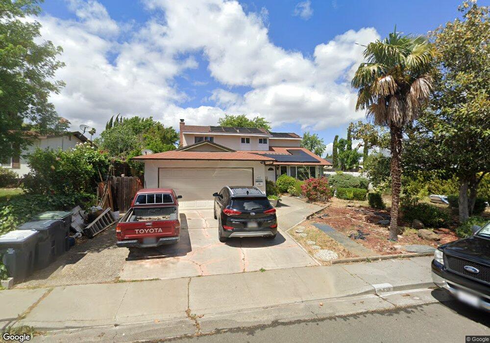
612 Whitehall Cir Fairfield, CA 94533
Fairfield AreaEstimated Value: $403,000 - $591,271
About This Home
This home is located at 612 Whitehall Cir, Fairfield, CA 94533 and is currently estimated at $511,568, approximately $268 per square foot. 612 Whitehall Cir is a home located in Solano County with nearby schools including David Weir Preparatory Academy, Grange Middle School, and Fairfield High School.
Ownership History
We collect this data history from publicly available records. To have your information removed, we recommend requesting removal directly through your county’s website.
Purchase Details
Home Financials for this Owner
Home Financials are based on the most recent Mortgage that was taken out on this home.Purchase Details
Home Values in the Area
Average Home Value in this Area
Purchase History
We collect this data history from publicly available records. To have your information removed, we recommend requesting removal directly through your county’s website.
| Date | Buyer | Sale Price | Title Company |
|---|---|---|---|
| $270,000 | Fidelity National Title Co | ||
| -- | -- |
Mortgage History
We collect this data history from publicly available records. To have your information removed, we recommend requesting removal directly through your county’s website.
| Date | Status | Borrower | Loan Amount |
|---|---|---|---|
| Open | $266,800 | ||
| Closed | $265,000 | ||
| Closed | $265,303 | ||
| Closed | $265,109 | ||
| Previous Owner | $194,150 | ||
| Previous Owner | $118,300 |
Tax History
We collect this data history from publicly available records. To have your information removed, we recommend requesting removal directly through your county’s website.
| Year | Tax Paid | Tax Assessment Tax Assessment Total Assessment is a certain percentage of the fair market value that is determined by local assessors to be the total taxable value of land and additions on the property. | Land | Improvement |
|---|---|---|---|---|
| 2025 | $3,707 | $330,970 | $73,544 | $257,426 |
| 2024 | $3,707 | $324,481 | $72,102 | $252,379 |
| 2023 | $3,593 | $318,120 | $70,689 | $247,431 |
| 2022 | $3,550 | $311,883 | $69,304 | $242,579 |
| 2021 | $3,515 | $305,769 | $67,946 | $237,823 |
| 2020 | $3,433 | $302,635 | $67,250 | $235,385 |
| 2019 | $3,348 | $296,702 | $65,932 | $230,770 |
| 2018 | $3,456 | $290,886 | $64,640 | $226,246 |
| 2017 | $3,297 | $285,183 | $63,373 | $221,810 |
| 2016 | $3,270 | $279,592 | $62,131 | $217,461 |
| 2015 | $3,053 | $275,393 | $61,198 | $214,195 |
| 2014 | $1,285 | $120,621 | $28,265 | $92,356 |
Map
- 843 Coventry Ln
- 424 Acacia St
- 378 Acacia St
- 1831 Clay St
- 937 Pacific Ave
- 362 Tabor Ave
- 2256 Dorset Ln
- 1719 Elm St
- 883 Inverness Ct
- 1713 Fillmore St
- 1718 Fillmore St
- 1712 Fillmore St
- 2275 Cambridge Dr
- 50 Anza Ct
- 1301 Sunningdale Ln
- 1306 Canterbury Dr
- 303 Dahlia St
- 1500 Monroe St
- 1517 Garfield St
- 1500 Harrison St
- 627 Tabor Ave
- 615 Tabor Ave
- 663 Tabor Ave
- 639 Tabor Ave
- 651 Tabor Ave
- 603 Tabor Ave
- 1953 Union Ave
- 2004 Hampton Place
- 715 Hillcrest Ct
- 703 Hillcrest Ct
- 1947 Union Ave
- 600 Tabor Ave
- 2001 Hampton Place
- 2010 Hampton Place
- 727 Hillcrest Ct
- 606 Whitehall Cir
- 618 Whitehall Cir
- 600 Whitehall Cir
- 537 Tabor Ave
- 2007 Hampton Place
Ask me questions while you tour the home.