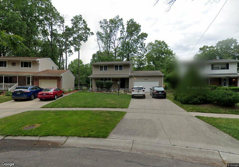
6120 Applegate Dr Toledo, OH 43615
Reynolds Corners NeighborhoodEstimated Value: $213,000 - $262,000
4
Beds
2
Baths
1,624
Sq Ft
$146/Sq Ft
Est. Value
About This Home
This home is located at 6120 Applegate Dr, Toledo, OH 43615 and is currently estimated at $237,850, approximately $146 per square foot. 6120 Applegate Dr is a home located in Lucas County with nearby schools including Stranahan Elementary School, Sylvania Timberstone Junior High School, and Sylvania Southview High School.
Ownership History
Date
Name
Owned For
Owner Type
Purchase Details
Closed on
Apr 20, 1993
Sold by
Mikkonen Jayne V
Current Estimated Value
Purchase Details
Closed on
Jul 17, 1990
Sold by
Mikkonen Mikkonen R R and Mikkonen J
Create a Home Valuation Report for This Property
The Home Valuation Report is an in-depth analysis detailing your home's value as well as a comparison with similar homes in the area
Home Values in the Area
Average Home Value in this Area
Purchase History
| Date | Buyer | Sale Price | Title Company |
|---|---|---|---|
| -- | $89,900 | -- | |
| -- | -- | -- |
Source: Public Records
Tax History
| Year | Tax Paid | Tax Assessment Tax Assessment Total Assessment is a certain percentage of the fair market value that is determined by local assessors to be the total taxable value of land and additions on the property. | Land | Improvement |
|---|---|---|---|---|
| 2025 | -- | $56,315 | $10,395 | $45,920 |
| 2024 | $1,675 | $56,315 | $10,395 | $45,920 |
| 2023 | $2,921 | $47,005 | $8,750 | $38,255 |
| 2022 | $2,922 | $47,005 | $8,750 | $38,255 |
| 2021 | $2,997 | $47,005 | $8,750 | $38,255 |
| 2020 | $2,818 | $39,130 | $7,280 | $31,850 |
| 2019 | $2,747 | $39,130 | $7,280 | $31,850 |
| 2018 | $2,685 | $39,130 | $7,280 | $31,850 |
| 2017 | $2,669 | $35,945 | $8,400 | $27,545 |
| 2016 | $2,650 | $102,700 | $24,000 | $78,700 |
| 2015 | $2,621 | $102,700 | $24,000 | $78,700 |
| 2014 | $2,261 | $35,950 | $8,400 | $27,550 |
| 2013 | $2,261 | $35,950 | $8,400 | $27,550 |
Source: Public Records
Map
Nearby Homes
- 6241 W Pembridge Dr
- 2714 Sweetbriar Ct Unit 2714
- 2757 Sweetbriar Ct Unit 2757
- 405 N Holland Sylvania Rd
- 5722 Candlestick Ct E
- 3210 Fairbanks Ave
- 5815 W Bancroft St
- 2015 Oakside Rd
- 2010 Oakside Rd
- 2004 Oakside Rd
- 1944 Silverpine Ct
- 5925 Haefner Rd
- 6753 Carrie Pine Ln
- 1950 Devinci Dr Unit A203
- 1911 N Holland Sylvania Rd
- 1809 Birdie Dr
- 2355 Parliament Square
- 2720 Westcastle Dr
- 5409 Westcastle Dr Unit 4
- 3426 Wilford Dr
- 6124 Applegate Dr
- 6116 Applegate Dr
- 6130 Applegate Dr
- 6149 W Pembridge Dr
- 6155 W Pembridge Dr
- 2546 Cherry Hill Rd
- 6163 W Pembridge Dr
- 6143 W Pembridge Dr
- 6136 Applegate Dr
- 6137 W Pembridge Dr
- 6125 Applegate Dr
- 6201 W Pembridge Dr
- 2542 Cherry Hill Rd
- 2538 Cherry Hill Rd
- 6142 Applegate Dr
- 2557 Vaness Dr
- 2553 Vaness Dr
- 2536 Cherry Hill Rd
- 6129 W Pembridge Dr
- 6207 W Pembridge Dr
Your Personal Tour Guide
Ask me questions while you tour the home.