Estimated Value: $1,058,000 - $1,232,000
6
Beds
2
Baths
2,625
Sq Ft
$437/Sq Ft
Est. Value
About This Home
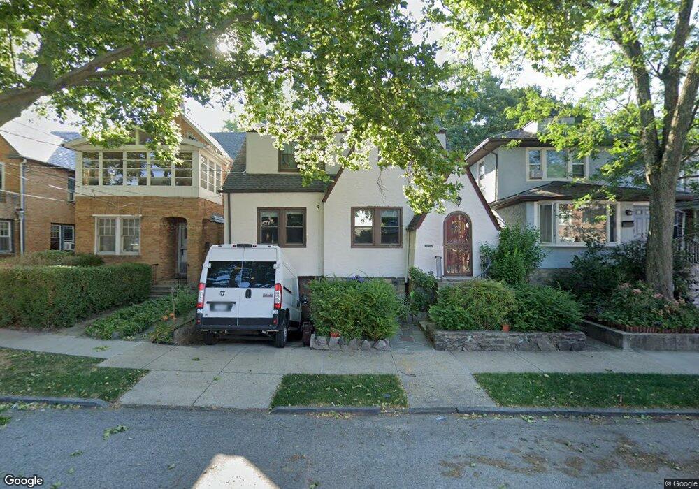
This home is located at 6120 Fieldston Rd, Bronx, NY 10471 and is currently estimated at $1,148,198, approximately $437 per square foot. 6120 Fieldston Rd is a home located in Bronx County with nearby schools including P.S. 81 - Robert J. Christen, Riverdale Kingsbridge Academy, and St Margaret Of Cortona School.
Ownership History
Date
Name
Owned For
Owner Type
Purchase Details
Closed on
Jun 18, 2020
Sold by
Catania Nicolas and Catania Salvatore
Bought by
Catania Nicolas and Flaherty Michelle
Current Estimated Value
Home Financials for this Owner
Home Financials are based on the most recent Mortgage that was taken out on this home.
Original Mortgage
$22,116
Outstanding Balance
$19,604
Interest Rate
3.2%
Mortgage Type
Unknown
Estimated Equity
$1,128,594
Purchase Details
Closed on
Oct 26, 2017
Sold by
Kennedy Glen and % Douglas Panero Esq
Bought by
Catania Nicholas and Catania Salvatore
Home Financials for this Owner
Home Financials are based on the most recent Mortgage that was taken out on this home.
Original Mortgage
$600,000
Interest Rate
3.9%
Mortgage Type
Purchase Money Mortgage
Create a Home Valuation Report for This Property
The Home Valuation Report is an in-depth analysis detailing your home's value as well as a comparison with similar homes in the area
Purchase History
| Date | Buyer | Sale Price | Title Company |
|---|---|---|---|
| Catania Nicolas | -- | -- | |
| Catania Nicholas | $800,000 | -- |
Source: Public Records
Mortgage History
| Date | Status | Borrower | Loan Amount |
|---|---|---|---|
| Open | Catania Nicolas | $22,116 | |
| Previous Owner | Catania Nicholas | $600,000 |
Source: Public Records
Tax History
| Year | Tax Paid | Tax Assessment Tax Assessment Total Assessment is a certain percentage of the fair market value that is determined by local assessors to be the total taxable value of land and additions on the property. | Land | Improvement |
|---|---|---|---|---|
| 2025 | $11,260 | $58,666 | $12,495 | $46,171 |
| 2024 | $11,260 | $56,062 | $11,100 | $44,962 |
| 2023 | $10,083 | $52,889 | $11,982 | $40,907 |
| 2022 | $9,303 | $56,940 | $15,360 | $41,580 |
| 2021 | $10,288 | $56,280 | $15,360 | $40,920 |
| 2020 | $10,348 | $56,460 | $15,360 | $41,100 |
| 2019 | $9,773 | $58,200 | $15,360 | $42,840 |
| 2018 | $8,984 | $44,074 | $12,509 | $31,565 |
| 2017 | $3,298 | $41,580 | $15,360 | $26,220 |
| 2016 | $3,159 | $40,740 | $15,360 | $25,380 |
| 2015 | $2,011 | $41,761 | $16,657 | $25,104 |
| 2014 | $2,011 | $39,398 | $15,715 | $23,683 |
Source: Public Records
Map
Nearby Homes
- 6126 Fieldston Rd
- 360 W 262nd St
- 351 W 262nd St
- 310 W 263rd St
- 6209 Spencer Terrace
- 6036 Liebig Ave
- 6601 Broadway Unit 6I
- 6200 Riverdale Ave Unit 3K
- 6200 Riverdale Ave Unit 7J
- 6200 Riverdale Ave Unit 7A
- 227 W 260th St
- 143 Bruce Ave Unit 7J
- 6300 Riverdale Ave Unit 5C
- 6300 Riverdale Ave Unit 6C
- 6300 Riverdale Ave Unit 1B
- 204 W 260th St
- 6004 Netherland Ave
- 568-L W 261st St
- 105 Bruce Ave
- 6535 Broadway Unit 2G
- 6118 Fieldston Rd
- 6122 Fieldston Rd
- 6116 Fieldston Rd
- 6124 Fieldston Rd
- 6114 Fieldston Rd
- 6114 Fieldston Rd Unit Building
- 6119 Spencer Ave
- 6113 Spencer Ave
- 6128 Fieldston Rd
- 6127 Spencer Ave
- 6111 Spencer Ave
- 6130 Fieldston Rd
- 460 W 262nd St
- 6125 Fieldston Rd
- 6121 Fieldston Rd
- 6131 Spencer Ave
- 6131 Spencer Ave Unit 3
- 6132 Fieldston Rd
- 275 W 261st St
- 275 W 261st St Unit Building
Your Personal Tour Guide
Ask me questions while you tour the home.