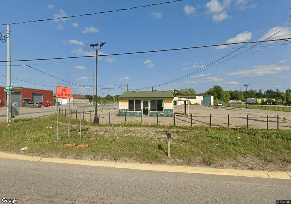
6120 N Dort Hwy Flint, MI 48505
Northeast Village NeighborhoodEstimated Value: $233,820
--
Bed
--
Bath
3,072
Sq Ft
$76/Sq Ft
Est. Value
About This Home
This home is located at 6120 N Dort Hwy, Flint, MI 48505 and is currently estimated at $233,820, approximately $76 per square foot. 6120 N Dort Hwy is a home located in Genesee County with nearby schools including Brownell STEM Academy, The New Standard Academy, and Richfield Public School Academy.
Ownership History
Date
Name
Owned For
Owner Type
Purchase Details
Closed on
Apr 13, 2023
Sold by
Dice-Parsons Properties Inc
Bought by
6120 N Dort Hwy Llc
Current Estimated Value
Purchase Details
Closed on
Dec 1, 2006
Sold by
Jones Danny C
Bought by
Dice Parsons Properties Inc
Purchase Details
Closed on
May 3, 2004
Sold by
Jones Danny
Bought by
Dice Parsons Properties Inc
Home Financials for this Owner
Home Financials are based on the most recent Mortgage that was taken out on this home.
Original Mortgage
$111,800
Interest Rate
5.85%
Mortgage Type
Seller Take Back
Purchase Details
Closed on
Dec 2, 2002
Sold by
Hoenicke Raymond E and Hoenicke Dolores J
Bought by
Jones Danny C
Create a Home Valuation Report for This Property
The Home Valuation Report is an in-depth analysis detailing your home's value as well as a comparison with similar homes in the area
Home Values in the Area
Average Home Value in this Area
Purchase History
| Date | Buyer | Sale Price | Title Company |
|---|---|---|---|
| 6120 N Dort Hwy Llc | $200,000 | Devon Title | |
| Dice Parsons Properties Inc | $125,000 | None Available | |
| Dice Parsons Properties Inc | $125,000 | -- | |
| Jones Danny C | -- | -- |
Source: Public Records
Mortgage History
| Date | Status | Borrower | Loan Amount |
|---|---|---|---|
| Previous Owner | Dice Parsons Properties Inc | $111,800 |
Source: Public Records
Tax History Compared to Growth
Tax History
| Year | Tax Paid | Tax Assessment Tax Assessment Total Assessment is a certain percentage of the fair market value that is determined by local assessors to be the total taxable value of land and additions on the property. | Land | Improvement |
|---|---|---|---|---|
| 2025 | $7,147 | $94,800 | $0 | $0 |
| 2024 | $6,467 | $99,100 | $0 | $0 |
| 2023 | $4,128 | $90,400 | $0 | $0 |
| 2022 | $0 | $85,500 | $0 | $0 |
| 2021 | $4,265 | $87,300 | $0 | $0 |
| 2020 | $3,821 | $87,300 | $0 | $0 |
| 2019 | $3,664 | $89,100 | $0 | $0 |
| 2018 | $3,869 | $86,600 | $0 | $0 |
| 2017 | $3,741 | $0 | $0 | $0 |
| 2016 | $3,708 | $0 | $0 | $0 |
| 2015 | -- | $0 | $0 | $0 |
| 2014 | -- | $0 | $0 | $0 |
| 2012 | -- | $64,800 | $0 | $0 |
Source: Public Records
Map
Nearby Homes
- 5910 N Dort Hwy
- 1704 E Webster Rd
- 1218 E Piper Ave
- E E Carpenter Rd
- 946 E Bundy Ave
- 802 E Russell Ave
- 4923 Alpha Way
- 5919 Western Rd
- 5220 Western Rd
- 5501 Western Rd
- 2710 Eaton Place
- 418 E Foss Ave
- 738 E York Ave
- 2802 Eaton Place
- 2910 Hampstead Dr
- 2801 Epsilon Trail
- 1320 E Cornell Ave
- 638 E Foss Ave
- 0 E Marengo Ave Unit 50166417
- 680 E Pierson Rd
- 6200 N Dort Hwy
- 6002 N Dort Hwy
- 1652 E Webster Rd
- 1702 E Webster Rd
- 1701 E Webster Rd
- 6217 Hathaway Dr
- 6221 Hathaway Dr
- 6213 Hathaway Dr
- 1705 E Webster Rd
- 6209 Hathaway Dr
- 6225 Hathaway Dr
- 6301 Hathaway Dr
- 6305 Hathaway Dr
- 1706 E Webster Rd
- 6309 Hathaway Dr
- 17 Ave C
- 5 Ave C
- 6313 Hathaway Dr
- 6202 Hathaway Dr
- 1710 E Webster Rd