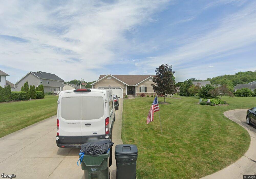
6120 Nist Cir Canal Fulton, OH 44614
Estimated Value: $359,000 - $404,000
3
Beds
3
Baths
2,032
Sq Ft
$187/Sq Ft
Est. Value
About This Home
This home is located at 6120 Nist Cir, Canal Fulton, OH 44614 and is currently estimated at $379,649, approximately $186 per square foot. 6120 Nist Cir is a home located in Stark County with nearby schools including W.S. Stinson Elementary School, Northwest Primary School, and Northwest Middle School.
Ownership History
Date
Name
Owned For
Owner Type
Purchase Details
Closed on
Sep 28, 2004
Sold by
Schalmo Properties Inc
Bought by
Badger Sean A and Badger Debra K
Current Estimated Value
Home Financials for this Owner
Home Financials are based on the most recent Mortgage that was taken out on this home.
Original Mortgage
$157,675
Outstanding Balance
$83,656
Interest Rate
5.81%
Mortgage Type
Purchase Money Mortgage
Estimated Equity
$295,993
Create a Home Valuation Report for This Property
The Home Valuation Report is an in-depth analysis detailing your home's value as well as a comparison with similar homes in the area
Home Values in the Area
Average Home Value in this Area
Purchase History
| Date | Buyer | Sale Price | Title Company |
|---|---|---|---|
| Badger Sean A | $39,900 | -- |
Source: Public Records
Mortgage History
| Date | Status | Borrower | Loan Amount |
|---|---|---|---|
| Open | Badger Sean A | $157,675 |
Source: Public Records
Tax History Compared to Growth
Tax History
| Year | Tax Paid | Tax Assessment Tax Assessment Total Assessment is a certain percentage of the fair market value that is determined by local assessors to be the total taxable value of land and additions on the property. | Land | Improvement |
|---|---|---|---|---|
| 2025 | -- | $124,850 | $20,300 | $104,550 |
| 2024 | -- | $120,260 | $20,300 | $99,960 |
| 2023 | $4,257 | $93,490 | $19,780 | $73,710 |
| 2022 | $4,252 | $93,490 | $19,780 | $73,710 |
| 2021 | $4,263 | $93,490 | $19,780 | $73,710 |
| 2020 | $3,733 | $73,190 | $15,930 | $57,260 |
| 2019 | $3,774 | $70,500 | $15,930 | $54,570 |
| 2018 | $3,553 | $70,500 | $15,930 | $54,570 |
| 2017 | $3,476 | $65,390 | $11,970 | $53,420 |
| 2016 | $3,493 | $65,390 | $11,970 | $53,420 |
| 2015 | $3,503 | $65,390 | $11,970 | $53,420 |
| 2014 | $1,273 | $56,430 | $10,360 | $46,070 |
| 2013 | $1,612 | $56,430 | $10,360 | $46,070 |
Source: Public Records
Map
Nearby Homes
- 11380 Banning Cir NW
- 5484 Bonham Ave NW
- 12347 Stover Farm Dr NW
- 12562 Weygandt St NW
- 1719 Bruce St
- 915 Shackleton Dr
- 919 Baffin Dr
- 782 Beverly Ave
- 10778 Yare Cir NW
- 1808 Pauli St
- 2101 Livingston Dr
- 921 Cabot Dr
- 0 V L Milhaven Ave NW
- 764 Chris Cir
- 707 Parkview Ave
- 872 Sandlewood Dr NW
- 6030 Hann Ave NW
- 389 Stonewood St
- 413 Stonewood St
- 6764 Silver Leaf Ave NW
- 6176 Cartage Ave NW
- 6164 Cartage Ave NW
- 6182 Cartage Ave NW
- 6106 Nist Cir
- 6188 Cartage Ave NW
- 6145 Slavin Cir NW
- 6159 Slavin Cir NW
- 6107 Nist Cir
- 6146 Cartage Ave NW
- 6123 Nist Cir
- 6121 Slavin Cir NW
- 6177 Cartage Ave NW
- 6175 Slavin Cir NW
- 6196 Cartage Ave NW
- 6165 Cartage Ave NW
- 6113 Slavin Cir NW
- 6189 Cartage Ave NW
- 6134 Cartage Ave NW
- 6153 Cartage Ave NW
- 6116 Slavin Cir NW