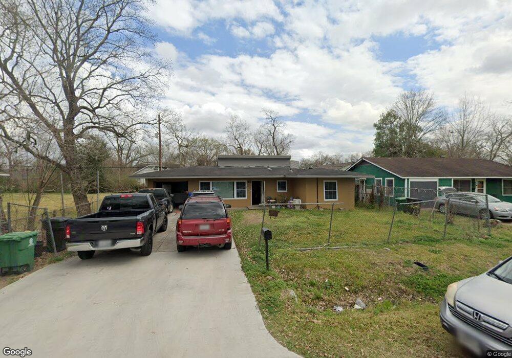
6121 Wayland St Houston, TX 77021
OST-South Union NeighborhoodEstimated Value: $182,111 - $256,000
3
Beds
1
Bath
1,806
Sq Ft
$118/Sq Ft
Est. Value
About This Home
This home is located at 6121 Wayland St, Houston, TX 77021 and is currently estimated at $213,528, approximately $118 per square foot. 6121 Wayland St is a home located in Harris County with nearby schools including Peck Elementary School, Cullen Middle School, and Yates High School.
Ownership History
Date
Name
Owned For
Owner Type
Purchase Details
Closed on
Mar 10, 2000
Sold by
Eaton Marie
Bought by
Smith Daniel R
Current Estimated Value
Home Financials for this Owner
Home Financials are based on the most recent Mortgage that was taken out on this home.
Original Mortgage
$38,700
Outstanding Balance
$13,059
Interest Rate
8.23%
Estimated Equity
$200,469
Purchase Details
Closed on
Aug 4, 1994
Sold by
Eaton Harold T and Eaton Larry James
Bought by
Eaton Marie
Create a Home Valuation Report for This Property
The Home Valuation Report is an in-depth analysis detailing your home's value as well as a comparison with similar homes in the area
Home Values in the Area
Average Home Value in this Area
Purchase History
| Date | Buyer | Sale Price | Title Company |
|---|---|---|---|
| Smith Daniel R | -- | Fidelity National Title | |
| Eaton Marie | -- | -- |
Source: Public Records
Mortgage History
| Date | Status | Borrower | Loan Amount |
|---|---|---|---|
| Open | Smith Daniel R | $38,700 |
Source: Public Records
Tax History Compared to Growth
Tax History
| Year | Tax Paid | Tax Assessment Tax Assessment Total Assessment is a certain percentage of the fair market value that is determined by local assessors to be the total taxable value of land and additions on the property. | Land | Improvement |
|---|---|---|---|---|
| 2025 | $2,048 | $174,568 | $97,427 | $77,141 |
| 2024 | $2,048 | $174,568 | $97,427 | $77,141 |
| 2023 | $2,048 | $175,891 | $88,831 | $87,060 |
| 2022 | $2,034 | $167,954 | $80,234 | $87,720 |
| 2021 | $1,958 | $96,733 | $48,714 | $48,019 |
| 2020 | $1,849 | $76,357 | $31,521 | $44,836 |
| 2019 | $1,792 | $73,665 | $31,521 | $42,144 |
| 2018 | $139 | $64,391 | $25,790 | $38,601 |
| 2017 | $1,628 | $64,391 | $25,790 | $38,601 |
| 2016 | $1,628 | $64,391 | $25,790 | $38,601 |
| 2015 | $950 | $64,391 | $25,790 | $38,601 |
| 2014 | $950 | $54,644 | $14,328 | $40,316 |
Source: Public Records
Map
Nearby Homes
- 6109 Grace Ln
- 6014 Grace Ln Unit A/B
- 4624 Kingsbury St
- 0 Perry St
- 4613 Dewberry St
- 5902 Grace Ln
- 5831 Grace Ln
- 5023 Cosby St
- 4604 Keystone St
- 4603 Keystone St
- 5822 Grace Ln
- 4611 Dewberry St
- 5111 Cosby St
- 6919 Calhoun Rd
- 6417 Madrid St
- 6309 Calhoun Rd
- 6419 Madrid St
- 6421 Madrid St
- 6302 Calhoun Rd
- 4523 Keystone St
- 6203 Wayland St
- 6113 Wayland St
- 5321 Keystone St
- 6036 Grace Ln
- 6207 Wayland St
- 6120 Grace Ln
- 4627 Keystone St
- 6032 Grace Ln
- 6211 Wayland St
- 6109 Wayland St
- 4626 Kingsbury St
- 4626 Keystone St
- 4625 Keystone St
- 6030 Grace Ln
- 6215 Wayland St
- 4624 Keystone St
- 6117 Grace Ln
- 6113 Grace
- 4623 Keystone St
- 6121 Grace Ln