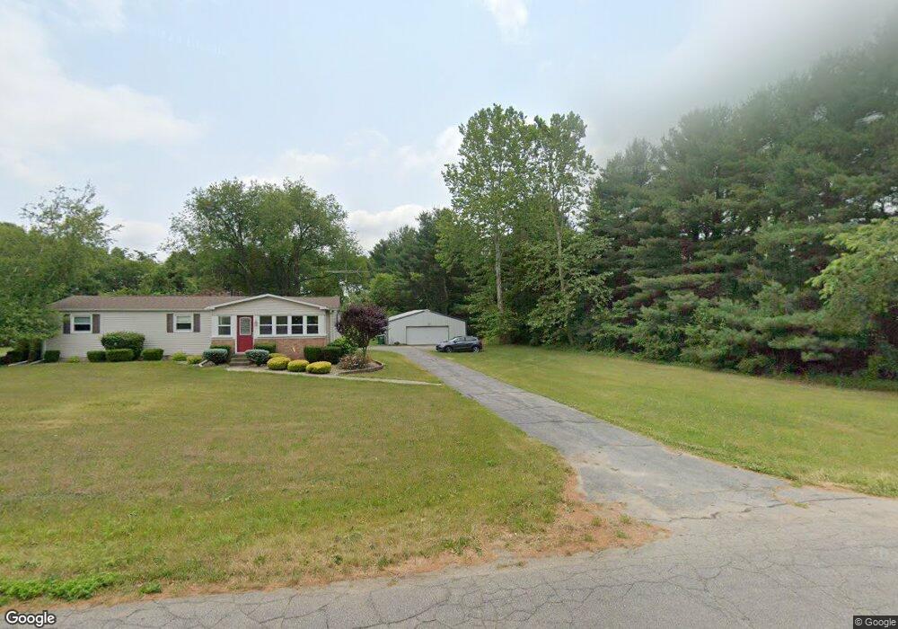
6122 E 350 N Rolling Prairie, IN 46371
Estimated Value: $254,931 - $358,000
3
Beds
2
Baths
1,636
Sq Ft
$192/Sq Ft
Est. Value
About This Home
This home is located at 6122 E 350 N, Rolling Prairie, IN 46371 and is currently estimated at $313,733, approximately $191 per square foot. 6122 E 350 N is a home located in LaPorte County with nearby schools including New Prairie High School and Sacred Heart Apostolic School.
Create a Home Valuation Report for This Property
The Home Valuation Report is an in-depth analysis detailing your home's value as well as a comparison with similar homes in the area
Home Values in the Area
Average Home Value in this Area
Tax History Compared to Growth
Tax History
| Year | Tax Paid | Tax Assessment Tax Assessment Total Assessment is a certain percentage of the fair market value that is determined by local assessors to be the total taxable value of land and additions on the property. | Land | Improvement |
|---|---|---|---|---|
| 2024 | $1,881 | $184,300 | $55,500 | $128,800 |
| 2023 | $1,802 | $184,100 | $55,500 | $128,600 |
| 2022 | $2,030 | $188,000 | $55,500 | $132,500 |
| 2021 | $2,114 | $180,800 | $55,500 | $125,300 |
| 2020 | $2,143 | $180,800 | $55,500 | $125,300 |
| 2019 | $2,154 | $181,500 | $55,500 | $126,000 |
| 2018 | $1,654 | $157,600 | $41,900 | $115,700 |
| 2017 | $1,466 | $143,800 | $37,500 | $106,300 |
| 2016 | $1,575 | $147,900 | $37,500 | $110,400 |
| 2014 | $1,717 | $174,700 | $28,000 | $146,700 |
Source: Public Records
Map
Nearby Homes
- 67 Acres E 300 N
- 7428 E 400 N
- 5303 E Bootjack Rd
- 6798 E 350 N
- 7674 Potato Hole Ct
- 109 N Depot St
- 4222 N 400 E
- 3803 E State Road 2
- 3429 E Sand Ridge Rd
- 8196 E Walnut Ridge
- 2692 N Morning Glory Ave
- 2897 N Morning Glory Ave
- 2945 N Morning Glory Ave Unit 73
- 2983 N Morning Glory Ave Unit 72
- 2979 N Morning Glory Ave
- 2893 N Morning Glory Ave
- 2952 N Morning Glory Ave
- 4271 E 50 N
- 3202 N 300 E
- 55554 County Line Rd