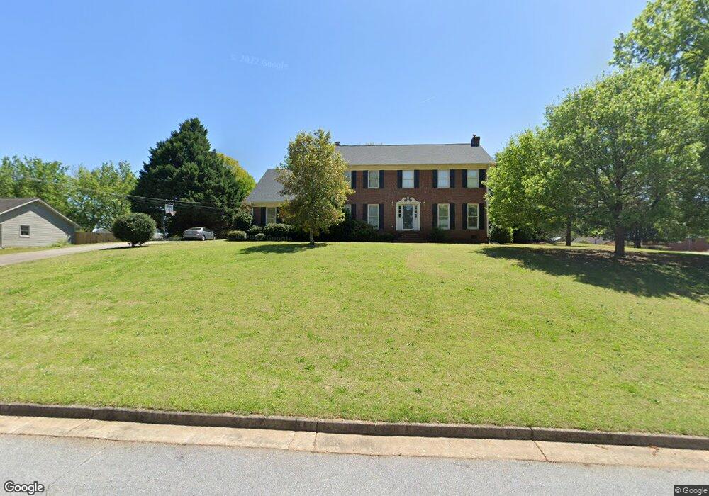
6122 Pinewood Dr SE Covington, GA 30014
Estimated Value: $403,012 - $468,000
--
Bed
2
Baths
3,194
Sq Ft
$137/Sq Ft
Est. Value
About This Home
This home is located at 6122 Pinewood Dr SE, Covington, GA 30014 and is currently estimated at $436,253, approximately $136 per square foot. 6122 Pinewood Dr SE is a home located in Newton County with nearby schools including East Newton Elementary School, Cousins Middle School, and Eastside High School.
Ownership History
Date
Name
Owned For
Owner Type
Purchase Details
Closed on
May 9, 2017
Sold by
Hamby Johnny L
Bought by
Hamby Amy J
Current Estimated Value
Purchase Details
Closed on
Feb 20, 2004
Sold by
Fisher Dennis G and Fisher Olive L
Bought by
Hamby Johnny L and Hamby Amy
Home Financials for this Owner
Home Financials are based on the most recent Mortgage that was taken out on this home.
Original Mortgage
$22,000
Interest Rate
5.63%
Mortgage Type
Stand Alone Refi Refinance Of Original Loan
Purchase Details
Closed on
Apr 16, 1999
Sold by
Clark Chester A and Clark Betty B
Bought by
Fisher Dennis C and Fisher Olive L
Home Financials for this Owner
Home Financials are based on the most recent Mortgage that was taken out on this home.
Original Mortgage
$162,000
Interest Rate
7.13%
Mortgage Type
New Conventional
Create a Home Valuation Report for This Property
The Home Valuation Report is an in-depth analysis detailing your home's value as well as a comparison with similar homes in the area
Home Values in the Area
Average Home Value in this Area
Purchase History
| Date | Buyer | Sale Price | Title Company |
|---|---|---|---|
| Hamby Amy J | -- | -- | |
| Hamby Johnny L | $219,600 | -- | |
| Fisher Dennis C | $180,000 | -- |
Source: Public Records
Mortgage History
| Date | Status | Borrower | Loan Amount |
|---|---|---|---|
| Previous Owner | Hamby Johnny L | $22,000 | |
| Previous Owner | Fisher Dennis C | $162,000 |
Source: Public Records
Tax History Compared to Growth
Tax History
| Year | Tax Paid | Tax Assessment Tax Assessment Total Assessment is a certain percentage of the fair market value that is determined by local assessors to be the total taxable value of land and additions on the property. | Land | Improvement |
|---|---|---|---|---|
| 2024 | $4,171 | $143,280 | $17,600 | $125,680 |
| 2023 | $4,287 | $137,080 | $17,600 | $119,480 |
| 2022 | $3,936 | $124,360 | $17,600 | $106,760 |
| 2021 | $4,852 | $136,840 | $16,000 | $120,840 |
| 2020 | $4,624 | $119,200 | $16,000 | $103,200 |
| 2019 | $4,688 | $118,640 | $16,000 | $102,640 |
| 2018 | $4,220 | $107,400 | $12,800 | $94,600 |
| 2017 | $4,122 | $103,560 | $12,800 | $90,760 |
| 2016 | $3,586 | $90,520 | $12,800 | $77,720 |
| 2015 | $3,268 | $82,680 | $12,800 | $69,880 |
| 2014 | $3,269 | $82,680 | $0 | $0 |
Source: Public Records
Map
Nearby Homes
- 322 Pinewood Dr
- 6134 Linwood Dr SE
- 6129 Linwood Dr SE
- 6176 Pinewood Dr SE
- 5132 Forest Dr SE
- 6169 Pinewood Dr SE
- 4138 Pemberton Dr SE
- 13238 Tolstoy
- 6203 Crestview Dr SE
- 4208 Brookhaven Dr SE
- 6111 Old Monticello St SE
- 4187 Cherry Laurel Dr SE
- 8239 High Lake Terrace SE
- 8384 Fairway Dr
- 8370 Fairway Dr
- 3183 Conyers St SE
- 5118 Floyd St NE
- 7128 Honeysuckle Ct SE
- 6136 Pinewood Dr SE
- 6136 Pinewood Dr SE
- 6159 N Dearing St SE Unit 1
- 6159 N Dearing St SE
- 6144 N Dearing St SE
- 6130 N Dearing St SE
- 6117 Pinewood Dr SE
- 6146 Pinewood Dr SE
- 6129 Pinewood Dr SE
- 6154 N Dearing St SE
- 6154 N Dearing St SE
- 6139 Pinewood Dr SE
- 6160 N Dearing St SE
- 0 Dearing St SE Unit 7442129
- S Dearing St SE
- N Dearing St SE
- 6156 Pinewood Dr SE
- 7195 Golfside Dr SE
- 6116 N Dearing St SE
- 6170 N Dearing St SE