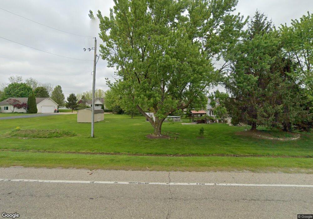
6122 W Pierson Rd Unit 10 Flushing, MI 48433
Estimated Value: $251,968 - $607,000
--
Bed
--
Bath
6,704
Sq Ft
$62/Sq Ft
Est. Value
About This Home
This home is located at 6122 W Pierson Rd Unit 10, Flushing, MI 48433 and is currently estimated at $412,742, approximately $61 per square foot. 6122 W Pierson Rd Unit 10 is a home located in Genesee County with nearby schools including Col. Donald McMonagle Elementary School, Hamady Community Middle/High School, and Linden Charter Academy.
Ownership History
Date
Name
Owned For
Owner Type
Purchase Details
Closed on
Feb 4, 2025
Sold by
Wallace Family Trust
Bought by
Jbjb Holdings Llc
Current Estimated Value
Purchase Details
Closed on
Feb 3, 2025
Sold by
Future Property Group Llc
Bought by
Wallace Family Trust and Wallace
Purchase Details
Closed on
Feb 5, 2014
Sold by
Unit #10 Llc
Bought by
Future Property Group Llc
Create a Home Valuation Report for This Property
The Home Valuation Report is an in-depth analysis detailing your home's value as well as a comparison with similar homes in the area
Home Values in the Area
Average Home Value in this Area
Purchase History
| Date | Buyer | Sale Price | Title Company |
|---|---|---|---|
| Jbjb Holdings Llc | -- | Sargents Title | |
| Wallace Family Trust | -- | None Listed On Document | |
| Future Property Group Llc | $223,000 | Cislo Title Co |
Source: Public Records
Tax History Compared to Growth
Tax History
| Year | Tax Paid | Tax Assessment Tax Assessment Total Assessment is a certain percentage of the fair market value that is determined by local assessors to be the total taxable value of land and additions on the property. | Land | Improvement |
|---|---|---|---|---|
| 2025 | $8,967 | $154,200 | $0 | $0 |
| 2024 | $1,690 | $147,100 | $0 | $0 |
| 2023 | $1,698 | $147,600 | $0 | $0 |
| 2022 | $10,127 | $166,700 | $0 | $0 |
| 2021 | $10,111 | $196,500 | $0 | $0 |
| 2020 | $1,882 | $207,600 | $0 | $0 |
| 2019 | $1,852 | $202,400 | $0 | $0 |
| 2018 | $9,502 | $187,600 | $0 | $0 |
| 2017 | $9,170 | $186,300 | $0 | $0 |
| 2016 | $9,088 | $160,200 | $0 | $0 |
| 2015 | $8,926 | $150,800 | $0 | $0 |
| 2014 | $1,949 | $186,300 | $0 | $0 |
| 2012 | -- | $193,200 | $193,200 | $0 |
Source: Public Records
Map
Nearby Homes
- 3495 Luce Rd
- 5424 W Pierson Rd
- 6346 Squire Lake Dr Unit 33 Bldg 99
- 6367 W Pierson Rd
- 3442 Eastman Dr
- 3371 Ann Dr
- 3844 Ann Dr
- 145 N Elms Rd
- 3191 Brentfield Dr
- 0 Sonny Ave
- 5234 Kelly Rd
- 1506 Golfside Ct
- 1436 E Pierson Rd
- 162 Beacon Point Pkwy
- 5023 W Pierson Rd
- 7040 Cambridge Dr
- 7042 Cambridge Dr
- 7044 Cambridge Dr
- 7048 Cambridge Dr
- 7050 Cambridge Dr
- 6122 W Pierson Rd
- 6122 W Pierson Rd
- 6122 W Pierson Rd Unit 5
- 6122 W Pierson Rd Unit 4187
- 6104 W Pierson Rd
- 6158 W Pierson Rd
- 6172 W Pierson Rd
- 4048 Marianne Dr
- 6190 W Pierson Rd
- 4060 Marianne Dr
- 4208 Woodland Ct
- 4033 Marianne Dr
- 4043 Marianne Dr
- 4210 Woodland Ct
- 4055 Marianne Dr
- 4084 Marianne Dr
- 6201 W Pierson Rd
- 4047 Eagles Nest
- 4065 Marianne Dr
- 4204 Woodland Ct
