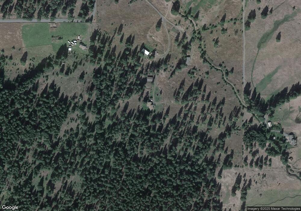
61228 Small Graffi Rd Enterprise, OR 97828
Estimated Value: $884,884 - $1,599,000
2
Beds
3
Baths
3,295
Sq Ft
$377/Sq Ft
Est. Value
About This Home
This home is located at 61228 Small Graffi Rd, Enterprise, OR 97828 and is currently estimated at $1,241,942, approximately $376 per square foot. 61228 Small Graffi Rd is a home located in Wallowa County with nearby schools including Enterprise Elementary School and Enterprise High School.
Ownership History
Date
Name
Owned For
Owner Type
Purchase Details
Closed on
Mar 23, 2021
Sold by
Wood Denny E and Jones Lindsey W
Bought by
Jones Lindsey W and Jones Justin F
Current Estimated Value
Purchase Details
Closed on
Nov 1, 2017
Sold by
Jones Justin F and Jones Lindsey W
Bought by
Jones Justin F and Jones Lindsey W
Home Financials for this Owner
Home Financials are based on the most recent Mortgage that was taken out on this home.
Original Mortgage
$250,000
Interest Rate
3.88%
Mortgage Type
New Conventional
Create a Home Valuation Report for This Property
The Home Valuation Report is an in-depth analysis detailing your home's value as well as a comparison with similar homes in the area
Home Values in the Area
Average Home Value in this Area
Purchase History
| Date | Buyer | Sale Price | Title Company |
|---|---|---|---|
| Jones Lindsey W | -- | None Listed On Document | |
| Jones Justin F | -- | Wallowa Title Co |
Source: Public Records
Mortgage History
| Date | Status | Borrower | Loan Amount |
|---|---|---|---|
| Previous Owner | Jones Justin F | $250,000 |
Source: Public Records
Tax History Compared to Growth
Tax History
| Year | Tax Paid | Tax Assessment Tax Assessment Total Assessment is a certain percentage of the fair market value that is determined by local assessors to be the total taxable value of land and additions on the property. | Land | Improvement |
|---|---|---|---|---|
| 2024 | $3,010 | $272,200 | $6,915 | $265,285 |
| 2023 | $2,928 | $264,445 | $6,886 | $257,559 |
| 2022 | $2,833 | $256,917 | $6,859 | $250,058 |
| 2021 | $2,763 | $249,607 | $6,832 | $242,775 |
| 2020 | $2,541 | $242,510 | $6,806 | $235,704 |
| 2019 | $2,470 | $235,454 | $6,615 | $228,839 |
| 2018 | $2,350 | $228,597 | $6,423 | $222,174 |
| 2017 | $2,323 | $221,939 | $6,236 | $215,703 |
| 2016 | $2,189 | $215,591 | $0 | $0 |
| 2015 | $2,162 | $209,470 | $6,148 | $203,322 |
| 2014 | $1,997 | $196,503 | $5,933 | $190,570 |
| 2013 | $1,964 | $192,737 | $5,917 | $186,820 |
Source: Public Records
Map
Nearby Homes
- 61687 Lime Quarry Rd
- 1 Century Ln
- 81202 Reavis Ln
- 81897 Reavis Ln
- 82580 Boner Ln
- 0 Red Hawk Ln Unit 194945137
- 64929 Hurricane Creek Rd
- 64782 Alder Slope Rd
- 82952 Eggleson Ln
- 118 Fish Hatchery Ln
- 0 0 Highland Dr
- 606 SW Mildred Ave
- 305 Montclair St
- 203 Court St
- 609 Mildred St
- 212 Court St
- 604 SW 2nd St
- 0 Hamel Dr
- 205 William St
- 404 Depot St
- 61206 Small Graffi Rd
- 61256 Small Graffi Rd
- 81492 Black Marble Ln
- 81772 Black Marble Ln
- 81774 Black Marble Ln
- 81748 Black Marble Ln
- 81304 Black Marble Ln
- 0 Black Marble Ln
- 81289 Black Marble Ln
- 64436 Alder Slope Rd
- 83213 Century Ln
- 61413 Lime Quarry Rd
- 81962 Black Marble Ln
- 64586 Alder Slope Rd
- 82029 Black Marble Ln
- 60916 Lime Quarry Rd
- 83210 Century Ln
- 0 Lime Quarry Rd
- 83126 Century Ln
- 61448 Lime Quarry Rd
