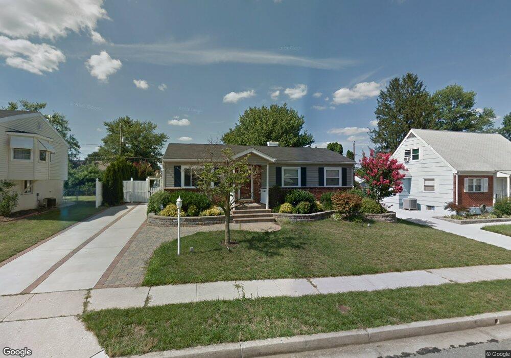
6124 Moorefield Rd Catonsville, MD 21228
Estimated Value: $339,886 - $455,000
Studio
2
Baths
1,092
Sq Ft
$375/Sq Ft
Est. Value
About This Home
This home is located at 6124 Moorefield Rd, Catonsville, MD 21228 and is currently estimated at $409,722, approximately $375 per square foot. 6124 Moorefield Rd is a home located in Baltimore County with nearby schools including Woodbridge Elementary School, Southwest Academy, and Woodlawn High School.
Ownership History
Date
Name
Owned For
Owner Type
Purchase Details
Closed on
Jan 26, 2016
Sold by
Whisler Stephen D and Whisler Amanda K
Bought by
Whisler Amanda K
Current Estimated Value
Home Financials for this Owner
Home Financials are based on the most recent Mortgage that was taken out on this home.
Original Mortgage
$254,150
Outstanding Balance
$202,866
Interest Rate
3.99%
Mortgage Type
FHA
Estimated Equity
$206,856
Purchase Details
Closed on
Apr 8, 1993
Sold by
Lewis William D
Bought by
Whisler Stephen D and Whisler Amanda K
Purchase Details
Closed on
Jun 3, 1991
Sold by
Dwyer Dale S
Bought by
Lewis William D
Create a Home Valuation Report for This Property
The Home Valuation Report is an in-depth analysis detailing your home's value as well as a comparison with similar homes in the area
Home Values in the Area
Average Home Value in this Area
Purchase History
| Date | Buyer | Sale Price | Title Company |
|---|---|---|---|
| Whisler Amanda K | -- | Attorney | |
| Whisler Stephen D | $118,500 | -- | |
| Lewis William D | $103,000 | -- |
Source: Public Records
Mortgage History
| Date | Status | Borrower | Loan Amount |
|---|---|---|---|
| Open | Whisler Amanda K | $254,150 |
Source: Public Records
Tax History
| Year | Tax Paid | Tax Assessment Tax Assessment Total Assessment is a certain percentage of the fair market value that is determined by local assessors to be the total taxable value of land and additions on the property. | Land | Improvement |
|---|---|---|---|---|
| 2025 | $4,100 | $302,367 | -- | -- |
| 2024 | $4,100 | $284,600 | $78,200 | $206,400 |
| 2023 | $1,994 | $270,933 | $0 | $0 |
| 2022 | $3,644 | $257,267 | $0 | $0 |
| 2021 | $5,263 | $243,600 | $78,200 | $165,400 |
| 2020 | $5,263 | $235,667 | $0 | $0 |
| 2019 | $5,753 | $227,733 | $0 | $0 |
| 2018 | $4,295 | $219,800 | $64,700 | $155,100 |
| 2017 | $3,155 | $215,567 | $0 | $0 |
| 2016 | $2,517 | $211,333 | $0 | $0 |
| 2015 | $2,517 | $207,100 | $0 | $0 |
| 2014 | $2,517 | $207,100 | $0 | $0 |
Source: Public Records
Map
Nearby Homes
- 1407 Adamsview Rd
- 6104 Chanceford Rd
- 1338 Middleford Rd
- 6112 Chesworth Rd
- 1204 Canberwell Rd
- 5 Blackridge Ct
- 6035 Moorehead Rd
- 2012 Cedar Circle Dr
- 1019 Crosby Rd
- 1201 Wisteria Dr
- 1111 Mirga Cir
- 912 Marksworth Rd
- 910 Prestwood Rd
- 1008 Collwood Rd
- 1111 Cummings Ave
- 914 Vanderwood Rd
- 1210 Carli Ct
- 1104 Lisadale Cir Unit 1D
- 517 Winters Ln
- 6003 Johnnycake Rd
- 6126 Moorefield Rd
- 6122 Moorefield Rd
- 6129 Wheatland Rd
- 6127 Wheatland Rd
- 6131 Wheatland Rd
- 6120 Moorefield Rd
- 6128 Moorefield Rd
- 6125 Moorefield Rd
- 1317 Glenwilde Rd
- 6127 Moorefield Rd
- 6125 Wheatland Rd
- 6121 Moorefield Rd
- 6133 Wheatland Rd
- 6118 Moorefield Rd
- 6119 Moorefield Rd
- 6123 Wheatland Rd
- 1401 Glenwilde Rd
- 1403 Glenwilde Rd
- 6123 Moorefield Rd
- 6117 Moorefield Rd
Your Personal Tour Guide
Ask me questions while you tour the home.