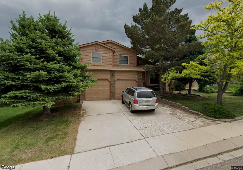
6125 Ampersand Way Colorado Springs, CO 80918
Norwood NeighborhoodEstimated Value: $443,482 - $535,000
3
Beds
3
Baths
1,808
Sq Ft
$261/Sq Ft
Est. Value
About This Home
This home is located at 6125 Ampersand Way, Colorado Springs, CO 80918 and is currently estimated at $471,871, approximately $260 per square foot. 6125 Ampersand Way is a home located in El Paso County with nearby schools including Martinez Elementary School, Jenkins Middle School, and Doherty High School.
Ownership History
Date
Name
Owned For
Owner Type
Purchase Details
Closed on
Jan 29, 2004
Sold by
Rubio Louise
Bought by
Rubio Frank and Trivigno Scott James
Current Estimated Value
Purchase Details
Closed on
Jan 23, 2004
Sold by
Rubio Frank
Bought by
Rubio Louise
Purchase Details
Closed on
Jan 9, 1989
Bought by
Trivigno Scott J
Purchase Details
Closed on
Mar 9, 1988
Bought by
Trivigno Scott J
Purchase Details
Closed on
Jun 30, 1987
Bought by
Trivigno Scott J
Purchase Details
Closed on
Aug 29, 1986
Bought by
Rubio Frank
Create a Home Valuation Report for This Property
The Home Valuation Report is an in-depth analysis detailing your home's value as well as a comparison with similar homes in the area
Home Values in the Area
Average Home Value in this Area
Purchase History
| Date | Buyer | Sale Price | Title Company |
|---|---|---|---|
| Rubio Frank | -- | -- | |
| Rubio Louise | -- | -- | |
| Trivigno Scott J | -- | -- | |
| Trivigno Scott J | -- | -- | |
| Trivigno Scott J | -- | -- | |
| Rubio Frank | -- | -- |
Source: Public Records
Tax History Compared to Growth
Tax History
| Year | Tax Paid | Tax Assessment Tax Assessment Total Assessment is a certain percentage of the fair market value that is determined by local assessors to be the total taxable value of land and additions on the property. | Land | Improvement |
|---|---|---|---|---|
| 2025 | $1,623 | $31,730 | -- | -- |
| 2024 | $1,508 | $31,660 | $5,700 | $25,960 |
| 2023 | $1,508 | $31,660 | $5,700 | $25,960 |
| 2022 | $1,356 | $22,640 | $5,060 | $17,580 |
| 2021 | $1,466 | $23,290 | $5,210 | $18,080 |
| 2020 | $1,417 | $19,740 | $4,530 | $15,210 |
| 2019 | $1,410 | $19,740 | $4,530 | $15,210 |
| 2018 | $1,304 | $16,870 | $3,810 | $13,060 |
| 2017 | $1,239 | $16,870 | $3,810 | $13,060 |
| 2016 | $999 | $16,130 | $3,940 | $12,190 |
| 2015 | $995 | $16,130 | $3,940 | $12,190 |
| 2014 | $958 | $14,940 | $3,890 | $11,050 |
Source: Public Records
Map
Nearby Homes
- 6030 Barnacle Ct
- 3840 Summer Breeze Dr
- 4265 Dolphin Cir
- 3887 Point of the Rocks Dr
- 3716 Adirondack Dr
- 3550 Summer Breeze Dr
- 6125 Northwind Dr
- 3613 Summer Breeze Dr
- 5904 Mapleton Dr
- 6103 Treeledge Dr
- 5978 Maroon Mesa Dr
- 3928 Diamond Ridge View
- 4224 Mesa Overlook Point
- 4217 High Timberline View
- 6463 Bluffmont Point
- 4229 High Timberline View
- 3437 Trenary Ln Unit 3437
- 5745 Doe Skin Ct
- 5419 Gardenia Cir
- 6565 Baytree Grove
- 6135 Ampersand Way
- 6132 Breeze Ct
- 6140 Breeze Ct
- 6145 Ampersand Way
- 6148 Breeze Ct
- 6130 Ampersand Way
- 6116 Breeze Ct
- 6122 Ampersand Way
- 6138 Ampersand Way
- 6108 Breeze Ct
- 6114 Ampersand Way
- 6146 Ampersand Way
- 6155 Ampersand Way
- 6156 Breeze Ct
- 6154 Ampersand Way
- 6090 Breeze Ct
- 6145 Breeze Ct
- 6129 Cranberry Ln
- 6121 Cranberry Ln
- 6164 Breeze Ct