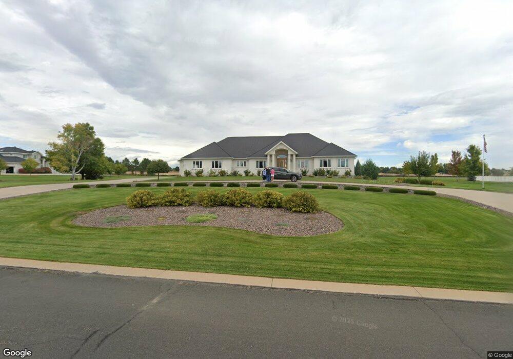
6125 Lesser Dr Greeley, CO 80634
Estimated Value: $715,000 - $1,046,000
3
Beds
4
Baths
3,092
Sq Ft
$296/Sq Ft
Est. Value
About This Home
This home is located at 6125 Lesser Dr, Greeley, CO 80634 and is currently estimated at $913,997, approximately $295 per square foot. 6125 Lesser Dr is a home located in Weld County with nearby schools including Greeley West High School, Union Colony Preparatory School, and Mountain View Academy.
Ownership History
Date
Name
Owned For
Owner Type
Purchase Details
Closed on
Apr 30, 1999
Sold by
Davhar Development Llc
Bought by
Howe Donald F and Howe Laurie Gene
Current Estimated Value
Home Financials for this Owner
Home Financials are based on the most recent Mortgage that was taken out on this home.
Original Mortgage
$51,437
Outstanding Balance
$13,323
Interest Rate
7.07%
Estimated Equity
$900,674
Purchase Details
Closed on
Nov 15, 1994
Bought by
Davhar Development Llc
Create a Home Valuation Report for This Property
The Home Valuation Report is an in-depth analysis detailing your home's value as well as a comparison with similar homes in the area
Home Values in the Area
Average Home Value in this Area
Purchase History
| Date | Buyer | Sale Price | Title Company |
|---|---|---|---|
| Howe Donald F | $58,000 | -- | |
| Davhar Development Llc | -- | -- |
Source: Public Records
Mortgage History
| Date | Status | Borrower | Loan Amount |
|---|---|---|---|
| Open | Howe Donald F | $51,437 |
Source: Public Records
Tax History Compared to Growth
Tax History
| Year | Tax Paid | Tax Assessment Tax Assessment Total Assessment is a certain percentage of the fair market value that is determined by local assessors to be the total taxable value of land and additions on the property. | Land | Improvement |
|---|---|---|---|---|
| 2025 | $4,169 | $52,420 | $9,130 | $43,290 |
| 2024 | $4,169 | $52,420 | $9,130 | $43,290 |
| 2023 | $3,976 | $59,880 | $11,500 | $48,380 |
| 2022 | $3,237 | $43,910 | $7,650 | $36,260 |
| 2021 | $3,340 | $45,170 | $7,870 | $37,300 |
| 2020 | $3,081 | $42,330 | $7,870 | $34,460 |
| 2019 | $3,089 | $42,330 | $7,870 | $34,460 |
| 2018 | $2,341 | $35,340 | $6,340 | $29,000 |
| 2017 | $2,958 | $35,340 | $6,340 | $29,000 |
| 2016 | $2,802 | $37,660 | $6,530 | $31,130 |
| 2015 | $2,792 | $37,660 | $6,530 | $31,130 |
| 2014 | $2,458 | $32,360 | $5,890 | $26,470 |
Source: Public Records
Map
Nearby Homes
- 6239 Ashcroft Rd
- 6349 Ashcroft Rd
- 3105 58th Avenue Ct
- 6108 W 27th St
- 3127 58th Ave
- 5775 W 29th St Unit 1208
- 3300 Sapphire Ct
- 5613 W 29th Street Rd
- 3303 Sapphire Ct
- 3304 Sapphire Ct
- 5775 29th St Unit 1307
- 5775 29th St Unit 605
- 5775 29th St Unit 206
- 5775 29th St Unit 1403
- 5775 29th St Unit 312
- 3308 Sapphire Ct
- 3307 Sapphire Ct
- 3218 Grenache St
- 3315 Sapphire Ct
- 3311 Sapphire Ct
- 6049 Lesser Dr
- 6141 Lesser Dr
- 6138 Lesser Dr
- 6110 Lesser Dr
- 6023 Lesser Dr
- 6235 Ashcroft Rd
- 6208 Lesser Dr
- 3115 Ashton Ave
- 6005 Lesser Dr
- 3114 Ashton Ave
- 6219 Ashcroft Rd
- 3102 Ashton Ave
- 6228 Ashcroft Rd
- 6123 Ashcroft Rd
- 3137 Ashton Ave
- 3126 Ashton Ave
- 6045 Ashcroft Rd
- 6303 Ashcroft Rd
- 6306 Ashcroft Rd
- 6226 Ashcroft Rd