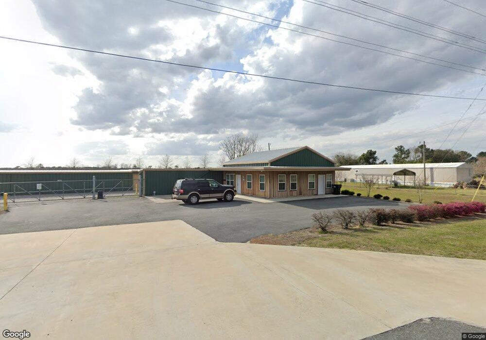
6125 Union Rd Hahira, GA 31632
Estimated Value: $123,000
3
Beds
1
Bath
6,875
Sq Ft
$18/Sq Ft
Est. Value
About This Home
This home is located at 6125 Union Rd, Hahira, GA 31632 and is currently priced at $123,000, approximately $17 per square foot. 6125 Union Rd is a home located in Lowndes County with nearby schools including Hahira Elementary School, Hahira Middle School, and Lowndes High School.
Ownership History
Date
Name
Owned For
Owner Type
Purchase Details
Closed on
Sep 16, 2025
Sold by
Superior Metal Construction Llc
Bought by
Franks Creek Storage Llc
Current Estimated Value
Purchase Details
Closed on
Apr 9, 2020
Sold by
Stubbs Harry Stacy
Bought by
Superior Metal Construction Llc
Home Financials for this Owner
Home Financials are based on the most recent Mortgage that was taken out on this home.
Original Mortgage
$382,751
Interest Rate
3.3%
Mortgage Type
New Conventional
Purchase Details
Closed on
Sep 11, 2018
Sold by
Browning Ashley
Bought by
Stubbs Harry Stacey
Purchase Details
Closed on
Nov 14, 2008
Sold by
Parker Ronny L
Bought by
Browning Ashley
Purchase Details
Closed on
Oct 17, 2002
Sold by
Parker Brinson and Parker Linnie
Bought by
Parker Linnie V
Purchase Details
Closed on
Dec 9, 1988
Sold by
Parker Brinson
Bought by
Parker Brinson and Parker Linnie
Create a Home Valuation Report for This Property
The Home Valuation Report is an in-depth analysis detailing your home's value as well as a comparison with similar homes in the area
Home Values in the Area
Average Home Value in this Area
Purchase History
| Date | Buyer | Sale Price | Title Company |
|---|---|---|---|
| Franks Creek Storage Llc | -- | -- | |
| Superior Metal Construction Llc | -- | -- | |
| Stubbs Harry Stacey | $113,367 | -- | |
| Browning Ashley | $125,000 | -- | |
| Parker Ronny L | -- | -- | |
| Parker Ronny L | -- | -- | |
| Parker Linnie V | -- | -- | |
| Parker Brinson | $2,400 | -- |
Source: Public Records
Mortgage History
| Date | Status | Borrower | Loan Amount |
|---|---|---|---|
| Previous Owner | Superior Metal Construction Llc | $382,751 |
Source: Public Records
Tax History Compared to Growth
Tax History
| Year | Tax Paid | Tax Assessment Tax Assessment Total Assessment is a certain percentage of the fair market value that is determined by local assessors to be the total taxable value of land and additions on the property. | Land | Improvement |
|---|---|---|---|---|
| 2024 | $15,766 | $660,861 | $102,480 | $558,381 |
| 2023 | $15,766 | $531,460 | $102,480 | $428,980 |
| 2022 | $14,835 | $532,129 | $102,480 | $429,649 |
| 2021 | $6,510 | $223,582 | $102,480 | $121,102 |
| 2020 | $6,097 | $225,470 | $102,480 | $122,990 |
| 2019 | $966 | $35,346 | $33,346 | $2,000 |
| 2018 | $1,098 | $45,757 | $33,346 | $12,411 |
| 2017 | $992 | $41,348 | $28,937 | $12,411 |
| 2016 | $995 | $41,348 | $28,937 | $12,411 |
| 2015 | $1,471 | $60,570 | $28,937 | $31,633 |
| 2014 | $1,382 | $50,340 | $24,810 | $25,530 |
Source: Public Records
Map
Nearby Homes
- 6936 Simpson Rd
- 6453 Meadow Creek Rd
- 5670 Barber Cir
- 6628 Brookridge Dr
- 6622 Brookridge Dr
- 209 Orvis Ln
- The Belfort Plan at Phillips Place
- The Galen Plan at Phillips Place
- The Cali Plan at Phillips Place
- The Lakeside Plan at Phillips Place
- The Lismore Plan at Phillips Place
- 1601 Beverly Ln
- 1604 Beverly Ln
- 1596 Beverly Ln
- 840 Kristen Ln
- 819 Kristen Ln
- 5460 Union Rd
- 489 Bryson Cir
- 1055 Angie Ln
- The Ozark Plan at Reynolda Place
- 6034 Red Tail Dr
- 6033 Union Springs Dr
- 6030 Red Tail Dr
- 6029 Union Springs Dr
- 6033 Red Tail Dr
- 6161 Union Rd
- 6029 Red Tail Dr
- 6026 Red Tail Dr
- 6139 Union Rd
- 6025 Union Springs Dr
- 6034 Union Springs Dr
- 6025 Red Tail Dr
- 6018 Red Tail Dr
- 6022 Red Tail Dr
- 6030 Union Springs Dr
- 6021 Union Springs Dr
- 6021 Red Tail Dr
- 6100 Union Rd
- 6026 Union Springs Dr
- 6194 Union Rd