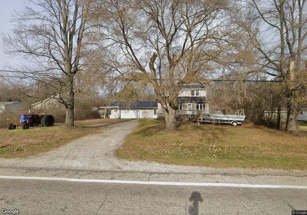
6126 Griswold Rd Kimball, MI 48074
Estimated Value: $153,000 - $204,000
3
Beds
1
Bath
1,440
Sq Ft
$128/Sq Ft
Est. Value
About This Home
This home is located at 6126 Griswold Rd, Kimball, MI 48074 and is currently estimated at $183,799, approximately $127 per square foot. 6126 Griswold Rd is a home located in St. Clair County with nearby schools including Kimball Elementary School, Central Middle School, and Port Huron High School.
Ownership History
Date
Name
Owned For
Owner Type
Purchase Details
Closed on
Mar 25, 2020
Sold by
Sloan Robert J
Bought by
Mcclelland David A
Current Estimated Value
Purchase Details
Closed on
Mar 23, 2020
Sold by
Sloan Robert J
Bought by
Mcclelland David A
Purchase Details
Closed on
Oct 29, 2014
Sold by
Sloan Rebecca S
Bought by
Sloan Robert J
Purchase Details
Closed on
Jun 16, 2006
Sold by
Chandler James G and Chandler Hazel B
Bought by
Sloan Robert J and Sloan Rebecca S
Create a Home Valuation Report for This Property
The Home Valuation Report is an in-depth analysis detailing your home's value as well as a comparison with similar homes in the area
Home Values in the Area
Average Home Value in this Area
Purchase History
| Date | Buyer | Sale Price | Title Company |
|---|---|---|---|
| Mcclelland David A | -- | None Listed On Document | |
| Mcclelland David A | -- | None Listed On Document | |
| Sloan Robert J | -- | None Available | |
| Sloan Robert J | $35,000 | None Available |
Source: Public Records
Tax History Compared to Growth
Tax History
| Year | Tax Paid | Tax Assessment Tax Assessment Total Assessment is a certain percentage of the fair market value that is determined by local assessors to be the total taxable value of land and additions on the property. | Land | Improvement |
|---|---|---|---|---|
| 2025 | $1,292 | $63,600 | $0 | $0 |
| 2024 | $723 | $58,500 | $0 | $0 |
| 2023 | $663 | $55,100 | $0 | $0 |
| 2022 | $1,156 | $47,800 | $0 | $0 |
| 2021 | $866 | $42,100 | $0 | $0 |
| 2020 | $866 | $43,600 | $43,600 | $0 |
| 2019 | $850 | $39,900 | $0 | $0 |
| 2018 | $830 | $36,700 | $0 | $0 |
| 2017 | $813 | $37,400 | $0 | $0 |
| 2016 | $454 | $37,400 | $0 | $0 |
| 2015 | -- | $37,200 | $37,200 | $0 |
| 2014 | -- | $31,900 | $31,900 | $0 |
| 2013 | -- | $36,600 | $0 | $0 |
Source: Public Records
Map
Nearby Homes
- 00 Griswold Rd
- 2019 Edward Ln E
- 1876 Morningstar Ave
- 6417 Dove Rd
- 1688 Sturdevant Rd
- 1371 Sturdevant Rd
- 6153 Birch Creek Ct
- I-69 vac Taylor Dr
- 599 Trout Lake Ct
- 1261 Sturdevant Rd
- 0 Wadhams Rd Unit 50155021
- 6241 Twin Lakes Dr
- 0 Sparling Rd Unit 2210034403
- 2758 E Lake Dr
- 504 Bush Lake Ln
- 5653 Pine Ct
- 6201 Lapeer Rd
- 5878 S Bob White Dr
- 1533 Richman Rd
- 2991 W Bob White Dr Unit 53
- 6114 Griswold Rd
- 6114 Griswold Rd
- 6148 Griswold Rd
- 6136 Griswold Rd
- 6154 Griswold Rd
- 6109 Griswold Rd
- 6117 Griswold Rd
- 6099 Griswold Rd
- 6080 Griswold Rd
- 6087 S Birch Hill Dr
- 2055 W Birch Hill Dr
- 6165 Griswold Rd
- 6149 Griswold Rd
- 6180 Griswold Rd
- 2063 W Birch Hill Dr
- 6085 S Birch Hill Dr
- 6085 S Birch Hill Dr
- 6070 Griswold Rd
- 6062 Griswold Rd
- 6090 S Birch Hill Dr