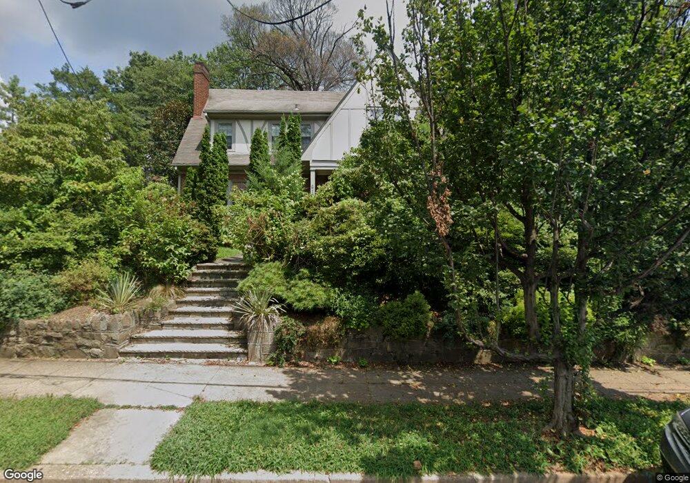
6129 Broad Branch Rd NW Washington, DC 20015
Chevy Chase NeighborhoodEstimated Value: $1,476,000 - $1,592,000
4
Beds
3
Baths
2,402
Sq Ft
$631/Sq Ft
Est. Value
About This Home
This home is located at 6129 Broad Branch Rd NW, Washington, DC 20015 and is currently estimated at $1,516,359, approximately $631 per square foot. 6129 Broad Branch Rd NW is a home located in District of Columbia with nearby schools including Lafayette Elementary School, Sequoia Union Elementary, and Alice Deal Middle School.
Ownership History
Date
Name
Owned For
Owner Type
Purchase Details
Closed on
Dec 29, 1997
Sold by
Stover Ruby R Estate Of By P R
Bought by
Campbell+ John M
Current Estimated Value
Home Financials for this Owner
Home Financials are based on the most recent Mortgage that was taken out on this home.
Original Mortgage
$292,000
Outstanding Balance
$47,372
Interest Rate
7.15%
Mortgage Type
New Conventional
Estimated Equity
$1,468,987
Create a Home Valuation Report for This Property
The Home Valuation Report is an in-depth analysis detailing your home's value as well as a comparison with similar homes in the area
Home Values in the Area
Average Home Value in this Area
Purchase History
| Date | Buyer | Sale Price | Title Company |
|---|---|---|---|
| Campbell+ John M | $365,000 | -- |
Source: Public Records
Mortgage History
| Date | Status | Borrower | Loan Amount |
|---|---|---|---|
| Open | Campbell+ John M | $292,000 |
Source: Public Records
Tax History Compared to Growth
Tax History
| Year | Tax Paid | Tax Assessment Tax Assessment Total Assessment is a certain percentage of the fair market value that is determined by local assessors to be the total taxable value of land and additions on the property. | Land | Improvement |
|---|---|---|---|---|
| 2025 | $9,884 | $1,252,620 | $710,130 | $542,490 |
| 2024 | $9,639 | $1,221,000 | $699,180 | $521,820 |
| 2023 | $8,998 | $1,142,580 | $656,310 | $486,270 |
| 2022 | $8,424 | $1,069,760 | $609,050 | $460,710 |
| 2021 | $8,211 | $1,042,330 | $599,840 | $442,490 |
| 2020 | $7,918 | $1,007,170 | $567,840 | $439,330 |
| 2019 | $7,693 | $979,860 | $555,070 | $424,790 |
| 2018 | $7,465 | $951,530 | $0 | $0 |
| 2017 | $7,385 | $941,320 | $0 | $0 |
| 2016 | $6,974 | $892,160 | $0 | $0 |
| 2015 | $6,812 | $872,770 | $0 | $0 |
| 2014 | $6,453 | $829,350 | $0 | $0 |
Source: Public Records
Map
Nearby Homes
- 6008 34th Place NW
- 105 Summerfield Rd
- 6515 Brookville Rd
- 1 W Melrose St
- 3210 Quesada St NW
- 5606 Chevy Chase Pkwy NW
- 6709 Melville Place
- 3216 Patterson St NW
- 3609 Morrison St NW
- 6116 30th St NW
- 3510 Morrison St NW
- 3804 Raymond St
- 3417 Cummings Ln
- 3500 Shepherd St
- 3206 Morrison St NW
- 32 W Irving St
- 5445 33rd St NW
- 44 Grafton St
- 4008 Rosemary St
- 5410 Connecticut Ave NW Unit 505
- 6123 Broad Branch Rd NW
- 3388 Stephenson Place NW
- 6117 Broad Branch Rd NW
- 3393 Stephenson Place NW
- 3391 Stephenson Place NW
- 3386 Stephenson Place NW
- 3395 Stephenson Place NW
- 3389 Stephenson Place NW
- 6126 Broad Branch Rd NW
- 3373 Runnymede Place NW
- 6120 Broad Branch Rd NW
- 6132 Broad Branch Rd NW
- 3387 Stephenson Place NW
- 3384 Stephenson Place NW
- 6207 Broad Branch Rd NW
- 3369 Runnymede Place NW
- 3505 Runnymede Place NW
- 3385 Stephenson Place NW
- 6206 Broad Branch Rd NW
- 3382 Stephenson Place NW