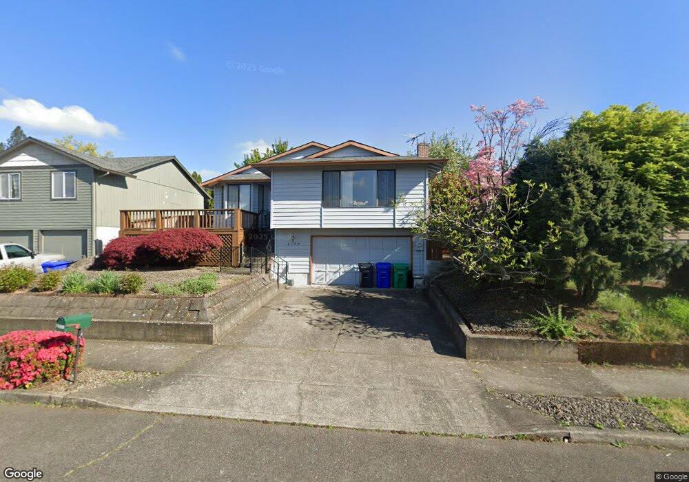
6129 SE Sherman St Portland, OR 97215
Mount Tabor NeighborhoodEstimated Value: $603,000 - $703,000
3
Beds
2
Baths
1,531
Sq Ft
$435/Sq Ft
Est. Value
About This Home
This home is located at 6129 SE Sherman St, Portland, OR 97215 and is currently estimated at $666,323, approximately $435 per square foot. 6129 SE Sherman St is a home located in Multnomah County with nearby schools including Atkinson Elementary School, Franklin High School, and Mt. Scott Park Center for Learning.
Ownership History
Date
Name
Owned For
Owner Type
Purchase Details
Closed on
Jul 5, 2024
Sold by
Chan Hung Siu and Chan Wo Mao
Bought by
Chan Suet Fong
Current Estimated Value
Purchase Details
Closed on
Mar 14, 1997
Sold by
Chan Hung S
Bought by
Chan Wo Mao and Chan Suet Fong
Home Financials for this Owner
Home Financials are based on the most recent Mortgage that was taken out on this home.
Original Mortgage
$60,000
Interest Rate
7.63%
Mortgage Type
Purchase Money Mortgage
Purchase Details
Closed on
Mar 20, 1996
Sold by
Chan Hung Siu
Bought by
Chan Hung Siu
Create a Home Valuation Report for This Property
The Home Valuation Report is an in-depth analysis detailing your home's value as well as a comparison with similar homes in the area
Home Values in the Area
Average Home Value in this Area
Purchase History
| Date | Buyer | Sale Price | Title Company |
|---|---|---|---|
| Chan Suet Fong | -- | None Listed On Document | |
| Chan Wo Mao | -- | Fidelity National Title Co | |
| Chan Hung Siu | $8,000 | -- |
Source: Public Records
Mortgage History
| Date | Status | Borrower | Loan Amount |
|---|---|---|---|
| Previous Owner | Chan Wo Mao | $60,000 |
Source: Public Records
Tax History Compared to Growth
Tax History
| Year | Tax Paid | Tax Assessment Tax Assessment Total Assessment is a certain percentage of the fair market value that is determined by local assessors to be the total taxable value of land and additions on the property. | Land | Improvement |
|---|---|---|---|---|
| 2024 | $7,440 | $278,060 | -- | -- |
| 2023 | $7,154 | $269,970 | $0 | $0 |
| 2022 | $6,999 | $262,110 | $0 | $0 |
| 2021 | $6,880 | $254,480 | $0 | $0 |
| 2020 | $6,312 | $247,070 | $0 | $0 |
| 2019 | $6,080 | $239,880 | $0 | $0 |
| 2018 | $5,901 | $232,900 | $0 | $0 |
| 2017 | $5,656 | $226,120 | $0 | $0 |
| 2016 | $5,176 | $219,540 | $0 | $0 |
| 2015 | $5,040 | $213,150 | $0 | $0 |
| 2014 | $4,965 | $206,950 | $0 | $0 |
Source: Public Records
Map
Nearby Homes
- 2416 SE 60th Ave
- 2353 SE 58th Ave
- 6600 SE Division St Unit 202
- 1703 SE 59th Ave
- 6678 SE Clinton St
- 2013 SE 54th Ave
- 2931 SE 67th Ave
- 3182 SE 62nd Ave
- 2409 SE 51st Ave Unit 10
- 1314 SE 55th Ave
- 2332 2334 SE 72nd Ave
- 5205 SE Taggart Ct
- 7247 SE Division St
- 6300 SE Yamhill St
- 4910 SE Caruthers St Unit 1
- 4950 SE Caruthers St Unit 5
- 4960 SE Caruthers St Unit 6
- 3306 SE 56th Ave
- 3120 SE 53rd Ave
- 2850 SE 50th Ave
- 6117 SE Sherman St
- 6135 SE Sherman St
- 6105 SE Sherman St
- 6126 SE Grant St
- 6143 SE Sherman St
- 6116 SE Grant St
- 6120 SE Sherman St
- 6146 SE Grant St
- 6104 SE Grant St
- 6045 SE Sherman St
- 6205 SE Sherman St
- 6124 SE Sherman St
- 6114 SE Sherman St
- 6136 SE Sherman St
- 6204 SE Grant St
- 6106 SE Sherman St
- 6044 SE Grant St
- 6144 SE Sherman St
- 6035 SE Sherman St
- 6217 SE Sherman St