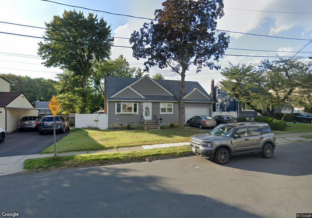
613 Briarcliff Ave Maywood, NJ 07607
Estimated Value: $578,000 - $686,000
--
Bed
--
Bath
1,554
Sq Ft
$408/Sq Ft
Est. Value
About This Home
This home is located at 613 Briarcliff Ave, Maywood, NJ 07607 and is currently estimated at $633,741, approximately $407 per square foot. 613 Briarcliff Ave is a home located in Bergen County with nearby schools including Memorial Elementary School, Maywood Avenue Elementary School, and Ben Porat Yosef.
Ownership History
Date
Name
Owned For
Owner Type
Purchase Details
Closed on
May 31, 2018
Sold by
Luyster Barry R
Bought by
Luster Barry R and Luyster Christina M
Current Estimated Value
Purchase Details
Closed on
May 31, 2005
Purchase Details
Closed on
Aug 29, 1996
Sold by
Andrisani Elizabeth
Bought by
Buono Frank
Home Financials for this Owner
Home Financials are based on the most recent Mortgage that was taken out on this home.
Original Mortgage
$114,000
Interest Rate
8.11%
Create a Home Valuation Report for This Property
The Home Valuation Report is an in-depth analysis detailing your home's value as well as a comparison with similar homes in the area
Home Values in the Area
Average Home Value in this Area
Purchase History
| Date | Buyer | Sale Price | Title Company |
|---|---|---|---|
| Luster Barry R | -- | -- | |
| -- | $330,000 | -- | |
| Buono Frank | $154,000 | -- |
Source: Public Records
Mortgage History
| Date | Status | Borrower | Loan Amount |
|---|---|---|---|
| Previous Owner | Buono Frank | $114,000 |
Source: Public Records
Tax History Compared to Growth
Tax History
| Year | Tax Paid | Tax Assessment Tax Assessment Total Assessment is a certain percentage of the fair market value that is determined by local assessors to be the total taxable value of land and additions on the property. | Land | Improvement |
|---|---|---|---|---|
| 2025 | $10,958 | $537,600 | $297,900 | $239,700 |
| 2024 | $10,532 | $509,200 | $282,900 | $226,300 |
| 2023 | $10,169 | $489,200 | $270,400 | $218,800 |
| 2022 | $10,169 | $445,600 | $245,400 | $200,200 |
| 2021 | $10,077 | $414,000 | $220,300 | $193,700 |
| 2020 | $10,362 | $327,900 | $158,600 | $169,300 |
| 2019 | $8,066 | $259,200 | $158,600 | $100,600 |
| 2018 | $7,887 | $259,200 | $158,600 | $100,600 |
| 2017 | $7,760 | $259,200 | $158,600 | $100,600 |
| 2016 | $7,522 | $259,200 | $158,600 | $100,600 |
| 2015 | $7,315 | $259,200 | $158,600 | $100,600 |
| 2014 | $7,211 | $259,200 | $158,600 | $100,600 |
Source: Public Records
Map
Nearby Homes
- 195 Cumming Ave
- 645 Spring Valley Rd
- 644 Wyoming Ave
- 25 Marinus St
- 50 Crescent St
- 31 Thiem Ave
- 47 Colling Ave
- 37 Terrace Ave
- 46 Woodland Ave
- 15 Schlosser Dr
- 12 Lakeview Ave
- 59 Washington Ave
- 49 E Pleasant Ave
- 6 Central Ave Unit 1
- 345 Jaeger Ave
- 175 Rochelle Ave
- 175 Rochelle Ave Unit 321
- 175 Rochelle Ave Unit 110
- 175 Rochelle Ave Unit 308
- 350 Maywood Ave
- 617 Briarcliff Ave
- 609 Briarcliff Ave
- 621 Briarcliff Ave
- 226 Desoto Ave
- 229 Desoto Ave
- 605 Briarcliff Ave
- 605 Briarcliff Ave Unit 2FL
- 605 Briarcliff Ave Unit 2nd floor
- 625 Briarcliff Ave
- 223 Desoto Ave
- 218 Desoto Ave
- 250 Parkway
- 629 Briarcliff Ave
- 246 Parkway
- 219 Desoto Ave
- 240 Parkway
- 210 Desoto Ave
- 633 Briarcliff Ave
- 211 Desoto Ave
- 236 Parkway