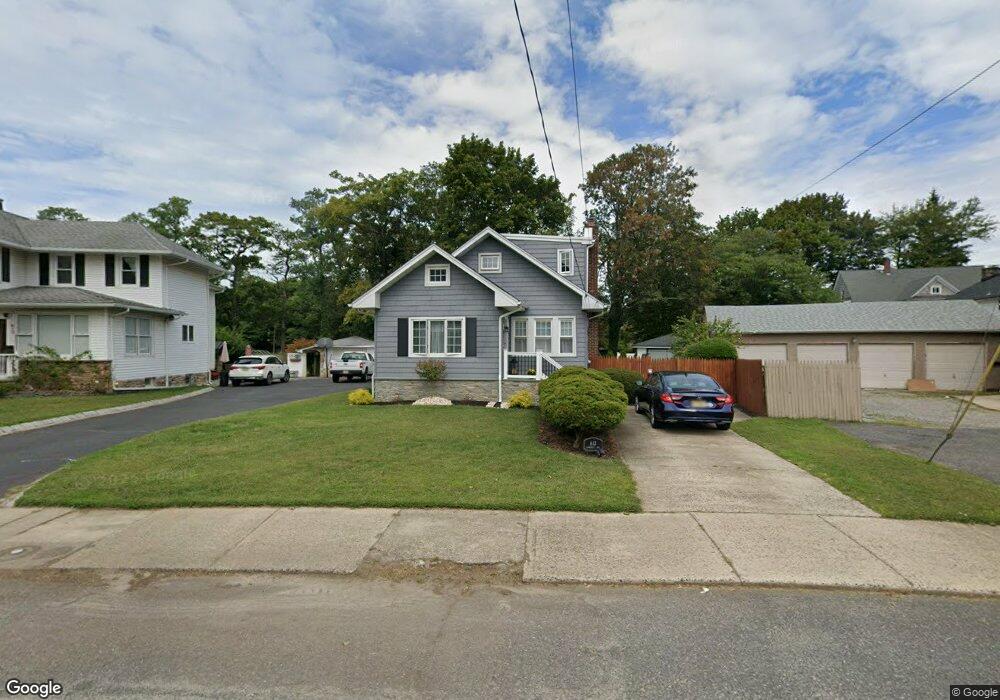
613 Campbell Ave Long Branch, NJ 07740
Estimated Value: $487,303 - $693,000
4
Beds
1
Bath
1,585
Sq Ft
$359/Sq Ft
Est. Value
About This Home
This home is located at 613 Campbell Ave, Long Branch, NJ 07740 and is currently estimated at $569,076, approximately $359 per square foot. 613 Campbell Ave is a home located in Monmouth County with nearby schools including Long Branch High School, Holy Trinity School, and Bet Yaakov of the Jersey Shore.
Ownership History
Date
Name
Owned For
Owner Type
Purchase Details
Closed on
Nov 19, 2018
Sold by
Lowney Stephen D
Bought by
Lowney Stephen D and Lowney Geri Lynn
Current Estimated Value
Purchase Details
Closed on
Jan 13, 1994
Sold by
Bernhardt Donald
Bought by
Lowney Stephen
Home Financials for this Owner
Home Financials are based on the most recent Mortgage that was taken out on this home.
Original Mortgage
$106,000
Interest Rate
7.11%
Create a Home Valuation Report for This Property
The Home Valuation Report is an in-depth analysis detailing your home's value as well as a comparison with similar homes in the area
Home Values in the Area
Average Home Value in this Area
Purchase History
| Date | Buyer | Sale Price | Title Company |
|---|---|---|---|
| Lowney Stephen D | -- | Lawyers Title Insurance Corp | |
| Lowney Stephen | $117,500 | -- |
Source: Public Records
Mortgage History
| Date | Status | Borrower | Loan Amount |
|---|---|---|---|
| Closed | Lowney Stephen | $106,000 |
Source: Public Records
Tax History Compared to Growth
Tax History
| Year | Tax Paid | Tax Assessment Tax Assessment Total Assessment is a certain percentage of the fair market value that is determined by local assessors to be the total taxable value of land and additions on the property. | Land | Improvement |
|---|---|---|---|---|
| 2025 | $7,225 | $539,500 | $330,600 | $208,900 |
| 2024 | $6,119 | $470,100 | $270,300 | $199,800 |
| 2023 | $6,119 | $394,000 | $203,300 | $190,700 |
| 2022 | $5,290 | $297,800 | $129,800 | $168,000 |
| 2021 | $5,290 | $266,900 | $109,800 | $157,100 |
| 2020 | $5,350 | $256,000 | $99,800 | $156,200 |
| 2019 | $5,125 | $243,800 | $94,800 | $149,000 |
| 2018 | $5,006 | $236,800 | $91,800 | $145,000 |
| 2017 | $4,823 | $234,000 | $91,800 | $142,200 |
| 2016 | $4,677 | $231,400 | $92,800 | $138,600 |
| 2015 | $5,748 | $258,100 | $84,200 | $173,900 |
| 2014 | $5,255 | $248,700 | $94,400 | $154,300 |
Source: Public Records
Map
Nearby Homes
- 88 Norwood Ave
- 2 Hilltop Rd
- 28 Norwood Ave
- 264 Norwood Ave
- 440 W End Ave
- 54 Wall St
- 21 Dennis St
- 317 Norwood Ave
- 399 Willow Ave
- 11 Fairway Ave
- 434 Westwood Ave
- 11 Golf St
- 364 Westwood Ave Unit 39
- 364 Westwood Ave Unit 71
- 364 Westwood Ave Unit 21
- 570 Monmouth Place
- 298 Poole Ave
- 377 Westwood Ave
- 552 Westwood Ave
- 388 Brookdale Ave
- 615 Campbell Ave
- 138 Norwood Ave
- 130 Norwood Ave
- 621 Campbell Ave
- 612 Campbell Ave
- 612 Campbell Ave Unit 1
- 126 Norwood Ave
- 126 Norwood Ave Unit A
- 126 Norwood Ave Unit B
- 620 Campbell Ave
- 144 Norwood Ave Unit 3
- 144 Norwood Ave
- 144 Norwood Ave Unit 1 ANNUAL
- 144 Norwood Ave Unit 4 ANNUAL
- 144 Norwood Ave Unit 3 ANNUAL
- 144 Norwood Ave Unit 2 ANNUAL
- 623 Campbell Ave
- 616 Campbell Ave
- 128 Norwood Ave
- 624 Campbell Ave