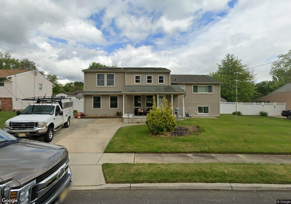
613 Colgate Ln Wenonah, NJ 08090
Deptford Township NeighborhoodEstimated Value: $299,000 - $448,000
--
Bed
--
Bath
2,566
Sq Ft
$143/Sq Ft
Est. Value
About This Home
This home is located at 613 Colgate Ln, Wenonah, NJ 08090 and is currently estimated at $367,726, approximately $143 per square foot. 613 Colgate Ln is a home located in Gloucester County with nearby schools including Deptford Township High School and St Margaret Regional School.
Ownership History
Date
Name
Owned For
Owner Type
Purchase Details
Closed on
Apr 30, 1997
Sold by
Rodgers Garnett J
Bought by
Burns Lance J and Burns Joyce E
Current Estimated Value
Home Financials for this Owner
Home Financials are based on the most recent Mortgage that was taken out on this home.
Original Mortgage
$87,259
Outstanding Balance
$11,797
Interest Rate
7.85%
Mortgage Type
FHA
Estimated Equity
$355,930
Create a Home Valuation Report for This Property
The Home Valuation Report is an in-depth analysis detailing your home's value as well as a comparison with similar homes in the area
Home Values in the Area
Average Home Value in this Area
Purchase History
| Date | Buyer | Sale Price | Title Company |
|---|---|---|---|
| Burns Lance J | $87,900 | Homestead Title Agency |
Source: Public Records
Mortgage History
| Date | Status | Borrower | Loan Amount |
|---|---|---|---|
| Open | Burns Lance J | $87,259 |
Source: Public Records
Tax History Compared to Growth
Tax History
| Year | Tax Paid | Tax Assessment Tax Assessment Total Assessment is a certain percentage of the fair market value that is determined by local assessors to be the total taxable value of land and additions on the property. | Land | Improvement |
|---|---|---|---|---|
| 2025 | $7,865 | $219,400 | $41,600 | $177,800 |
| 2024 | $7,613 | $219,400 | $41,600 | $177,800 |
| 2023 | $7,613 | $219,400 | $41,600 | $177,800 |
| 2022 | $7,558 | $219,400 | $41,600 | $177,800 |
| 2021 | $7,451 | $219,400 | $41,600 | $177,800 |
| 2020 | $7,365 | $219,400 | $41,600 | $177,800 |
| 2019 | $7,225 | $219,400 | $41,600 | $177,800 |
| 2018 | $7,062 | $219,400 | $41,600 | $177,800 |
| 2017 | $6,874 | $219,400 | $41,600 | $177,800 |
| 2016 | $6,733 | $219,400 | $41,600 | $177,800 |
| 2015 | $6,525 | $219,400 | $41,600 | $177,800 |
| 2014 | $6,356 | $219,400 | $41,600 | $177,800 |
Source: Public Records
Map
Nearby Homes
- 629 Vassar Rd
- 136 Vanderbilt Ave
- 417 Auburn St
- 505 University Blvd
- 916 Georgetown Rd
- 7 Manchester Ct
- 525 Westminster Rd
- 114 Buddy Powell Ln
- 213 Barclay Ct
- 418 Westminster Rd
- 807 Saint Regis Ct
- 100 Buddy Powell Ln
- 477 Bucknell Ave
- 15 Ash Ave
- 124 Linden Ave
- 827 Saint Regis Ct
- 411 Durham Ct Unit 411
- 463 Durham Ct
- 8 Clark Dr
- 441 Bucknell Ave