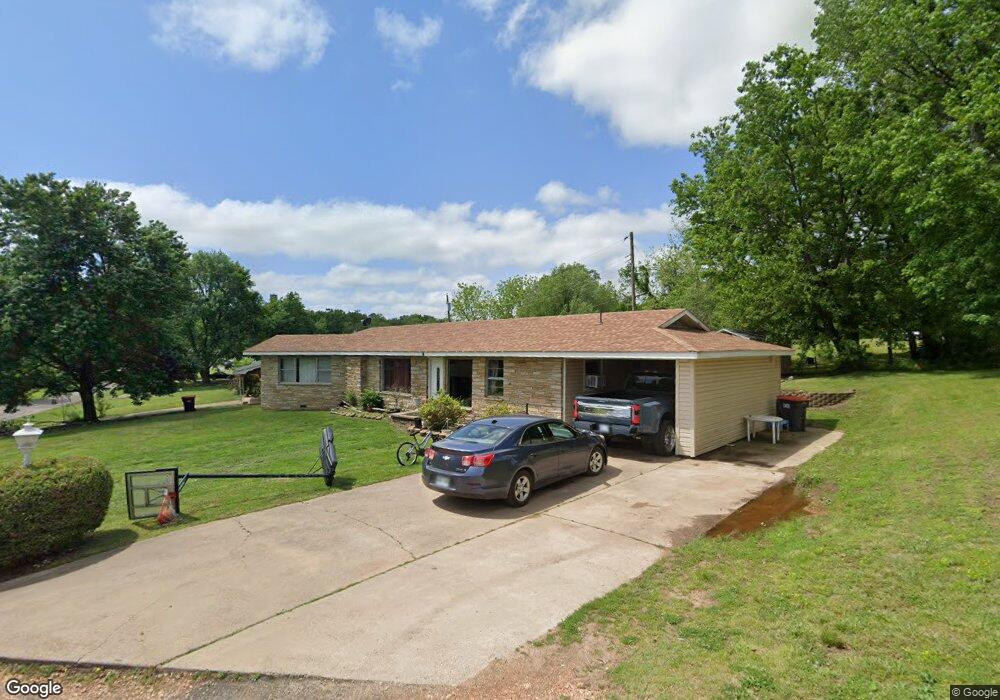
613 Crescent Dr Unit 1 South West City, MO 64863
Estimated Value: $147,000 - $215,907
3
Beds
2
Baths
1,264
Sq Ft
$140/Sq Ft
Est. Value
About This Home
This home is located at 613 Crescent Dr Unit 1, South West City, MO 64863 and is currently estimated at $176,727, approximately $139 per square foot. 613 Crescent Dr Unit 1 is a home located in McDonald County with nearby schools including McDonald County High School.
Ownership History
Date
Name
Owned For
Owner Type
Purchase Details
Closed on
Jul 16, 2013
Sold by
Secretary Of Housing & Urban Development
Bought by
Garcia Maria
Current Estimated Value
Home Financials for this Owner
Home Financials are based on the most recent Mortgage that was taken out on this home.
Original Mortgage
$32,000
Outstanding Balance
$23,279
Interest Rate
3.93%
Mortgage Type
Future Advance Clause Open End Mortgage
Estimated Equity
$153,448
Purchase Details
Closed on
Jun 29, 2012
Sold by
Mckee Ryan Keith and Mckee Angela
Bought by
Bac Home Loans Servicing Lp
Purchase Details
Closed on
Jul 14, 2006
Sold by
Vancuren Kevin
Bought by
Mckee Ryan Keith and Mckee Angela
Home Financials for this Owner
Home Financials are based on the most recent Mortgage that was taken out on this home.
Original Mortgage
$75,000
Interest Rate
9.64%
Mortgage Type
New Conventional
Create a Home Valuation Report for This Property
The Home Valuation Report is an in-depth analysis detailing your home's value as well as a comparison with similar homes in the area
Home Values in the Area
Average Home Value in this Area
Purchase History
| Date | Buyer | Sale Price | Title Company |
|---|---|---|---|
| Garcia Maria | -- | None Available | |
| Bac Home Loans Servicing Lp | $81,886 | None Available | |
| Mckee Ryan Keith | -- | None Available |
Source: Public Records
Mortgage History
| Date | Status | Borrower | Loan Amount |
|---|---|---|---|
| Open | Garcia Maria | $32,000 | |
| Previous Owner | Mckee Ryan Keith | $75,000 |
Source: Public Records
Tax History Compared to Growth
Tax History
| Year | Tax Paid | Tax Assessment Tax Assessment Total Assessment is a certain percentage of the fair market value that is determined by local assessors to be the total taxable value of land and additions on the property. | Land | Improvement |
|---|---|---|---|---|
| 2024 | $511 | $12,880 | $0 | $0 |
| 2023 | $511 | $12,880 | $0 | $0 |
| 2022 | $510 | $12,880 | $0 | $0 |
| 2021 | $510 | $12,880 | $0 | $0 |
| 2020 | $450 | $11,320 | $0 | $0 |
| 2019 | $385 | $9,700 | $0 | $0 |
| 2018 | $379 | $9,530 | $0 | $0 |
| 2017 | $379 | $9,530 | $0 | $0 |
| 2016 | $379 | $9,530 | $0 | $0 |
| 2015 | -- | $9,530 | $0 | $0 |
| 2014 | -- | $9,530 | $0 | $0 |
Source: Public Records
Map
Nearby Homes
- 0 Tbd 000 4355 Unit 1322974
- 303 Farm Road Sw9097
- 658 Niogo
- 70331 E 360 Rd
- 70251 E 360 Rd
- 201 Benton Rd
- 37483 S 700 Rd
- 1898 Holly Rd
- 2638 Frye Rd
- 000 Route Mm
- TBD Route Mm
- . Timlake Rd
- 24128 Honey Creek Rd
- 0000 E 380 Rd
- 10+/- Acres State Highway 90
- 68840 E 314 Trail
- 53402 E 332 Loop
- 14465 Wet Prairie Rd
- 0 Timlake Rd Unit 1325743