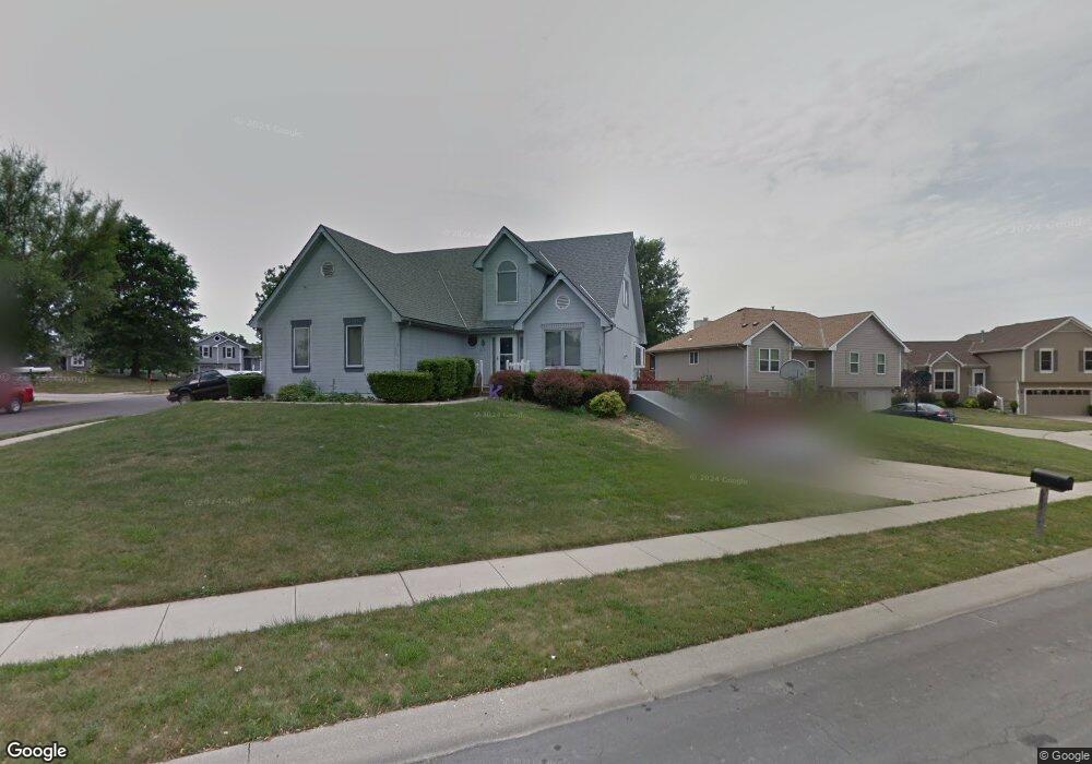
613 E 15th St Kearney, MO 64060
Estimated Value: $319,724 - $355,000
3
Beds
2
Baths
1,551
Sq Ft
$216/Sq Ft
Est. Value
About This Home
This home is located at 613 E 15th St, Kearney, MO 64060 and is currently estimated at $334,431, approximately $215 per square foot. 613 E 15th St is a home located in Clay County with nearby schools including Kearney Junior High School and Kearney High School.
Ownership History
Date
Name
Owned For
Owner Type
Purchase Details
Closed on
Jun 29, 2004
Sold by
Burns Paul Alan and Burns Michelle Scott
Bought by
Augustine Anthony A and Augustine Lisa
Current Estimated Value
Home Financials for this Owner
Home Financials are based on the most recent Mortgage that was taken out on this home.
Original Mortgage
$150,955
Outstanding Balance
$75,809
Interest Rate
6.3%
Mortgage Type
Purchase Money Mortgage
Estimated Equity
$258,622
Purchase Details
Closed on
Oct 12, 1999
Sold by
Drewek Erwin L
Bought by
Burns Paul Alan and Burns Michelle Scott
Home Financials for this Owner
Home Financials are based on the most recent Mortgage that was taken out on this home.
Original Mortgage
$134,509
Interest Rate
7.86%
Mortgage Type
FHA
Purchase Details
Closed on
Aug 20, 1998
Sold by
Drewek Erwin
Bought by
Drewek Erwin and Drewek Carol L
Create a Home Valuation Report for This Property
The Home Valuation Report is an in-depth analysis detailing your home's value as well as a comparison with similar homes in the area
Home Values in the Area
Average Home Value in this Area
Purchase History
| Date | Buyer | Sale Price | Title Company |
|---|---|---|---|
| Augustine Anthony A | -- | -- | |
| Burns Paul Alan | -- | United Title Company | |
| Drewek Erwin | -- | -- |
Source: Public Records
Mortgage History
| Date | Status | Borrower | Loan Amount |
|---|---|---|---|
| Open | Augustine Anthony A | $150,955 | |
| Previous Owner | Burns Paul Alan | $134,509 |
Source: Public Records
Tax History
| Year | Tax Paid | Tax Assessment Tax Assessment Total Assessment is a certain percentage of the fair market value that is determined by local assessors to be the total taxable value of land and additions on the property. | Land | Improvement |
|---|---|---|---|---|
| 2025 | $2,852 | $47,690 | -- | -- |
| 2024 | $2,852 | $41,610 | -- | -- |
| 2023 | $2,842 | $41,610 | $0 | $0 |
| 2022 | $2,620 | $37,090 | $0 | $0 |
| 2021 | $2,568 | $37,088 | $4,940 | $32,148 |
| 2020 | $2,479 | $32,570 | $0 | $0 |
| 2019 | $2,466 | $32,566 | $4,940 | $27,626 |
Source: Public Records
Map
Nearby Homes
- 1505 Emerald Cir
- 1710 Rockwater Ln
- 801 Southbrook Pkwy
- 1300 Robin Cir
- 623 E 13th St
- 1307 Stonecrest Dr
- 402 E 14th St
- 1209 Noah's Ln
- 709 Feldspar St
- 1204 Noah's Ln
- 1202 Noah's Ln
- 1300 Melissa Ct
- 1304 S Jefferson St
- 905 Susan St
- 1933 Meadowlane
- 819 Susan St
- 2118 Glenside Rd
- 1102 Melody Ct
- 200 E 10th St
- 1207 E 15th St
Your Personal Tour Guide
Ask me questions while you tour the home.