Estimated Value: $230,290 - $260,000
Studio
--
Bath
1,197
Sq Ft
$203/Sq Ft
Est. Value
About This Home
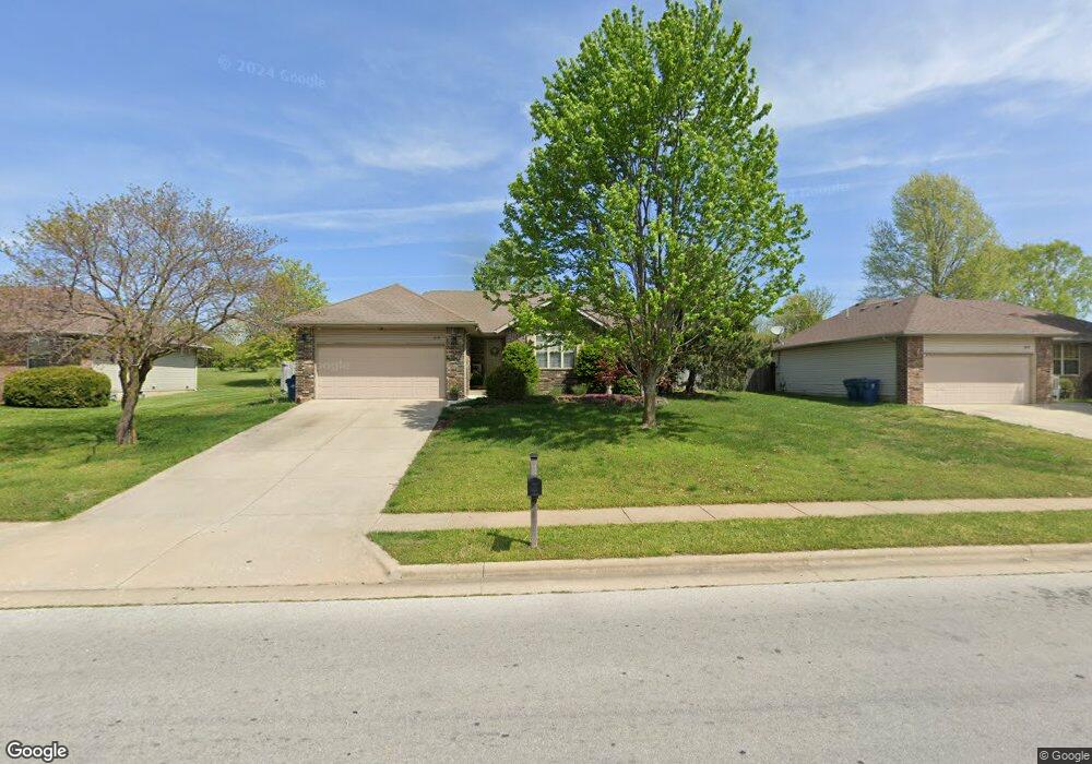
This home is located at 613 E Gallup Hill Rd, Nixa, MO 65714 and is currently estimated at $243,073, approximately $203 per square foot. 613 E Gallup Hill Rd is a home with nearby schools including Summit Intermediate School, High Pointe Elementary School, and Nixa Junior High School.
Ownership History
Date
Name
Owned For
Owner Type
Purchase Details
Closed on
Oct 28, 2013
Sold by
Brock Terry W
Bought by
Reed Beth A and Francis Dustin A
Current Estimated Value
Home Financials for this Owner
Home Financials are based on the most recent Mortgage that was taken out on this home.
Original Mortgage
$97,000
Outstanding Balance
$71,856
Interest Rate
4.37%
Mortgage Type
New Conventional
Estimated Equity
$171,217
Purchase Details
Closed on
Jan 11, 2011
Sold by
Brock Terry Warren and Brock Barbara J
Bought by
Brock Christopher T and Ramsey April L
Purchase Details
Closed on
Oct 24, 2005
Sold by
Mcbride Mark and Mcbride Barbara
Bought by
Brock Terry W and Brock Barbara J
Home Financials for this Owner
Home Financials are based on the most recent Mortgage that was taken out on this home.
Original Mortgage
$88,000
Interest Rate
5.9%
Mortgage Type
New Conventional
Create a Home Valuation Report for This Property
The Home Valuation Report is an in-depth analysis detailing your home's value as well as a comparison with similar homes in the area
Home Values in the Area
Average Home Value in this Area
Purchase History
| Date | Buyer | Sale Price | Title Company |
|---|---|---|---|
| Reed Beth A | -- | Fidelity Title Agency | |
| Brock Christopher T | -- | None Available | |
| Brock Terry W | -- | None Available |
Source: Public Records
Mortgage History
| Date | Status | Borrower | Loan Amount |
|---|---|---|---|
| Open | Reed Beth A | $97,000 | |
| Previous Owner | Brock Terry W | $88,000 |
Source: Public Records
Tax History
| Year | Tax Paid | Tax Assessment Tax Assessment Total Assessment is a certain percentage of the fair market value that is determined by local assessors to be the total taxable value of land and additions on the property. | Land | Improvement |
|---|---|---|---|---|
| 2025 | $1,314 | $22,570 | -- | -- |
| 2024 | $1,314 | $21,090 | -- | -- |
| 2023 | $1,314 | $21,090 | $0 | $0 |
| 2022 | $1,209 | $19,380 | $0 | $0 |
| 2021 | $1,210 | $19,380 | $0 | $0 |
| 2020 | $1,138 | $17,390 | $0 | $0 |
| 2019 | $1,138 | $17,390 | $0 | $0 |
| 2018 | $1,060 | $17,390 | $0 | $0 |
| 2017 | $1,060 | $17,390 | $0 | $0 |
| 2016 | $992 | $16,530 | $0 | $0 |
| 2015 | $993 | $16,530 | $16,530 | $0 |
| 2014 | $967 | $16,490 | $0 | $0 |
| 2013 | $10 | $16,490 | $0 | $0 |
| 2011 | $10 | $33,820 | $0 | $0 |
Source: Public Records
Map
Nearby Homes
- 316 S Market St
- 425 S Devonshire St
- 573 Barn Stable
- 427 S Main St
- 577 S Canterbury Ln
- 104 Willow Ln
- 404 E Elm St
- 601 Carriage Crossing
- 512 Baldknobber St
- 209&211 E Mount Vernon St
- 104 Missouri Ave
- 117 W Trail Point Dr
- 108 W Walnut St
- 307 N Prospect St
- 308 N Prospect St
- 985 Crimson Ave
- Sw Corner Highway 160 & St S
- 640 E Spring Valley Cir Unit 1
- 821 S Barberry Ct
- 403 Cherry St
- 611 E Gallup Hill Rd
- 615 E Gallup Hill Rd
- 601 S Ashwood Ct
- 609 E Gallup Hill Rd
- 601 Ashwood Ct
- 603 Ashwood Ct
- 607 E Gallup Hill Rd
- 602 S Amberwood Cir
- 619 E Gallup Hill Rd
- 602 S Ashwood Ct
- 587 S Stoney Path
- 604 S Ashwood Ct
- 604 S Amberwood Cir
- 605 S Ashwood Ct
- 605 E Gallup Hill Rd
- 604 Ashwood Ct
- 585 Stoney Path
- 606 S Amberwood Cir
- 606 E Gallup Hill Rd
- 583 Stoney Path
Your Personal Tour Guide
Ask me questions while you tour the home.