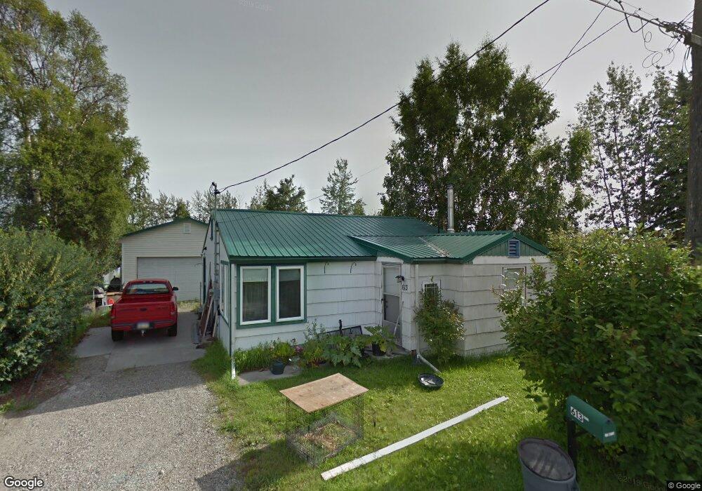
613 Noyes St Fairbanks, AK 99701
Northeast City NeighborhoodEstimated Value: $138,000
--
Bed
2
Baths
696
Sq Ft
$198/Sq Ft
Est. Value
About This Home
This home is located at 613 Noyes St, Fairbanks, AK 99701 and is currently priced at $138,000, approximately $198 per square foot. 613 Noyes St is a home located in Fairbanks North Star Borough with nearby schools including Joy Elementary School, Anne Wien Elementary School, and Tanana Middle School.
Ownership History
Date
Name
Owned For
Owner Type
Purchase Details
Closed on
Nov 20, 2019
Sold by
Eilis Sheila R and Eilis Richard A
Bought by
Krouse Morgan
Current Estimated Value
Home Financials for this Owner
Home Financials are based on the most recent Mortgage that was taken out on this home.
Original Mortgage
$169,653
Outstanding Balance
$149,251
Interest Rate
3.6%
Mortgage Type
New Conventional
Purchase Details
Closed on
Jul 15, 2003
Sold by
Bostic William H
Bought by
Ellis Richard A
Home Financials for this Owner
Home Financials are based on the most recent Mortgage that was taken out on this home.
Original Mortgage
$133,941
Interest Rate
5.18%
Mortgage Type
FHA
Create a Home Valuation Report for This Property
The Home Valuation Report is an in-depth analysis detailing your home's value as well as a comparison with similar homes in the area
Home Values in the Area
Average Home Value in this Area
Purchase History
| Date | Buyer | Sale Price | Title Company |
|---|---|---|---|
| Krouse Morgan | -- | None Available | |
| Ellis Richard A | -- | Fairbanks Title Agency Inc |
Source: Public Records
Mortgage History
| Date | Status | Borrower | Loan Amount |
|---|---|---|---|
| Open | Krouse Morgan | $169,653 | |
| Previous Owner | Ellis Richard A | $133,941 |
Source: Public Records
Tax History Compared to Growth
Tax History
| Year | Tax Paid | Tax Assessment Tax Assessment Total Assessment is a certain percentage of the fair market value that is determined by local assessors to be the total taxable value of land and additions on the property. | Land | Improvement |
|---|---|---|---|---|
| 2023 | -- | $0 | $0 | $0 |
| 2022 | $0 | $0 | $0 | $0 |
| 2021 | $0 | $0 | $0 | $0 |
| 2020 | $0 | $0 | $0 | $0 |
| 2019 | $2,215 | $27,678 | $27,678 | $0 |
| 2018 | $2,215 | $151,164 | $27,678 | $123,486 |
| 2017 | $2,306 | $149,650 | $27,678 | $121,972 |
| 2016 | $2,100 | $143,030 | $27,678 | $115,352 |
| 2015 | $2,282 | $143,030 | $27,678 | $115,352 |
| 2014 | $2,282 | $143,030 | $27,678 | $115,352 |
Source: Public Records
Map
Nearby Homes
- 237 Ellingson St
- L1-5 College Rd
- NHN College Rd
- Lot 7B-2 Bentley Trust Rd
- 274 Bentley Trust Rd
- 141 Dunkel St
- 79 Slater Dr Unit 4
- 79 Slater Dr
- 550 2nd St
- 6 Harriet Ave
- 15 Farewell Ave Unit 207
- 204 Antoinette Ave
- 612 College Rd
- 205 A St
- 812 Andrew St Unit 810 Andrew Street
- 214 Craig Ave
- 211 Craig Ave
- 582 Slater Dr
- 579 Slater Dr
- 202 10th Ave