Estimated Value: $469,168 - $612,000
4
Beds
2
Baths
1,712
Sq Ft
$315/Sq Ft
Est. Value
About This Home
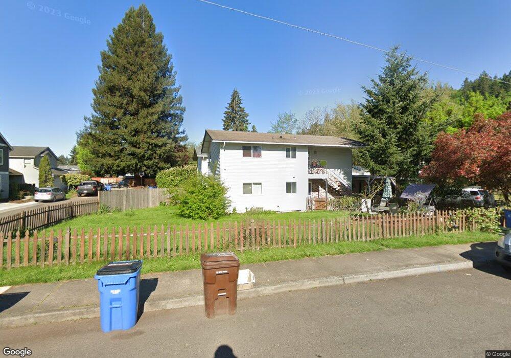
This home is located at 613 NW 9th Ave, Camas, WA 98607 and is currently estimated at $538,792, approximately $314 per square foot. 613 NW 9th Ave is a home located in Clark County with nearby schools including Prune Hill Elementary School, Skyridge Middle School, and Camas High School.
Ownership History
Date
Name
Owned For
Owner Type
Purchase Details
Closed on
May 10, 2007
Sold by
Clark Lucy A
Bought by
Clark Lucy A
Current Estimated Value
Home Financials for this Owner
Home Financials are based on the most recent Mortgage that was taken out on this home.
Original Mortgage
$130,000
Outstanding Balance
$78,945
Interest Rate
6.14%
Mortgage Type
New Conventional
Estimated Equity
$459,847
Purchase Details
Closed on
Feb 9, 1996
Sold by
Nesbitt Connie
Bought by
Clark Lucy A
Home Financials for this Owner
Home Financials are based on the most recent Mortgage that was taken out on this home.
Original Mortgage
$78,000
Interest Rate
9.5%
Create a Home Valuation Report for This Property
The Home Valuation Report is an in-depth analysis detailing your home's value as well as a comparison with similar homes in the area
Home Values in the Area
Average Home Value in this Area
Purchase History
| Date | Buyer | Sale Price | Title Company |
|---|---|---|---|
| Clark Lucy A | -- | Stewart Title | |
| Clark Lucy A | -- | Stewart Title | |
| Clark Lucy A | $98,000 | Charter Title Corp |
Source: Public Records
Mortgage History
| Date | Status | Borrower | Loan Amount |
|---|---|---|---|
| Open | Clark Lucy A | $130,000 | |
| Previous Owner | Clark Lucy A | $78,000 |
Source: Public Records
Tax History Compared to Growth
Tax History
| Year | Tax Paid | Tax Assessment Tax Assessment Total Assessment is a certain percentage of the fair market value that is determined by local assessors to be the total taxable value of land and additions on the property. | Land | Improvement |
|---|---|---|---|---|
| 2025 | $4,056 | $340,068 | $107,255 | $232,813 |
| 2024 | $3,535 | $425,201 | $167,318 | $257,883 |
| 2023 | $3,881 | $398,211 | $163,028 | $235,183 |
| 2022 | $3,486 | $415,881 | $163,028 | $252,853 |
| 2021 | $3,434 | $312,265 | $126,561 | $185,704 |
| 2020 | $3,281 | $285,193 | $117,981 | $167,212 |
| 2019 | $3,133 | $252,657 | $107,255 | $145,402 |
| 2018 | $3,182 | $257,053 | $0 | $0 |
| 2017 | $2,647 | $219,424 | $0 | $0 |
| 2016 | $2,244 | $198,751 | $0 | $0 |
| 2015 | $2,113 | $167,606 | $0 | $0 |
| 2014 | -- | $148,799 | $0 | $0 |
| 2013 | -- | $135,359 | $0 | $0 |
Source: Public Records
Map
Nearby Homes
- 912 NW Fargo St
- 715 NW 10th Ave
- 536 NW 10th Ave
- 535 NW 9th Ave
- 527 NW 9th Ave
- 907 NW Greeley St
- 541 NW 8th Ave
- 615 NW 7th Ave
- 802 NW 5th Cir Unit 802
- 634 NW 5th Ave
- 1123 NW Ash St
- 441 NW 15th Ave
- 1303 Division St
- 1623 Division St
- 124 NW 18th Ave
- 222 NW 19th Ave
- 719 NE Dallas St Unit A4
- 737 NW 20th Ave
- 2052 NW Fargo Loop
- 2120 NW Fargo Loop
- 911 NW Elm St
- 617 NW 9th Ave
- 614 NW 10th Ave
- 608 NW 10th Ave
- 606 NW 10th Ave
- 630 NW 10th Ave
- 604 NW 9th Ave
- 640 NW 10th Ave
- 612 NW 9th Ave
- 600 NW 9th Ave
- 529 NW 9th Ave
- 616 NW 9th Ave
- 827 NW Elm St
- 0 NW 8th Ave
- 650 NW 10th Ave
- 838 NW Elm St
- 842 NW Fargo St
- 654 NW 10th Ave
- 625 NW 8th Ave
- 522 NW 10th Ave